1980s Maps of Horry County, South Carolina
Explore 11 historic maps of Horry County from the 1980s. These maps offer a rare glimpse into what life looked like during the 1980s — showing old roads, neighborhoods, homes, and landmarks that have changed or disappeared over time.
Whether you're researching your family's past, planning a metal detecting trip, or studying how Horry County's landscape evolved across the 1980s, these high-resolution maps are a powerful tool for exploring the history of this region.
- Focus on a specific era: All maps on this page are from the 1980s, giving you a focused view of this time period.
- See what’s changed: Compare century-old streets, trails, and buildings to today's modern landscape using overlays and satellite layers.
- Research with precision: Use these maps for genealogy, historical research, land use analysis, or educational projects.
- View, download, or print: Maps are fully viewable online in high resolution, and can be downloaded or printed for your own records.
Start exploring Horry County's history through authentic maps from the 1980s. This is your window into the past.
Horry County, SC maps
(11)- 1983 Map of Florence, 1985 Print
 1983 Florence1985 Print · USGSThe Pee Dee region in the early eighties shows a landscape shaped by river commerce and rail expansion. Researchers can trace historic river crossings at Galivants Ferry or locate vanished rail stops like Willow Creek Siding and Blue Brick.
 - 1984 Map of Nixonville
 1984 Nixonville1984 Print · USGSHorry County’s lowcountry landscape is captured here in the mid-1980s, centered on the Waccamaw River and its rural landings. Genealogists can trace local roots through family cemeteries like Price Cem and numerous country churches including Salem Ch and True Vine Ch.
 - 1984 Map of Shell
 1984 Shell1984 Print · USGSCoastal South Carolina wetlands and riverfront settlements are frozen in time in the early eighties. Genealogists can trace family landmarks like Cherry Hill Cem and Fox Branch Cem near the banks of Kingston Lake.
 - 1984 Map of Hammond
 1984 Hammond1984 Print · USGSCoastal South Carolina in the mid-1980s reveals a landscape of deep swamps and riverfront crossings. Genealogists and local historians can trace family locations through Hardee Cem and Grainger Cem, or locate rural landmarks like Red Bluff Crossroads and Leon Sch.
 - 1984 Map of Ocean Forest
 1984 Ocean Forest1984 Print · USGSCoastal South Carolina shows its expanding residential and resort footprint in the 1980s as Myrtle Beach moves north. Genealogists and historians can trace neighborhood development near Ocean Forest, find local institutions like Coastal Academy, or locate landmarks such as Memorial Stadium.2 unique versions available
 - 1984 Map of Hand
 1984 Hand1984 Print · USGSCoastal South Carolina in the mid-eighties shows a unique intersection of rural swamp country and the expanding resort culture of the Grand Strand. Genealogists and local historians can trace family locations near Hand, Star Bluff Crossroads, and Sharon Ch.2 unique versions available
 - 1984 Map of Myrtle Beach, 1985 Print
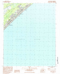
 1984 Myrtle Beach1985 Print · USGSThe Grand Strand in the early eighties shows a fascinating mix of military activity and vacation development. Researchers can trace the massive footprint of the Myrtle Beach Air Force Base or locate local landmarks like the Springmaid Beach Pier and Socastee.
 - 1984 Map of Surfside Beach, 1985 Print
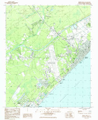
 1984 Surfside Beach1985 Print · USGSThe Grand Strand coastline during the mid-eighties shows a period of rapid residential and resort growth. Trace the development of Surfside Beach and Garden City Beach via landmarks like the Town Hall, Ocean Lakes Family Campground, and the local Pier.2 unique versions available
 - 1986 Map of Kingstree
 1986 Kingstree1986 Print · USGSThe South Carolina Lowcountry in the mid-eighties shows a landscape defined by the Black River and the growing coastal communities of the Grand Strand. Researchers can trace historic river settlements and rail stops like Salters Depot, Pamplico, and Hemingway.2 unique versions available
 - 1986 Map of Whiteville
 1986 Whiteville1986 Print · USGSSoutheastern North Carolina and the South Carolina borderlands are captured here in the mid-1980s as a landscape of vast swamps and rail towns. Researchers can trace historic rail routes through Chadbourn, locate the namesake Lake Waccamaw, and explore family-named sites like Peacocks.
 - 1986 Map of Myrtle Beach
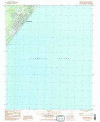
 1986 Myrtle Beach1986 Print · USGSThe Grand Strand and Brunswick County coast are captured in the mid-eighties before the late-century development boom. Researchers can trace the footprint of the Myrtle Beach Air Force Base and old coastal settlements like Atlantic Beach and Socastee.
End of results
Showing maps 1-11 of 11
Top cities of Horry County
- Myrtle Beach historical maps
- Conway historical maps
- Carolina Forest historical maps
- North Myrtle Beach historical maps
- Surfside Beach historical maps
- Loris historical maps
See more
Frequently asked questions
- What are the different types of historical maps available for Horry County?
- What is the oldest map of Horry County?
- Where can I purchase historical maps of Horry County for my home or office?
- Where can I download high-res historical maps of Horry County?
- Are there historical topographic maps available for Horry County?
- Is there historical aerial imagery available for Horry County?
- Where are historical maps of Horry County sourced from?