Old Maps of Lee County, South Carolina for Academic Research
Study the evolution of Lee County with 49 high-resolution historic maps. Whether you're teaching, researching, or modeling changes in land use, these maps provide essential visual documentation of urban, environmental, and geographic change.
- Analyze long-term change: Track patterns in development, transportation, and natural features.
- Ideal for environmental or urban studies: Support academic projects with primary historical map data.
- Use in the classroom or lab: Educators and researchers rely on these maps to bring historical context to life.
These maps are a powerful tool for teaching, research, and visualizing how Lee County has changed over the decades.
Lee County, SC maps
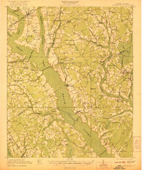
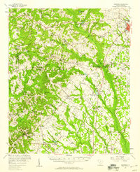
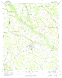
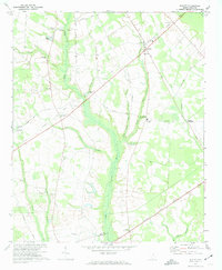
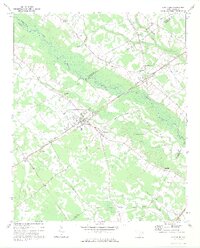
(49)- 1920 Map of Mayesville
 1920 Mayesville1920 Print · USGSCovers Lee County, including Mayesville, Turbeville, and other nearby areas
 - 1921 Map of Mayesville
 1921 Mayesville1921 Print · USGSCovers Lee County, including Mayesville, Turbeville, and other nearby areas3 unique versions available
 - 1941 Map of Spartanburg
 1941 Spartanburg1941 Print · USGSCovers Lee County, including Columbia, Rock Hill, and other nearby areas
 - 1943 Map of Mayesville
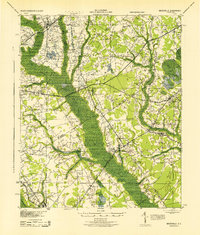 1943 Mayesville1943 Print · USGSCovers Lee County, including Mayesville, Turbeville, and other nearby areas
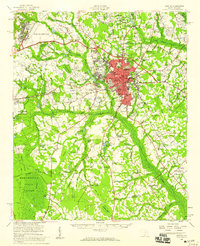
 - 1946 Map of Sumter
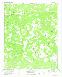
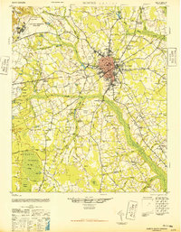 1946 Sumter1946 Print · USGSCovers Lee County, including Sumter, Midland Acres, and other nearby areas
 - 1953 Map of Spartanburg, 1966 Print
 1953 Spartanburg1966 Print · USGSCovers Lee County, including Columbia, Rock Hill, and other nearby areas4 unique versions available
 - 1954 Map of Augusta
 1954 Augusta1954 Print · USGSCovers Lee County, including Augusta, Columbia, and other nearby areas
 - 1957 Map of Sumter East, 1958 Print
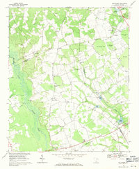
 1957 Sumter East1958 Print · USGSCovers Lee County, including Sumter, Midland Acres, and other nearby areas3 unique versions available
 - 1957 Map of Ashwood, 1958 Print
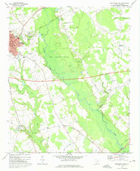
 1957 Ashwood1958 Print · USGSCovers Lee County, including Bishopville, Pisgah, and other nearby areas2 unique versions available
 - 1957 Map of Sumter, 1959 Print
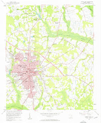
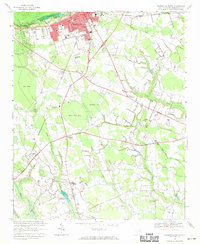
 1957 Sumter1959 Print · USGSCovers Lee County, including Sumter, Midland Acres, and other nearby areas2 unique versions available
 - 1957 Map of Augusta, 1966 Print
 1957 Augusta1966 Print · USGSCovers Lee County, including Augusta, Columbia, and other nearby areas3 unique versions available
 - 1958 Map of Augusta
 1958 Augusta1958 Print · USGSCovers Lee County, including Augusta, Columbia, and other nearby areas
 - 1960 Map of Spartanburg
 1960 Spartanburg1960 Print · USGSCovers Lee County, including Columbia, Rock Hill, and other nearby areas2 unique versions available
 - 1961 Map of Augusta
 1961 Augusta1961 Print · USGSCovers Lee County, including Augusta, Columbia, and other nearby areas2 unique versions available
 - 1962 Map of Augusta
 1962 Augusta1962 Print · USGSCovers Lee County, including Augusta, Columbia, and other nearby areas
 - 1963 Map of Spartanburg
 1963 Spartanburg1963 Print · USGSCovers Lee County, including Columbia, Rock Hill, and other nearby areas
 - 1964 Map of Spartanburg
 1964 Spartanburg1964 Print · USGSCovers Lee County, including Columbia, Rock Hill, and other nearby areas
 - 1968 Map of Kellytown, 1971 Print
 1968 Kellytown1971 Print · USGSCovers Lee County, including Hartsville, Ashland, and other nearby areas
 - 1968 Map of Hartsville South, 1971 Print
 1968 Hartsville South1971 Print · USGSCovers Lee County, including Hartsville, Kingsville Heights, and other nearby areas
 - 1969 Map of Lamar, 1974 Print
 1969 Lamar1974 Print · USGSCovers Lee County, including Lamar, Carters Crossroads, and other nearby areas
 - 1969 Map of Bishopville East, 1974 Print
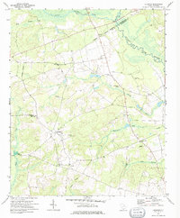
 1969 Bishopville East1974 Print · USGSCovers Lee County, including Bishopville, McCutchens Crossroads, and other nearby areas2 unique versions available
 - 1970 Map of Cassatt, 1975 Print
 1970 Cassatt1975 Print · USGSCovers Lee County, including Cassatt, Kershaw County, and other nearby areas
 - 1970 Map of Lucknow, 1975 Print
 1970 Lucknow1975 Print · USGSCovers Lee County, including Thursa, Lucknow, and other nearby areas
 - 1973 Map of Elliott, 1974 Print
 1973 Elliott1974 Print · USGSCovers Lee County, including Dunlape Crossroads, Wells Crossroads, and other nearby areas2 unique versions available
 - 1973 Map of Lynchburg, 1975 Print
 1973 Lynchburg1975 Print · USGSCovers Lee County, including Lynchburg, Cartersville, and other nearby areas
Showing maps 1-25 of 49
Top cities of Lee County
Frequently asked questions
- What are the different types of historical maps available for Lee County?
- What is the oldest map of Lee County?
- Where can I purchase historical maps of Lee County for my home or office?
- Where can I download high-res historical maps of Lee County?
- Are there historical topographic maps available for Lee County?
- Is there historical aerial imagery available for Lee County?
- Where are historical maps of Lee County sourced from?