Old Maps of Columbia, South Carolina for Hiking & Exploration
Hike through history with 95 historic maps of Columbia. Explore old trails, ghost towns, and forgotten backroads — perfect for outdoor adventurers and local explorers.
- Rediscover forgotten places: Map out old mining camps, roads, and footpaths that no longer exist on modern maps.
- Layer with modern tools: Combine with LiDAR or satellite views to plan hikes through historical terrain.
- Made for exploration: Popular among hikers, overlanders, and local history lovers.
Use these maps to find adventure and explore the hidden past of Columbia.
Columbia, SC maps
(95)- 1904 Map of Columbia
 1904 Columbia1904 Print · USGSRichland and Fairfield counties at the turn of the century are defined by their river-and-rail corridors and rural church communities. Genealogists can trace family footprints across Broad River ferries, the Southern R.R., and landmarks like The Old Brick Church or Winnsboro.2 unique versions available
 - 1935 Map of Killian
 1935 Killian1935 Print · USGSRichland County at the height of the mid-1930s is a landscape of rural schoolhouses and growing military infrastructure. Genealogists can trace family landmarks like Kelley Cem, Bookman Mill, and dozens of local churches including Roundtop Ch.2 unique versions available
 - 1937 Map of Killian
 1937 Killian1937 Print · USGSRichland and Kershaw counties in the mid-1930s show a landscape of growing military installations and rural community life. Genealogists can trace family names through dozens of landmarks like Bookmans Mill, Sand Level Sch, and Union Baptist Ch.4 unique versions available
 - 1938 Map of Hagood
 1938 Hagood1938 Print · USGSThe Wateree River basin comes to life in this pre-war study of the Kershaw and Sumter county borderlands. Researchers can trace the river's old crossings and mills at Ancrum Ferry and Boykin Mill Pond, alongside historic schools like Kershaw Industrial Sch.3 unique versions available
 - 1941 Map of Spartanburg
 1941 Spartanburg1941 Print · USGSSouth Carolina’s Piedmont and Sandhills regions are shown here during the mid-century peak of the rail era. Researchers can trace the sprawling Fort Jackson Military Reservation and the industrial growth of hubs like Spartanburg and Rock Hill.
 - 1942 Map of Camden
 1942 Camden1942 Print · USGSMid-century South Carolina comes into focus along the Wateree River as the region's rail and agricultural networks reached their peak. Genealogists and historians can trace old community hubs like Boykin Mill, Friends Neck Ch, and the grounds of the Sand Hill Experimental Station.
 - 1944 Map of Edmund, 1966 Print
 1944 Edmund1966 Print · USGSLexington County and the southern fringes of Columbia are shown in detail during the final years of World War II. Researchers can locate family landmarks like Saxe Gotha Sch, the Columbia Air Base, and Huckabaas Millpond.
 - 1946 Map of Irmo, 1968 Print
 1946 Irmo1968 Print · USGSMid-century Richland and Lexington Counties are caught in transition as the hydroelectric power of the Saluda River reshapes the land. Researchers can trace rural school locations like Rosenwald Sch and historical churches such as St Andrews Ch or Pilgrim Ch.
 - 1947 Map of Columbia North, 1965 Print
 1947 Columbia North1965 Print · USGSColumbia and its northern suburbs are captured in detail just after the war, showing the capital's rapid expansion into Eau Claire and Arden. Local historians can trace institutional history through the State Hospital, Allen Univ, and the State Penitentiary along the Broad River.
 - 1947 Map of Richtex, 1969 Print
 1947 Richtex1969 Print · USGSRichland and Fairfield counties meet along the Broad River in the late 1940s, showing a landscape of river-bend settlements and rural rail stops. Local historians can locate numerous small-community landmarks like Zion Pilgrim Ch, the Leitner Grove Sch & Cem, and the river crossing at Ashley Bridge.
 - 1948 Map of Hopkins
 1948 Hopkins1948 Print · USGSRichland and Calhoun counties are captured here just after the war, showing the expansion of federal military sites into the rural South Carolina landscape. Genealogists can locate family-named landmarks like Coughmans Pond and dozens of country schools including Lower Richland High Sch and Hopkins Sch.3 unique versions available
 - 1948 Map of Irmo
 1948 Irmo1948 Print · USGSThe Irmo area of South Carolina thrived as a railway and agricultural hub in the mid-forties, just as the Saluda River's transformation was complete. Genealogists and historians can trace institutional roots at the Harbison Institute or locate family plots at Upper Pine Grove Cem and Lower Pine Grove Cem.2 unique versions available
 - 1948 Map of Columbia North
 1948 Columbia North1948 Print · USGSColumbia and its northern suburbs are documented in the late 1940s as the city expanded across the Congaree and Broad River forks. Genealogists can trace family landmarks and historical sites including the Soldiers Home, Slatestone Graveyard Hill Cem, and Benedict College.2 unique versions available
 - 1949 Map of Richtex
 1949 Richtex1949 Print · USGSMid-century Fairfield and Richland counties are captured here along the banks of the Broad River just after the war. Local historians can trace family roots through numerous landmarks like Haltiwanger Cem, Wallaceville Sch, and the riverside stop at Richtex.
 - 1953 Map of Messers Pond, 1957 Print
 1953 Messers Pond1957 Print · USGSThe Richland and Kershaw county line is captured here in the mid-fifties, primarily within the bounds of the Fort Jackson Military Reservation. Researchers can trace old family sites and rural landmarks like Spears Creek Church and Cemetery and the Richland County Convalescent Home.
 - 1953 Map of Fort Jackson South, 1957 Print
 1953 Fort Jackson South1957 Print · USGSMid-century Richland County emerges as a landscape of suburban growth and military activity just outside the state capital. Genealogists and local historians can trace rural communities like Lykesland and Hopkins alongside institutional landmarks like Rock Hill School and Zion Chapel No 2.
 - 1953 Map of Fort Jackson North, 1957 Print
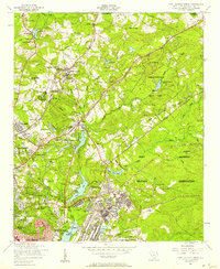 1953 Fort Jackson North1957 Print · USGSMid-century Richland County is caught in transition as the outskirts of Columbia expand toward the Fort Jackson Military Reservation. Researchers can trace the development of early suburbs like Forest Acres alongside older landmarks like the South Carolina Sanatorium and the Alta Vista Drive-In Theater.2 unique versions available
 - 1953 Map of Congaree, 1957 Print
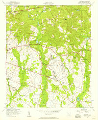 1953 Congaree1957 Print · USGSRichland County at the start of the 1950s reveals a landscape defined by significant military installations and a network of tight-knit rural communities. Researchers can locate numerous local landmarks such as Lower Richland High School, Congaree Air Force Base, and the Zion Benevolent Church.
 - 1953 Map of Blaney, 1957 Print
 1953 Blaney1957 Print · USGSRichland and Kershaw Counties come together in the early fifties near the rail town of Blaney. Researchers can trace old family footprints at Shady Grove Cem, find the historic Bethel Camp Ground, or locate rural landmarks like Bookman's Mill.
 - 1953 Map of Leesburg, 1957 Print
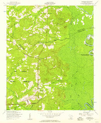 1953 Leesburg1957 Print · USGSMid-century Richland County is defined here by the meeting of rural life and military expansion. Genealogists and local historians can trace family-named sites like McCaskill and Dunns Mount alongside Concord School and Pine Grove Church.
 - 1953 Map of Spartanburg, 1966 Print
 1953 Spartanburg1966 Print · USGSMid-century South Carolina comes into focus through this survey of the Piedmont and the Sand Hills at a time of significant reservoir expansion. Researchers can trace the legacy of industrial transit and resource extraction from the Haile Gold Mine to the rail hubs of the Seaboard Air Line.4 unique versions available
 - 1954 Map of Augusta
 1954 Augusta1954 Print · USGSThe Savannah River valley and South Carolina Midlands are captured here during a period of post-war growth. Researchers can trace the rail-and-river economy through the Southern RR corridor and locate historic settlements like Aiken, Orangeburg, and Sumter.
 - 1957 Map of Augusta, 1966 Print
 1957 Augusta1966 Print · USGSThe Savannah River and Santee basins are captured here during a period of massive military and industrial expansion in the late fifties. Genealogists can trace family footprints across Four Hole Swamp or near the Savannah River Plant.3 unique versions available
 - 1958 Map of Augusta
 1958 Augusta1958 Print · USGSThe borderlands between Georgia and South Carolina come alive in the 1950s, showing the early footprint of the Savannah River Plant. Genealogists and historians can trace rail-dependent towns and rural landmarks from Orangeburg to the Fort Jackson Military Reservation.
 - 1960 Map of Spartanburg
 1960 Spartanburg1960 Print · USGSThe South Carolina Piedmont and North Carolina borderlands come alive in this mid-century survey of the region between Spartanburg and Columbia. Researchers can trace the Seaboard Air Line railroad and explore landmarks like Anderson Quarry, Lake Murray, and Mount Croghan.2 unique versions available
Showing maps 1-25 of 95
Top cities near Columbia
- Lexington historical maps
- West Columbia historical maps
- Cayce historical maps
- Forest Acres historical maps
- Lugoff historical maps
- Blythewood historical maps
See more
Top neighborhoods of Columbia
- Saint Marks Wood historical maps
- Hampton Ridge historical maps
- Heritage Woods historical maps
- Sims historical maps
- Brandon Hills historical maps
- Yorkshire historical maps
See more
Frequently asked questions
- What are the different types of historical maps available for Columbia?
- What is the oldest map of Columbia?
- Where can I purchase historical maps of Columbia for my home or office?
- Where can I download high-res historical maps of Columbia?
- Are there historical topographic maps available for Columbia?
- Is there historical aerial imagery available for Columbia?
- Where are historical maps of Columbia sourced from?