1970s Maps of India Hook, South Carolina
Explore 2 historic maps of India Hook from the 1970s. These maps offer a rare glimpse into what life looked like during the 1970s — showing old roads, neighborhoods, homes, and landmarks that have changed or disappeared over time.
Whether you're researching your family's past, planning a metal detecting trip, or studying how India Hook's landscape evolved across the 1970s, these high-resolution maps are a powerful tool for exploring the history of this region.
- Focus on a specific era: All maps on this page are from the 1970s, giving you a focused view of this time period.
- See what’s changed: Compare century-old streets, trails, and buildings to today's modern landscape using overlays and satellite layers.
- Research with precision: Use these maps for genealogy, historical research, land use analysis, or educational projects.
- View, download, or print: Maps are fully viewable online in high resolution, and can be downloaded or printed for your own records.
Start exploring India Hook's history through authentic maps from the 1970s. This is your window into the past.
India Hook, SC maps
(2)- 1973 Map of Lake Wylie, 1976 Print
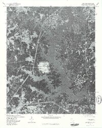
 1973 Lake Wylie1976 Print · USGSThe Catawba River valley in the early seventies shows a landscape in transition between rural heritage and lakeside development. Researchers can trace the roots of shoreline communities like Tega Cay or locate historic country landmarks such as Bethel Mission and the York County Nature Museum.
 - 1976 Map of Lake Wylie, 1978 Print
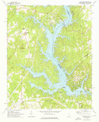
 1976 Lake Wylie1978 Print · USGSThe developing shorelines of the South Carolina-North Carolina border are captured in this mid-seventies aerial study. Researchers can trace the early footprints of settlements like Pine Harbor and India Hook alongside the waters of Lake Wylie.
End of results
Showing maps 1-2 of 2
Top cities near India Hook
- Charlotte historical maps
- Rock Hill historical maps
- Gastonia historical maps
- Fort Mill historical maps
- Indian Land historical maps
- Tega Cay historical maps
See more
Top neighborhoods of India Hook
- Forest Acres historical maps
- Hickory Hill historical maps
- Lakewood historical maps
- Island View Landing historical maps
- Lakewood Acres historical maps
Frequently asked questions
- What are the different types of historical maps available for India Hook?
- What is the oldest map of India Hook?
- Where can I purchase historical maps of India Hook for my home or office?
- Where can I download high-res historical maps of India Hook?
- Are there historical topographic maps available for India Hook?
- Is there historical aerial imagery available for India Hook?
- Where are historical maps of India Hook sourced from?