Old Maps of Aurora County, South Dakota for Hiking & Exploration
Hike through history with 132 historic maps of Aurora County. Explore old trails, ghost towns, and forgotten backroads — perfect for outdoor adventurers and local explorers.
- Rediscover forgotten places: Map out old mining camps, roads, and footpaths that no longer exist on modern maps.
- Layer with modern tools: Combine with LiDAR or satellite views to plan hikes through historical terrain.
- Made for exploration: Popular among hikers, overlanders, and local history lovers.
Use these maps to find adventure and explore the hidden past of Aurora County.
Aurora County, SD maps
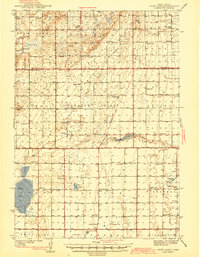
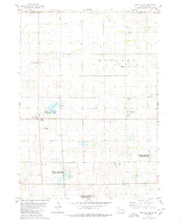
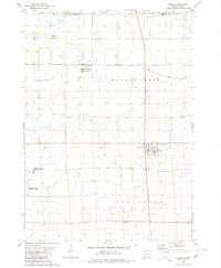
(132)- 1899 Map of Mitchell
 1899 Mitchell1899 Print · USGSSoutheastern South Dakota is captured during the era of rapid railroad expansion and prairie settlement. Genealogists can trace the early rail stops at Mt. Vernon and Letcher, or locate old watercourses like Enemy Creek and the James River.3 unique versions available
 - 1941 Map of Kimball North
 1941 Kimball North1941 Print · USGSBrule County's agricultural heartland is documented here on the eve of the Second World War, showing a landscape defined by rail and rural schools. Genealogists can trace family footprints near Kimball or locate specific country schools like Fagerhaug Sch and Brooks Sch.
 - 1942 Map of Crow Lake
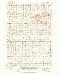
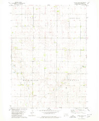
 1942 Crow Lake1942 Print · USGSThe South Dakota prairie of Jerauld and Aurora Counties is captured here in the early 1940s, showing a landscape defined by small townships and artesian wells. Genealogists can trace a dense network of rural landmarks, including Underwood Ch, Union Cem, and numerous schoolhouses like Willow Bend Sch.3 unique versions available
 - 1951 Map of Kimball North, 1953 Print
 1951 Kimball North1953 Print · USGSBrule County and the surrounding prairie are captured here in the early fifties, showing a landscape defined by small-town life and rural school districts. Genealogists can locate family landmarks like Lyonville, Crow Lake Ch, and the Brooks Sch.
 - 1955 Map of Mitchell, 1973 Print
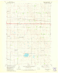
 1955 Mitchell1973 Print · USGSThe Missouri River valley undergoes a massive transformation in the mid-1950s as the Fort Randall Dam creates Lake Francis Case. You can trace the rail lines of the Chicago Milwaukee St Paul and Pacific through Mitchell or locate local landmarks like Butler Town Hall.2 unique versions available
 - 1959 Map of Mitchell
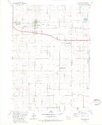
 1959 Mitchell1959 Print · USGSSouth Dakota’s river and rail corridors come alive in the late fifties as the Missouri River valley undergoes dramatic change. Genealogists and historians can trace family roots through numerous small towns and schools such as Academy, Stickney, and Gregory.2 unique versions available
 - 1979 Map of Cedar Grove Colony, 1980 Print
 1979 Cedar Grove Colony1980 Print · USGSThe Brule County prairie during the late seventies shows a landscape of established farm colonies and rural parish life. Genealogists can trace family landmarks like Larson Cem and Bulls Cem or local centers like the Cedar Grove Colony and Torrey Lake Sch.
 - 1979 Map of Fraser Dam, 1980 Print
 1979 Fraser Dam1980 Print · USGSAgricultural life in Jerauld and Aurora Counties is captured here in the late seventies as local townships managed the prairie landscape. Genealogists can locate family-named landmarks like Piersons Draw and community sites including Solberg Cem and Fraser Dam.
 - 1979 Map of New Holland, 1980 Print
 1979 New Holland1980 Print · USGSDouglas County farm country is captured here in the late seventies, showing the established communities of New Holland and Harrison. Researchers can trace local roots at Ebenezer Ch or locate the Markus Sch and Beukelman Sch schoolhouses.
 - 1979 Map of Laffey Lake, 1980 Print
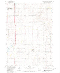
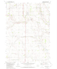
 1979 Laffey Lake1980 Print · USGSAurora County's agricultural heartland is documented here in the late seventies, showing the established township grids and prairie waterways. Researchers can trace land divisions across Gales and Center or locate landmarks like Laffey Lake.
 - 1979 Map of Crystal Lake, 1980 Print
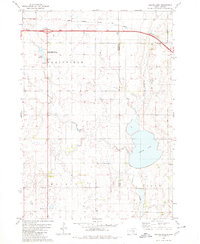
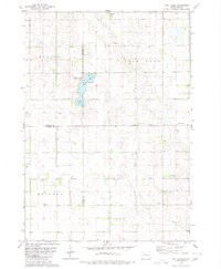
 1979 Crystal Lake1980 Print · USGSAurora County's prairie wetlands and conservation areas are documented here during the late 1970s. Researchers can trace the path of the Chicago Milwaukee St Paul and Pacific railroad and locate landmarks like Crystal Lake and the Flowing Well.
 - 1979 Map of White Lake, 1980 Print
 1979 White Lake1980 Print · USGSWhite Lake and the surrounding Aurora County prairie are captured here in the late seventies as a landscape of rail transit and wildlife conservation. Genealogists and historians can trace the Chicago Milwaukee St Paul and Pacific rail line or locate the Crystal Lake Cem near White Lake.
 - 1979 Map of Platte Lake, 1980 Print
 1979 Platte Lake1980 Print · USGSAcross the Brule and Aurora county line in the late seventies, this survey captures a landscape of prairie lakes and transition. Genealogists and historians can trace rural landmarks like the Wilbur Center Sch or the grounds of the Lake Sixteen State Public Shooting Area.
 - 1979 Map of Aurora Center, 1980 Print
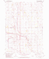
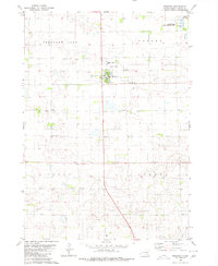
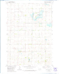 1979 Aurora Center1980 Print · USGSAurora County's prairie landscape in the late 1970s is defined by its vast public shooting areas and scattered wetlands. Researchers can locate the Quaker Cem, explore the shores of Crystal Lake, and trace the small community of Aurora Center.
 - 1979 Map of Joubert, 1980 Print
 1979 Joubert1980 Print · USGSThe rural prairie of Douglas and Aurora counties is captured here in the late seventies, showing a landscape shaped by agriculture and water management. Researchers can locate the Clark-Joubert Sch, the Townhall, and conserved lands in the National Waterfowl Production Area.
 - 1979 Map of Platte, 1980 Print
 1979 Platte1980 Print · USGSCharles Mix County thrived as a railroad-anchored agricultural center during the late seventies. Genealogists and local historians can trace the foundations of the community through sites like Platte, the C M St P & P rail line, and the Swedish Lutheran Cem.
 - 1979 Map of Storla SW, 1980 Print
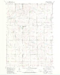
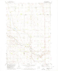
 1979 Storla SW1980 Print · USGSAurora County’s rural prairie landscape is captured here in the late seventies, showing the transition of its township lands. Researchers can locate the local Townhall and trace the drainage of Firesteel Creek near the National Waterfowl Production Area.
 - 1979 Map of Storla, 1980 Print
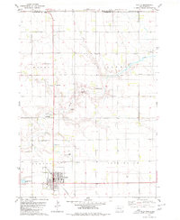
 1979 Storla1980 Print · USGSThe crossroads of Aurora, Sanborn, and Davison counties are documented here in the late seventies. Family historians can trace the rural community of Storla and its surrounding landmarks like Trinity Ch, Blendon Sch, and Knutson Cem.
 - 1979 Map of Twin Lakes, 1980 Print
 1979 Twin Lakes1980 Print · USGSSanborn County and its neighboring borderlands appear here in the late seventies, centered on the vital prairie waters of the James River Valley region. Researchers can locate rural landmarks like Belford Sch, Elliott Sch, and the Twin Lakes State Recreation Area.
 - 1980 Map of Stickney
 1980 Stickney1980 Print · USGSStickney and its surrounding townships are documented here during the early 1980s, showcasing a classic South Dakota agricultural landscape. Family historians can locate several local burial grounds like Silver Ridge Cem and Old St Paul Cem, or trace the course of Enemy creek.
 - 1980 Map of Corsica Lake
 1980 Corsica Lake1980 Print · USGSThe rural landscapes of Douglas County are captured here in the late twentieth century, centered on the waters of Corsica Lake. Local historians can trace early community sites like St John Ch, the Old Ebenezer Cem, and the village of Valley.
 - 1980 Map of Old Stickney Lake
 1980 Old Stickney Lake1980 Print · USGSThe South Dakota prairie stretches across the Davison and Aurora county line in the late 1970s. Local history researchers can trace rural community centers like the Townhall and Baker Sch, or locate family sites at Nicolaisen Cem and Metzgerville.
 - 1980 Map of Mount Vernon
 1980 Mount Vernon1980 Print · USGSThe agricultural plains of Davison and Aurora counties are captured here in the early 1980s. Genealogists and historians can trace the intersection of the Chicago Milwaukee St Paul and Pacific rail line and local sites like Quaker Cem and Mount Vernon.
 - 1980 Map of Plankinton
 1980 Plankinton1980 Print · USGSPlankinton and its surrounding townships are shown here in the early 1980s, revealing a prairie landscape defined by the railroad and local institutions. Genealogists can trace family records at St Johns Cem or Mizpah Cem, and locate the historic State Training Sch.
 - 1980 Map of Corsica, 1981 Print
 1980 Corsica1981 Print · USGSSouth Dakota's prairie landscape near Corsica is captured here during the late twentieth century. Genealogists and local historians can trace the town's development through Graceland Cem, the local Townhall, and the extensive National Waterfowl Production Area.
Showing maps 1-25 of 132
Frequently asked questions
- What are the different types of historical maps available for Aurora County?
- What is the oldest map of Aurora County?
- Where can I purchase historical maps of Aurora County for my home or office?
- Where can I download high-res historical maps of Aurora County?
- Are there historical topographic maps available for Aurora County?
- Is there historical aerial imagery available for Aurora County?
- Where are historical maps of Aurora County sourced from?