1980s Maps of Bennett County, South Dakota
Explore 23 historic maps of Bennett County from the 1980s. These maps offer a rare glimpse into what life looked like during the 1980s — showing old roads, neighborhoods, homes, and landmarks that have changed or disappeared over time.
Whether you're researching your family's past, planning a metal detecting trip, or studying how Bennett County's landscape evolved across the 1980s, these high-resolution maps are a powerful tool for exploring the history of this region.
- Focus on a specific era: All maps on this page are from the 1980s, giving you a focused view of this time period.
- See what’s changed: Compare century-old streets, trails, and buildings to today's modern landscape using overlays and satellite layers.
- Research with precision: Use these maps for genealogy, historical research, land use analysis, or educational projects.
- View, download, or print: Maps are fully viewable online in high resolution, and can be downloaded or printed for your own records.
Start exploring Bennett County's history through authentic maps from the 1980s. This is your window into the past.
Bennett County, SD maps
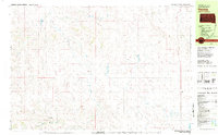
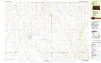
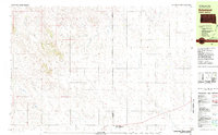
(23)- 1981 Map of Long Valley
 1981 Long Valley1981 Print · USGSWestern South Dakota's open range is captured here in the early eighties, showing the interface between Jackson County and the Pine Ridge Indian Reservation. Researchers can locate the Hawkwing Cemetery, the Rodeo Ground, and the small settlement of Long Valley.
 - 1981 Map of Wakpamani
 1981 Wakpamani1981 Print · USGSThe Pine Ridge Indian Reservation landscape is captured in the early 1980s, centered on the Wakpamani community. Researchers can trace local landmarks like St Andrew Chapel and family-named sites such as Feather-on-Head Cem.2 unique versions available
 - 1981 Map of Patricia
 1981 Patricia1981 Print · USGSBennett County ranching and water rights come into focus in the early eighties as the prairie landscape is mapped in detail. Genealogists and local historians can trace family locations near Patricia, Black Eyes, and along the banks of Bear-in-the-Lodge Creek.
 - 1981 Map of Phantom Lake
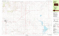
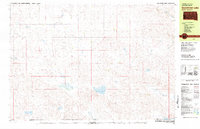
 1981 Phantom Lake1981 Print · USGSBennett County, South Dakota, is captured here in the early 1980s as a vital conservation landscape on the Nebraska border. Researchers can trace remote sites like Grace Cem and Our Lady of the Lake Cem near the Lacreek National Wildlife Refuge.
 - 1981 Map of Yellow Bear Camp
 1981 Yellow Bear Camp1981 Print · USGSThe Pine Ridge Indian Reservation is documented in the early eighties, showing a landscape defined by deep canyons and traditional community sites. Genealogists and historians can locate Yellow Bear Camp and trace family records at Mediator Cem or Body of Christ Cem.
 - 1981 Map of Martin
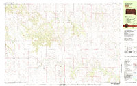
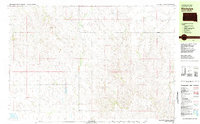
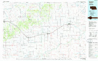
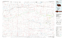
 1981 Martin1981 Print · USGSThe town of Martin sits at the center of this High Plains landscape in the early eighties, where agriculture and conservation meet. Researchers can trace the local infrastructure from the High Sch and Cem to the waters of Deadmans Lake and the Lacreek National Wildlife Refuge.
 - 1981 Map of Allen
 1981 Allen1981 Print · USGSBennett County in the early eighties reveals a sparse ranching and creek-side landscape focused on the community of Allen. Researchers can find numerous family-named landmarks and rural burial sites including Red Bear Cem, Plenty Bears, and Peyote Cem.
 - 1981 Map of Kyle
 1981 Kyle1981 Print · USGSThe Pine Ridge Indian Reservation is documented here in the early 1980s, centered on the community of Kyle. Local historians can trace the path of the Big Foot Trail and locate landmarks like the Little Wound Sch and St Barnabas Ch.
 - 1981 Map of Blackpipe
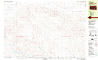
 1981 Blackpipe1981 Print · USGSBennett County ranchlands and creek beds appear in great detail during the early eighties. Researchers can trace the rural layout of the Blackpipe area, identifying local landmarks like the Pleasant Valley Sch and the waters of Pass Creek.
 - 1981 Map of Scotchman Lake
 1981 Scotchman Lake1981 Print · USGSThe South Dakota and Nebraska borderlands in the early eighties are defined here by cattle range and essential prairie waterways. Genealogists and historians can trace the paths of Peck Creek and Cedar Creek or locate landmarks like Scotchman Lake and Clear Lake.
 - 1981 Map of Ecoffey Lake
 1981 Ecoffey Lake1981 Print · USGSThe South Dakota and Nebraska borderlands are captured here in the early eighties, showing a remote landscape of prairie springs and intermittent streams. Researchers can trace the water network from Emma Springs and Allan Dam to the namesake Ecoffey Lake.
 - 1981 Map of Batesland
 1981 Batesland1981 Print · USGSBatesland and the surrounding plains of the Pine Ridge Indian Reservation are captured here in the early eighties. Genealogists and historians can trace the rural landscape across the Shannon Co Bennett Co line, locating Wimer and the winding American Horse Creek.
 - 1981 Map of Hisle
 1981 Hisle1981 Print · USGSThe Pine Ridge Indian Reservation and the rural landscapes of Jackson County are captured in this early 1980s survey. Genealogists can locate St Joseph Cem and trace the small community of Hisle along the banks of Bear-in-the-Lodge Creek.
 - 1981 Map of Swett
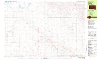
 1981 Swett1981 Print · USGSBennett County ranching country is captured here in the early 1980s, centered on the remote crossroads of Swett. Genealogists and local historians can locate the Gamble Cem, the Central Sch, and the winding banks of the White River.
 - 1981 Map of Buzzard Butte
 1981 Buzzard Butte1981 Print · USGSThe Pine Ridge Indian Reservation in Jackson and Bennett counties is captured here in the early eighties as a landscape of dramatic buttes and winding creeks. Genealogists and historians can trace the paths of Bear-in-the-Lodge Creek and landmarks like Eagle Nest Butte.
 - 1981 Map of Tuthill
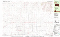
 1981 Tuthill1981 Print · USGSBennett County ranching country comes into focus in the early eighties as the Little White River winds through the prairie. Genealogists and local researchers can trace early homestead footprints near Vetal, Tuthill, and the rural England Sch.2 unique versions available
 - 1983 Map of Martin
 1983 Martin1983 Print · USGSBennett County and the neighboring tribal lands appear here in the early eighties as a network of High Plains settlements and conservation areas. Researchers can trace tribal boundaries and local genealogy through sites like Pine Ridge Indian Reservation, Long Valley, and Arnold Ranch.
 - 1985 Map of Gordon
 1985 Gordon1985 Print · USGSSheridan County and the High Plains thrive along the rail lines during the mid-eighties as agriculture and aviation modernize the region. Trace family roots and land patterns near Rushville, the Nebraska National Forest, and the Old Indian Treaty Boundary.2 unique versions available
 - 1985 Map of Cody East
 1985 Cody East1985 Print · USGSCherry County rangelands and the South Dakota border come into focus in the mid-1980s. Genealogists and local historians can trace the community of Cody, the Prairie Lawn Cem, and established family holdings like Metz Ranch.
 - 1985 Map of Eli
 1985 Eli1985 Print · USGSThe Nebraska Sandhills near the South Dakota border are captured here in the mid-1980s, showcasing the remote ranching landscape of Cherry County. Researchers can trace the path of Bear Creek or locate the small settlement of Eli and nearby Winslow Lake.
 - 1985 Map of Cody
 1985 Cody1985 Print · USGSThe Nebraska Sandhills and the South Dakota borderlands are captured here in the mid-1980s, centered on the Chicago and North Western rail corridor. Genealogists and local historians can trace small-town development in Cody and Merriman or locate rural landmarks within the Samuel R McKelvie National Forest.
 - 1985 Map of Pine Ridge
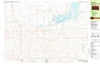
 1985 Pine Ridge1985 Print · USGSThe Pine Ridge Indian Reservation and the edge of the Badlands are detailed in this mid-eighties survey of the South Dakota-Nebraska border. Researchers can trace the drainages of Wounded Knee Creek and White River to locate landmarks like Red Dog Table and Wounded Knee.2 unique versions available
 - 1985 Map of Cody West
 1985 Cody West1985 Print · USGSCherry County ranching and the Nebraska-South Dakota borderlands are captured here in the mid-1980s. Researchers can trace the heritage of local cattle operations like Duck Brand Ranch or locate water features such as Cody Lake and Hay Creek.
End of results
Showing maps 1-23 of 23
Top cities of Bennett County
Frequently asked questions
- What are the different types of historical maps available for Bennett County?
- What is the oldest map of Bennett County?
- Where can I purchase historical maps of Bennett County for my home or office?
- Where can I download high-res historical maps of Bennett County?
- Are there historical topographic maps available for Bennett County?
- Is there historical aerial imagery available for Bennett County?
- Where are historical maps of Bennett County sourced from?