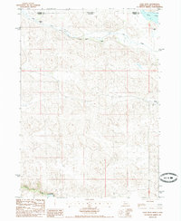
1985 Map of Cody West
USGS Topo · Published 1985About this map
Hay Creek meanders through the northern plains of Cherry County, defining a landscape marked by established cattle operations and remote water sources in the mid-1980s. This survey records several named homesteads, including Triangle B Ranch, Hay Creek Ranch, and Duck Brand Ranch, which illustrate the spread-out ranching economy of the Nebraska-South Dakota borderlands. Near the northeastern corner, Cody Lake and the western edge of Cody provide local landmarks in an area dominated by irrigation efforts, noted by the presence of several Irr Wells. In the south, the terrain descends toward the Niobrara R and the valley of Bear Creek, showing the drainage patterns that shaped regional land use and settlement during this era of agricultural development.
Find a feature on this map
12 named features on this map. Tap any name to fly to it.
Don’t see what you’re looking for? This feature index may not catch every label — zoom into the map to look around manually.
Map Details
Editions of this 1985 Cody West Map
This is the sole edition of this map. No revisions or reprints were ever made.
Other maps of this area

1950 · Cody
USGS Topo · 1:62,500

1952 · Eli
USGS Topo · 1:62,500

1955 · Martin
USGS Topo · 1:250,000

1957 · Valentine
USGS Topo · 1:250,000

1958 · Martin
USGS Topo · 1:250,000

1959 · Valentine
USGS Topo · 1:250,000

1969 · Spring Creek SW
USGS Topo · 1:24,000

1981 · Scotchman Lake
USGS Topo · 1:25,000

1983 · Martin
USGS Topo · 1:100,000

1985 · Eli SE
USGS Topo · 1:24,000