1960s Maps of Martin, South Dakota
Explore 5 historic maps of Martin from the 1960s. These maps offer a rare glimpse into what life looked like during the 1960s — showing old roads, neighborhoods, homes, and landmarks that have changed or disappeared over time.
Whether you're researching your family's past, planning a metal detecting trip, or studying how Martin's landscape evolved across the 1960s, these high-resolution maps are a powerful tool for exploring the history of this region.
- Focus on a specific era: All maps on this page are from the 1960s, giving you a focused view of this time period.
- See what’s changed: Compare century-old streets, trails, and buildings to today's modern landscape using overlays and satellite layers.
- Research with precision: Use these maps for genealogy, historical research, land use analysis, or educational projects.
- View, download, or print: Maps are fully viewable online in high resolution, and can be downloaded or printed for your own records.
Start exploring Martin's history through authentic maps from the 1960s. This is your window into the past.
Martin, SD maps
(5)- 1969 Map of Norris, 1971 Print
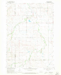 1969 Norris1971 Print · USGSMellette County and the Rosebud Indian Reservation come into focus during the late sixties as the community of Norris anchors this prairie landscape. Genealogists and local historians can trace family ties at Poor Thunder Cem, St Stephens Ch, and Red Leaf Cem along the Black Pipe Creek valley.
 - 1969 Map of Eagle Mans Butte, 1971 Print
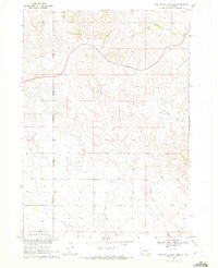
 1969 Eagle Mans Butte1971 Print · USGSTodd County during the late sixties reveals a landscape of high plains and scattered reservation communities. Genealogists and historians can locate the He Dog Village (Historic Site) and several parish landmarks like St Patrick Ch and St Stephen Cem.
 - 1969 Map of Hog Island, 1972 Print
 1969 Hog Island1972 Print · USGSThe Nebraska Sandhills at the South Dakota border are captured here in the late sixties, showing the vast network of lakes and marshes south of the Pine Ridge Indian Reservation Boundary. Researchers can trace the unique hydrology of Hog Island, Shell Lake, and the winding Meadow Horseshoe Ditch.
 - 1969 Map of Spring Creek SW, 1972 Print
 1969 Spring Creek SW1972 Print · USGSThe South Dakota and Nebraska borderlands come into focus in the late 1960s, showing a landscape defined by tribal boundaries and prairie waterways. Trace local history through family outposts like Barnes Ranch and landmarks like Cedar Lake and North Cody Lake.
 - 1969 Map of Iron Shell Flat West, 1972 Print
 1969 Iron Shell Flat West1972 Print · USGSTodd and Bennett Counties, South Dakota, are captured here in the late sixties at the meeting point of two major tribal lands. Researchers can trace the reservation boundaries while locating St Marys Cem and water features like Meat Creek and Coffee Creek.
End of results
Showing maps 1-5 of 5
Top cities near Martin
Top neighborhoods of Martin
- Tuthill historical maps
- Bad Wound historical maps
- Black Eyes historical maps
- Blackpipe historical maps
- Patricia historical maps
- Harrington historical maps
See more
Frequently asked questions
- What are the different types of historical maps available for Martin?
- What is the oldest map of Martin?
- Where can I purchase historical maps of Martin for my home or office?
- Where can I download high-res historical maps of Martin?
- Are there historical topographic maps available for Martin?
- Is there historical aerial imagery available for Martin?
- Where are historical maps of Martin sourced from?