1990s Maps of Martin, South Dakota
Explore 5 historic maps of Martin from the 1990s. These maps offer a rare glimpse into what life looked like during the 1990s — showing old roads, neighborhoods, homes, and landmarks that have changed or disappeared over time.
Whether you're researching your family's past, planning a metal detecting trip, or studying how Martin's landscape evolved across the 1990s, these high-resolution maps are a powerful tool for exploring the history of this region.
- Focus on a specific era: All maps on this page are from the 1990s, giving you a focused view of this time period.
- See what’s changed: Compare century-old streets, trails, and buildings to today's modern landscape using overlays and satellite layers.
- Research with precision: Use these maps for genealogy, historical research, land use analysis, or educational projects.
- View, download, or print: Maps are fully viewable online in high resolution, and can be downloaded or printed for your own records.
Start exploring Martin's history through authentic maps from the 1990s. This is your window into the past.
Martin, SD maps
(5)- 1990 Map of Merriman NE
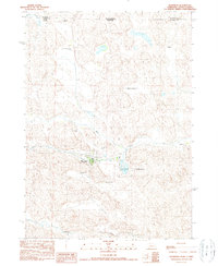
 1990 Merriman NE1990 Print · USGSThe Nebraska Sandhills come alive in this late twentieth-century record of the borderlands between Cherry County and South Dakota. Genealogists and local historians can trace legacy holdings like the Steve Moreland Ranch or the Quibble Ranch near Goose Lake.
 - 1990 Map of Merriman
 1990 Merriman1990 Print · USGSNorthern Nebraska's ranching country is documented here in the late twentieth century near the South Dakota border. Genealogists and historians can trace family landholdings like Sandoz Ranch and Gray Ranch or locate the Merriman town site.
 - 1990 Map of Irwin
 1990 Irwin1990 Print · USGSCherry County ranching country and the Nebraska-South Dakota border are captured here in the 1990s. Genealogists and historians can trace family-named outposts like Wiley Ranch and Irwin alongside hydrological landmarks such as Log Cabin Lake and Scott Meadow.
 - 1990 Map of Trumbull Lake
 1990 Trumbull Lake1990 Print · USGSThe ranching landscape of the Nebraska-South Dakota border is meticulously detailed in this late twentieth-century survey. Genealogists and historians can trace family-named homesteads such as Bear Creek Ranch and Skinner Ranch alongside water features like Trumbull Lake.
 - 1994 Map of Cody
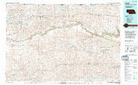 1994 Cody1994 Print · USGSThe Nebraska Sandhills and South Dakota borderlands are captured here in the mid-nineties, showing the vast ranching country around the Niobrara River. Local historians can trace early settlements like Eli and Lavaca alongside the borders of the Samuel R Mc Kelvie National Forest.
End of results
Showing maps 1-5 of 5
Top cities near Martin
Top neighborhoods of Martin
- Tuthill historical maps
- Bad Wound historical maps
- Black Eyes historical maps
- Blackpipe historical maps
- Patricia historical maps
- Harrington historical maps
See more
Frequently asked questions
- What are the different types of historical maps available for Martin?
- What is the oldest map of Martin?
- Where can I purchase historical maps of Martin for my home or office?
- Where can I download high-res historical maps of Martin?
- Are there historical topographic maps available for Martin?
- Is there historical aerial imagery available for Martin?
- Where are historical maps of Martin sourced from?