1900s (20th Century) Maps of Brown County, South Dakota
Explore 57 historic maps of Brown County from the 1900s (20th Century). These maps offer a rare glimpse into what life looked like during the 1900s — showing old roads, neighborhoods, homes, and landmarks that have changed or disappeared over time.
Whether you're researching your family's past, planning a metal detecting trip, or studying how Brown County's landscape evolved across the 1900s, these high-resolution maps are a powerful tool for exploring the history of this region.
- Focus on a specific era: All maps on this page are from the 1900s, giving you a focused view of this time period.
- See what’s changed: Compare century-old streets, trails, and buildings to today's modern landscape using overlays and satellite layers.
- Research with precision: Use these maps for genealogy, historical research, land use analysis, or educational projects.
- View, download, or print: Maps are fully viewable online in high resolution, and can be downloaded or printed for your own records.
Start exploring Brown County's history through authentic maps from the 1900s. This is your window into the past.
Brown County, SD maps
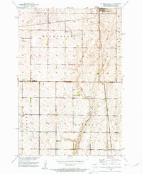
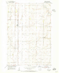
(57)- 1952 Map of Huffton, 1954 Print
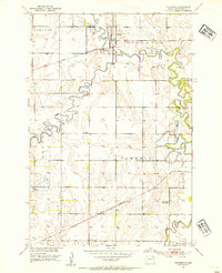
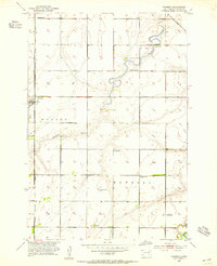
 1952 Huffton1954 Print · USGSBrown County's rural townships and rail-side settlements are captured here in the early fifties during a period of infrastructure transition. Researchers can locate the Great Northern rail line and several country schools like Happy Hour Sch and the Washington Sch (Abandoned).
 - 1952 Map of Columbia, 1954 Print
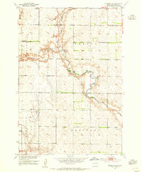
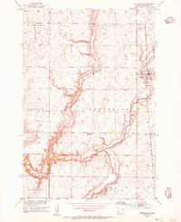
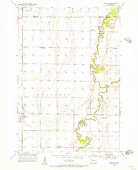
 1952 Columbia1954 Print · USGSBrown County’s river valleys and rail lines are captured here in the early fifties, showing the confluence of the James River and Elm River. Researchers can trace the path of the Great Northern railroad and locate rural landmarks like Davis Sch and Plana.
 - 1952 Map of Ordway, 1954 Print
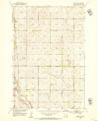
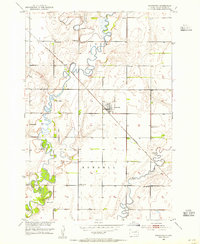
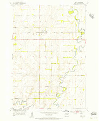
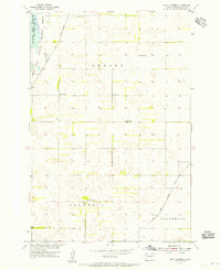
 1952 Ordway1954 Print · USGSMid-century Brown County is defined here by the winding Elm River and the rural rail crossroads at Ordway. Genealogists and local historians can trace the locations of the Thorson Sch, Prairie View Sch, and the Aberdeen Filtration Plant.
 - 1952 Map of Columbia NE, 1954 Print
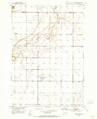
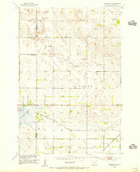
 1952 Columbia NE1954 Print · USGSThe James River valley of Brown County is captured here in the early fifties, showing the interplay of irrigation and conservation. Genealogists can trace the rural school system and family plots at St Johns Cem or follow the Chicago and North Western rail line.
 - 1952 Map of Westport, 1954 Print
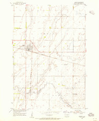
 1952 Westport1954 Print · USGSBrown County's prairie landscape is captured here in the early fifties, following the path of the Elm River through the townships of Oneota and Brainard. Genealogists and historians can trace the rail-side growth of Westport and Barnard or locate the rural Kelly Sch.2 unique versions available
 - 1952 Map of Richmond NE, 1954 Print
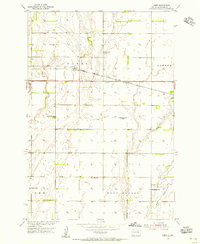
 1952 Richmond NE1954 Print · USGSBrown County's prairie landscape in the early fifties shows a rural community in transition as schools and small settlements consolidate. Researchers can locate family landmarks like the Westport Cem and trace the paths of Willow Creek and the Elm River.2 unique versions available
 - 1952 Map of Putney, 1954 Print
 1952 Putney1954 Print · USGSBrown County's rural townships and the meandering James River are captured here in the early fifties. Genealogists and local historians can trace schoolhouse sites like Riverside Sch and the rail-side community of Putney along the Great Northern line.
 - 1953 Map of Brentford, 1955 Print
 1953 Brentford1955 Print · USGSBrentford and the surrounding Spink County prairie are documented here in the early fifties during a period of rural school consolidation. Genealogists can trace the Plainview Cemetery and the sites of School No 3 and School No 1.
 - 1953 Map of Savo SW, 1955 Print
 1953 Savo SW1955 Print · USGSBrown County's rural townships are documented here in the early fifties, showing the settlement patterns of a Missouri River Basin community. Genealogists can locate family-named sites like Savo Cem and rural schools including Sumption Sch and School No 1.
 - 1953 Map of Frederick, 1955 Print
 1953 Frederick1955 Print · USGSMid-century Brown County is documented here during the Missouri River Basin development era, centered on the rail-side town of Frederick. Genealogists can locate rural landmarks like School No 10 and the site of School No 2 near the Maple River.2 unique versions available
 - 1953 Map of Ellendale South, 1955 Print
 1953 Ellendale South1955 Print · USGSThe borderlands of North and South Dakota are captured here in the early fifties, centering on the rail hub of Ellendale. Genealogists and historians can locate rural schoolhouses like Gustafson Sch and Senn Sch along with the path of the Great Northern railroad.3 unique versions available
 - 1953 Map of Stratford, 1955 Print
 1953 Stratford1955 Print · USGSBrown County, South Dakota, is captured here in the mid-fifties as a thriving rail-and-river agricultural community centered on the town of Stratford. Researchers can trace the legacy of rural education and faith through landmarks like Sunnyview Sch, Midway Sch, and the local Lutheran Ch.
 - 1953 Map of Hecla SE, 1955 Print
 1953 Hecla SE1955 Print · USGSBrown County's rural prairie landscape is captured here in the early fifties, a time when drainage ditches and artesian wells defined local agriculture. Researchers can locate the Detroit Cem, the Landing Field, and several country schools like Heipemann Sch.2 unique versions available
 - 1953 Map of Houghton, 1955 Print
 1953 Houghton1955 Print · USGSBrown County's marshy James River valley is captured here in the early fifties during the development of the Missouri River Basin project. Genealogists and researchers can locate the village of Houghton, local landmarks like Fangon Sch, and the extensive Sand Lake Reservoir.2 unique versions available
 - 1953 Map of Groton SW, 1955 Print
 1953 Groton SW1955 Print · USGSBrown County's agricultural heartland is captured here in the early fifties, showing a rural landscape organized by township sections. Genealogists can trace local history through a series of schoolhouses including Hanson Sch, School No 8, and the Minneapolis and St Louis railroad line.
 - 1953 Map of Newark SW, 1955 Print
 1953 Newark SW1955 Print · USGSThe borderlands of Marshall and Brown Counties are captured here in the mid-1950s, showing a landscape shaped by water management and rail. Researchers can locate the Great Northern tracks, the rural School No 3, and hydrology like Flowing Well.
 - 1953 Map of Savo SE, 1955 Print
 1953 Savo SE1955 Print · USGSBrown County's rural landscape is captured here in the early 1950s, showing the early infrastructure of the Sand Lake National Wildlife Refuge. Genealogists can trace local school locations such as Karlan Sch and Bushby Sch or the site of Houghton Dam.
 - 1953 Map of Warner, 1955 Print
 1953 Warner1955 Print · USGSBrown County's rural townships are captured in the mid-1950s just as the Missouri River Basin development was underway. Genealogists can locate several local landmarks including Bright Star Sch, Happy Valley Sch, and the Warner townsite along the Milwaukee Road.
 - 1953 Map of Milbank, 1958 Print
 1953 Milbank1958 Print · USGSThe tri-state border region of South Dakota, North Dakota, and Minnesota is shown here during the early fifties, a landscape defined by glacial lakes and the Sisseton Indian Reservation. Researchers can trace the legacy of the western railroads, locating old stops along the Great Northern and settlements like Milbank, Webster, and Sisseton.3 unique versions available
 - 1954 Map of Bath, 1955 Print
 1954 Bath1955 Print · USGSMid-century Brown County, South Dakota, reveals a landscape of prairie farms and river management. Trace rural life through the German Cem, local schoolhouses like Rainbow Sch, and the rail corridor of the Chicago Milwaukee St Paul and Pacific.2 unique versions available
 - 1954 Map of Groton, 1955 Print
 1954 Groton1955 Print · USGSGroton and the surrounding South Dakota prairie are shown in the mid-fifties as a vital rail junction and farming center. Genealogists and local historians can trace rural landmarks like the Prairie Side Sch, the Groton Cem, and the path of Mud Creek.2 unique versions available
 - 1954 Map of James, 1955 Print
 1954 James1955 Print · USGSBrown County's prairie landscape was dotted with family-named schoolhouses and rail sidings during the mid-1950s. Genealogists and local historians can trace specific community hubs like James, the Joan of Arc Sch, and the James Cemetery.2 unique versions available
 - 1954 Map of Ferney, 1955 Print
 1954 Ferney1955 Print · USGSBrown County farmland near the mid-century reveals a landscape of rural schools and rail-side settlements. Genealogists and historians can trace the foundations of Ferney or find old landmarks like St Pauls Cem, Haywood Sch, and Pigors Dam.
 - 1954 Map of Mellette, 1955 Print
 1954 Mellette1955 Print · USGSThe Spink County prairies are captured here in the mid-1950s as the rural landscape underwent significant social changes. Researchers can trace the meandering James River and locate several community sites like Armadale Park and the Dunker Sch.
 - 1954 Map of Daly Corners, 1955 Print
 1954 Daly Corners1955 Print · USGSAgricultural life in Brown County is captured here in the mid-1950s, showing a landscape defined by township grids and wildlife conservation. Genealogists can locate family landmarks like Knecht Sch, James Sch, and the Houghton Cem.3 unique versions available
Showing maps 1-25 of 57
Frequently asked questions
- What are the different types of historical maps available for Brown County?
- What is the oldest map of Brown County?
- Where can I purchase historical maps of Brown County for my home or office?
- Where can I download high-res historical maps of Brown County?
- Are there historical topographic maps available for Brown County?
- Is there historical aerial imagery available for Brown County?
- Where are historical maps of Brown County sourced from?