1960s Maps of Brown County, South Dakota
Explore 7 historic maps of Brown County from the 1960s. These maps offer a rare glimpse into what life looked like during the 1960s — showing old roads, neighborhoods, homes, and landmarks that have changed or disappeared over time.
Whether you're researching your family's past, planning a metal detecting trip, or studying how Brown County's landscape evolved across the 1960s, these high-resolution maps are a powerful tool for exploring the history of this region.
- Focus on a specific era: All maps on this page are from the 1960s, giving you a focused view of this time period.
- See what’s changed: Compare century-old streets, trails, and buildings to today's modern landscape using overlays and satellite layers.
- Research with precision: Use these maps for genealogy, historical research, land use analysis, or educational projects.
- View, download, or print: Maps are fully viewable online in high resolution, and can be downloaded or printed for your own records.
Start exploring Brown County's history through authentic maps from the 1960s. This is your window into the past.
Brown County, SD maps
(7)- 1960 Map of Aberdeen East, 1961 Print
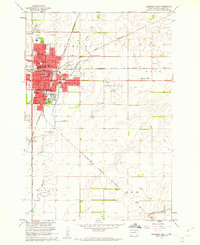 1960 Aberdeen East1961 Print · USGSAberdeen was a bustling South Dakota hub at the start of the sixties, where several major rail lines met the growing residential streets. Trace local genealogy and history at St Marys Cem, Presentation Heights College, and Northern State Teachers College.2 unique versions available
 - 1960 Map of Aberdeen West, 1961 Print
 1960 Aberdeen West1961 Print · USGSAberdeen in the early sixties was a bustling rail hub where major prairie lines converged near the growing city center. Researchers can trace local landmarks like Riverside Cemetery, find neighborhood schools such as Lincoln Sch, and locate the mid-century Drive-in Theater.3 unique versions available
 - 1960 Map of Rudolph, 1961 Print
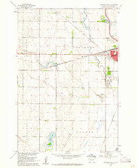
 1960 Rudolph1961 Print · USGSThe rural prairie of Brown County comes into focus in the early sixties, centered on the rail-side settlement of Rudolph. Genealogists can trace family landmarks and school districts like St John Sch, Sunshine Sch, and the Warner Cem.2 unique versions available
 - 1960 Map of Northville, 1961 Print
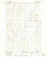
 1960 Northville1961 Print · USGSThe Spink County prairie in the early sixties was defined by rail-centered trade and vast section-line farmsteads. Researchers can trace the Chicago and North Western line through Northville and Mellette, or locate family sites near Fairview Cem.
 - 1966 Map of Chelsea, 1967 Print
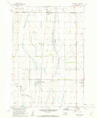
 1966 Chelsea1967 Print · USGSThe prairie landscape at the borders of Faulk and Spink counties is documented here in the mid-1960s. Genealogists and researchers can locate the Chelsea settlement, several Cem sites, and the path of an Old Railroad Grade.
 - 1968 Map of Frederick NW, 1970 Print
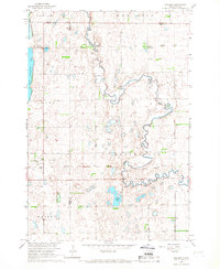
 1968 Frederick NW1970 Print · USGSThe borderlands of the Dakotas are captured in the late sixties as the prairie landscape centers on the waters of Elm Lake. Researchers can locate rural landmarks like the Aurdal Ch, the Great Northern rail line, and local Townhall sites.
 - 1968 Map of Frederick SW, 1970 Print
 1968 Frederick SW1970 Print · USGSBrown County’s rural townships are documented here in the late sixties as the agricultural landscape remained tied to the winding Elm River. Researchers can trace historic property boundaries and find local landmarks like the Townhall and the Spillway at Elm Lake.
End of results
Showing maps 1-7 of 7
Frequently asked questions
- What are the different types of historical maps available for Brown County?
- What is the oldest map of Brown County?
- Where can I purchase historical maps of Brown County for my home or office?
- Where can I download high-res historical maps of Brown County?
- Are there historical topographic maps available for Brown County?
- Is there historical aerial imagery available for Brown County?
- Where are historical maps of Brown County sourced from?