2020s Maps of Brule Township, South Dakota
Explore 4 historic maps of Brule Township from the 2020s. These maps offer a rare glimpse into what life looked like during the 2020s — showing old roads, neighborhoods, homes, and landmarks that have changed or disappeared over time.
Whether you're researching your family's past, planning a metal detecting trip, or studying how Brule Township's landscape evolved across the 2020s, these high-resolution maps are a powerful tool for exploring the history of this region.
- Focus on a specific era: All maps on this page are from the 2020s, giving you a focused view of this time period.
- See what’s changed: Compare century-old streets, trails, and buildings to today's modern landscape using overlays and satellite layers.
- Research with precision: Use these maps for genealogy, historical research, land use analysis, or educational projects.
- View, download, or print: Maps are fully viewable online in high resolution, and can be downloaded or printed for your own records.
Start exploring Brule Township's history through authentic maps from the 2020s. This is your window into the past.
Brule Township, SD maps
(4)- 2021 Map of Iona NW, 2021 Print
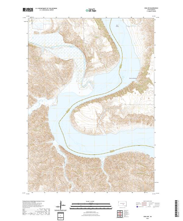 2021 Iona NW2021 Print · USGSThe Missouri River breaks of Lyman and Brule counties appear here in the early twenty-first century, showing the meeting of prairie and water. Researchers can trace the winding course of the White River as it feeds into Lake Francis Case near Bird Island.
 - 2021 Map of Red Lake West, 2021 Print
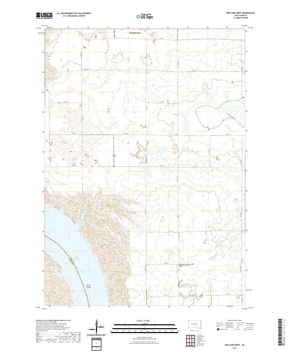 2021 Red Lake West2021 Print · USGSThe Missouri River breaks of South Dakota are captured here in the early twenty-first century, showing the intersection of prairie agriculture and river valley terrain. Researchers can trace the shoreline of Lake Francis Case and the southern outskirts of Chamberlain.
 - 2021 Map of Chamberlain, 2021 Print
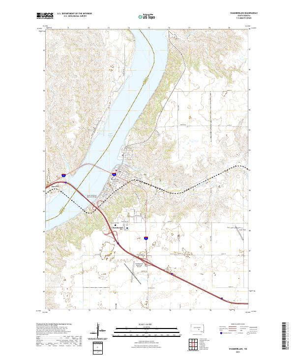 2021 Chamberlain2021 Print · USGSThe Missouri River corridor comes into sharp focus during this era as the reservoir separates Chamberlain and Oacoma. Researchers can trace the civic and transit history of the region via the Brule County Courthouse and the Lewis and Clark Memorial Bridge.
 - 2021 Map of Oacoma, 2021 Print
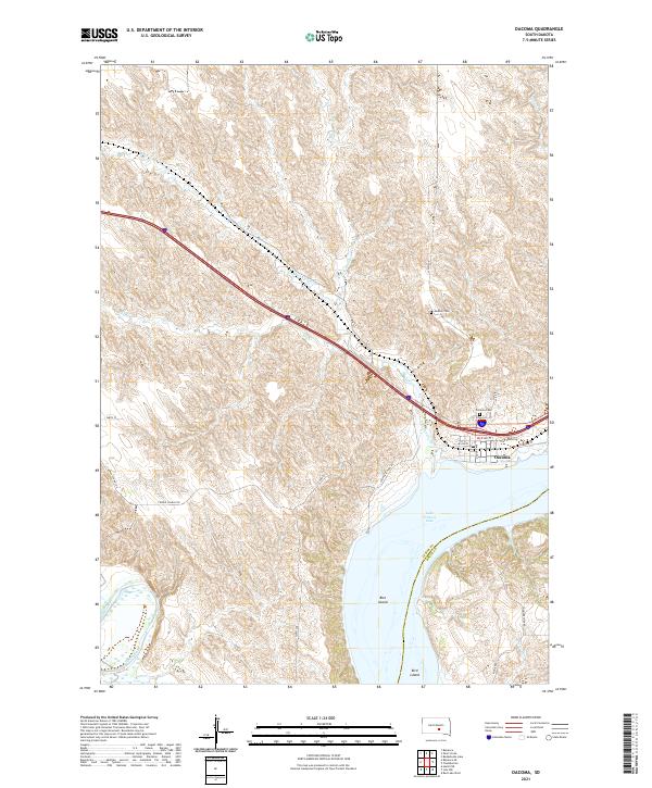 2021 Oacoma2021 Print · USGSOacoma and the rugged river breaks of the Missouri valley are captured in this recent survey. Genealogists and researchers can trace the roads around Oacoma Cem, locate the remote Moeller Cem, and study the river islands including Bice Island and Bird Island.
End of results
Showing maps 1-4 of 4
Top cities near Brule Township
- Chamberlain historical maps
- Oacoma historical maps
- Pukwana historical maps
- Ideal Segment historical maps
- Ola historical maps
- Iona historical maps
Frequently asked questions
- What are the different types of historical maps available for Brule Township?
- What is the oldest map of Brule Township?
- Where can I purchase historical maps of Brule Township for my home or office?
- Where can I download high-res historical maps of Brule Township?
- Are there historical topographic maps available for Brule Township?
- Is there historical aerial imagery available for Brule Township?
- Where are historical maps of Brule Township sourced from?