Old Maps of Brule Township, South Dakota for Genealogy
Trace your family roots with 28 historic maps of Brule Township. These high-res maps reveal old neighborhoods, homesites, landmarks, and streets — helping you uncover where your ancestors lived and how the area evolved over time.
- Explore historic neighborhoods: Identify where your relatives may have lived in the 1800s or 1900s.
- Compare maps over time: Trace the changes in streets, buildings, and landmarks for multi-generational research.
- Perfect for genealogy & ancestry research: Used by family historians and researchers to map out lineage and migration.
These maps are an incredible resource for exploring your personal connection to Brule Township's past.
Brule Township, SD maps
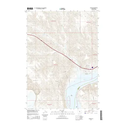
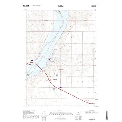
(28)- 1935 Map of Chamberlain, 1975 Print
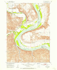
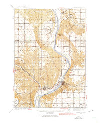 1935 Chamberlain1975 Print · USGSMid-century South Dakota river life centers on the Missouri crossing between Chamberlain and Oacoma during the mid-thirties. Genealogists can locate numerous country schools like Pleasant View Sch and historical sites such as the CCC Camp.
 - 1939 Map of Chamberlain
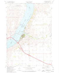
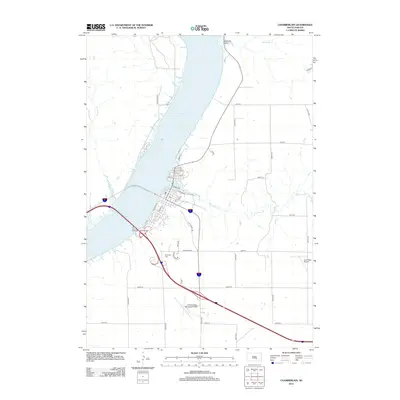
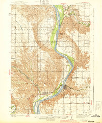 1939 Chamberlain1939 Print · USGSChamberlain and Oacoma face one another across the Missouri River in the late thirties, just as the region transitioned into the modern era. Genealogists and researchers can locate numerous country schools and churches, including St Albans Ch, Grace Mission Sch, and Riverview Cem.2 unique versions available
 - 1940 Map of Iona, 1958 Print
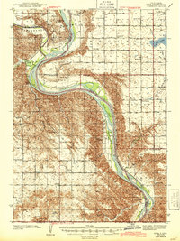
 1940 Iona1958 Print · USGSIn the early 1940s, the Missouri and White Rivers shaped life across South Dakota's Lyman and Brule counties. Genealogists can trace nearly twenty rural schoolhouses and cemeteries like Iona Cem, alongside landmarks such as Twilight Butte and the settlement of Iona.
 - 1944 Map of Iona
 1944 Iona1944 Print · USGSLyman County in the early 1940s reveals a landscape of isolated homesteads and river-bottom farms along the Missouri River. Genealogists and local historians can trace family roots through numerous country schools like Cable Sch and markers such as Iona Cem and Peterson.2 unique versions available
 - 1952 Map of Oacoma, 1954 Print
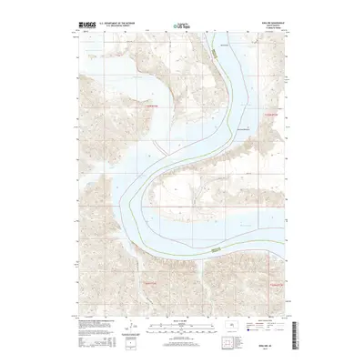
 1952 Oacoma1954 Print · USGSLyman County ranching and river life are frozen in time just before the valley changed forever. Trace family roots at Oacoma Cem, locate the tracks of the Chicago Milwaukee St Paul and Pacific, or find the original sites of Sharp Ranch and Lindly Ranch.
 - 1952 Map of Iona NW, 1955 Print
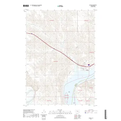
 1952 Iona NW1955 Print · USGSThe Missouri River breaks across the Lyman and Brule county lines in the early fifties, just before the Fort Randall Reservoir began to reshape the valley. Genealogists can locate family holdings like Ellis Ranch or Krammer Ranch and trace the drainage of Bull Creek.2 unique versions available
 - 1955 Map of Mitchell, 1973 Print
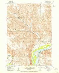
 1955 Mitchell1973 Print · USGSThe Missouri River valley undergoes a massive transformation in the mid-1950s as the Fort Randall Dam creates Lake Francis Case. You can trace the rail lines of the Chicago Milwaukee St Paul and Pacific through Mitchell or locate local landmarks like Butler Town Hall.2 unique versions available
 - 1959 Map of Mitchell
 1959 Mitchell1959 Print · USGSSouth Dakota’s river and rail corridors come alive in the late fifties as the Missouri River valley undergoes dramatic change. Genealogists and historians can trace family roots through numerous small towns and schools such as Academy, Stickney, and Gregory.2 unique versions available
 - 1974 Map of Red Lake West, 1977 Print
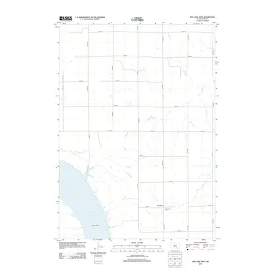
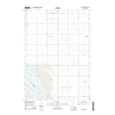
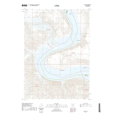
 1974 Red Lake West1977 Print · USGSBrule and Lyman Counties are captured in the mid-seventies, showing the Missouri River's transformation into the massive Lake Francis Case. Researchers can locate family landmarks like Grandview Cem and trace the course of Reimer Creek toward the reservoir.
 - 1974 Map of Chamberlain, 1977 Print
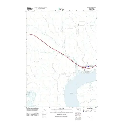
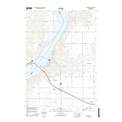
 1974 Chamberlain1977 Print · USGSChamberlain occupies a strategic riverfront position in the 1970s, where rail and road infrastructure meets the Missouri. Researchers can locate long-standing landmarks like St Josephs Indian School, trace the Milwaukee Road railroad, and find the old Drive-in Theater.
 - 1986 Map of Chamberlain
 1986 Chamberlain1986 Print · USGSCentral South Dakota during the mid-eighties shows a landscape shaped by the Missouri River and the rise of Interstate 90. Researchers can trace the development of river towns like Chamberlain and Oacoma or locate remote landmarks like Bijou Hills and Hamill.2 unique versions available
 - 1990 Map of Mitchell, 1991 Print
 1990 Mitchell1991 Print · USGSThe Missouri River and the surrounding South Dakota plains are captured here in the early nineties, showing a landscape shaped by water and wire. Genealogists and historians can trace the gridded townships from Mitchell to the Bijou Hills, locating sites like the Platte Colony and Academy.
 - 2012 Map of Oacoma, 2012 Print
 2012 Oacoma2012 Print · USGSCovers Brule Township, including Oacoma, Chamberlain Township, and other nearby areas
 - 2012 Map of Chamberlain, 2012 Print
 2012 Chamberlain2012 Print · USGSCovers Brule Township, including Chamberlain, Oacoma, and other nearby areas
 - 2012 Map of Iona NW, 2012 Print
 2012 Iona NW2012 Print · USGSCovers Brule Township, including Grandview Township, Lyman County, and other nearby areas
 - 2012 Map of Red Lake West, 2012 Print
 2012 Red Lake West2012 Print · USGSCovers Brule Township, including Grandview Township, Ola Township, and other nearby areas
 - 2015 Map of Oacoma, 2015 Print
 2015 Oacoma2015 Print · USGSCovers Brule Township, including Oacoma, Chamberlain Township, and other nearby areas
 - 2015 Map of Chamberlain, 2015 Print
 2015 Chamberlain2015 Print · USGSCovers Brule Township, including Chamberlain, Oacoma, and other nearby areas
 - 2015 Map of Iona NW, 2015 Print
 2015 Iona NW2015 Print · USGSCovers Brule Township, including Grandview Township, Lyman County, and other nearby areas
 - 2015 Map of Red Lake West, 2015 Print
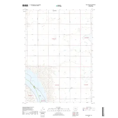
 2015 Red Lake West2015 Print · USGSCovers Brule Township, including Grandview Township, Ola Township, and other nearby areas
 - 2017 Map of Red Lake West, 2017 Print
 2017 Red Lake West2017 Print · USGSCovers Brule Township, including Grandview Township, Ola Township, and other nearby areas
 - 2017 Map of Chamberlain, 2017 Print
 2017 Chamberlain2017 Print · USGSCovers Brule Township, including Chamberlain, Oacoma, and other nearby areas
 - 2017 Map of Oacoma, 2017 Print
 2017 Oacoma2017 Print · USGSCovers Brule Township, including Oacoma, Chamberlain Township, and other nearby areas
 - 2017 Map of Iona NW, 2017 Print
 2017 Iona NW2017 Print · USGSCovers Brule Township, including Grandview Township, Lyman County, and other nearby areas
 - 2021 Map of Iona NW, 2021 Print
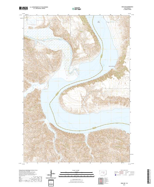 2021 Iona NW2021 Print · USGSThe Missouri River breaks of Lyman and Brule counties appear here in the early twenty-first century, showing the meeting of prairie and water. Researchers can trace the winding course of the White River as it feeds into Lake Francis Case near Bird Island.
Showing maps 1-25 of 28
Top cities near Brule Township
- Chamberlain historical maps
- Oacoma historical maps
- Pukwana historical maps
- Ideal Segment historical maps
- Ola historical maps
- Iona historical maps
Frequently asked questions
- What are the different types of historical maps available for Brule Township?
- What is the oldest map of Brule Township?
- Where can I purchase historical maps of Brule Township for my home or office?
- Where can I download high-res historical maps of Brule Township?
- Are there historical topographic maps available for Brule Township?
- Is there historical aerial imagery available for Brule Township?
- Where are historical maps of Brule Township sourced from?