2020s Maps of Jackson Township, South Dakota
Explore 5 historic maps of Jackson Township from the 2020s. These maps offer a rare glimpse into what life looked like during the 2020s — showing old roads, neighborhoods, homes, and landmarks that have changed or disappeared over time.
Whether you're researching your family's past, planning a metal detecting trip, or studying how Jackson Township's landscape evolved across the 2020s, these high-resolution maps are a powerful tool for exploring the history of this region.
- Focus on a specific era: All maps on this page are from the 2020s, giving you a focused view of this time period.
- See what’s changed: Compare century-old streets, trails, and buildings to today's modern landscape using overlays and satellite layers.
- Research with precision: Use these maps for genealogy, historical research, land use analysis, or educational projects.
- View, download, or print: Maps are fully viewable online in high resolution, and can be downloaded or printed for your own records.
Start exploring Jackson Township's history through authentic maps from the 2020s. This is your window into the past.
Jackson Township, SD maps
(5)- 2021 Map of Bovee, 2021 Print
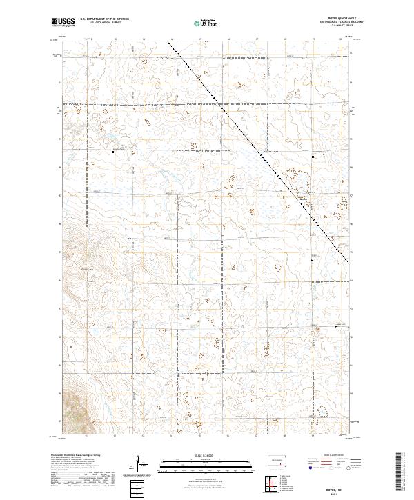 2021 Bovee2021 Print · USGSCharles Mix County at the start of the 2020s remains a landscape of section-line roads and prairie drainages centered on the community of Bovee. Researchers can locate several remote burial grounds like Jasper Cem and Bloomington Cem or trace the path of Edgerton Cr.
 - 2021 Map of Lake Andes NW, 2021 Print
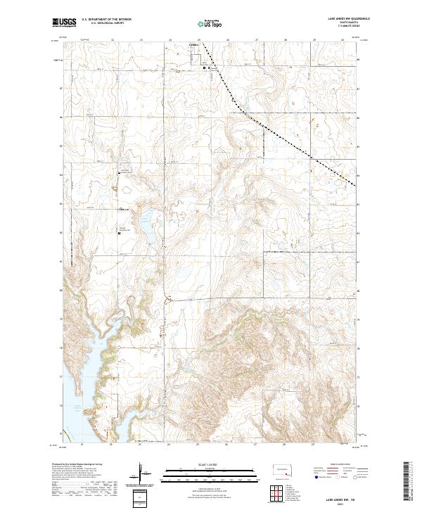 2021 Lake Andes NW2021 Print · USGSCharles Mix County is documented here in its contemporary state, showing the prairie uplands above the Missouri River bluffs. Genealogists can locate several key burial sites like Saint Anns Catholic Cem and Jackson Township Cem near the town of Geddes.
 - 2021 Map of Lake Andes SW, 2021 Print
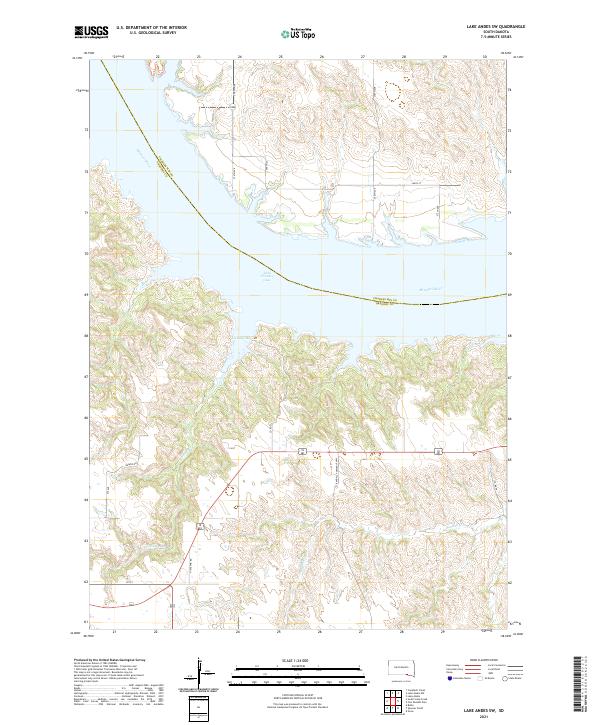 2021 Lake Andes SW2021 Print · USGSSouth-central South Dakota river country is captured here as it appeared in the early 2020s, dominated by the reservoir of the Missouri River. Local historians can trace rural routes like Randall Township Hwy and explore the rugged inlets of Joe Days Bay and Joe Days Cr.
 - 2021 Map of Campbell Creek, 2021 Print
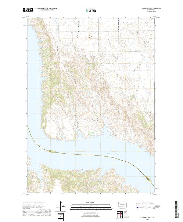 2021 Campbell Creek2021 Print · USGSThe Missouri River breaks through the South Dakota prairie in the early 2020s, creating a landscape of deep coulees and wide reservoir waters. Researchers can trace the winding course of Campbell Creek and locate local landmarks like Odenbach Bay and South Scalp Creek.
 - 2021 Map of Geddes, 2021 Print
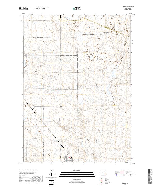 2021 Geddes2021 Print · USGSThe prairie landscape surrounding Geddes is documented here as it appeared in 2021, showing the intersection of rural agriculture and township history. Researchers can trace the town’s street grid or locate landmarks like Morningside Cem and Stoten Lake among the section roads.
End of results
Showing maps 1-5 of 5
Top cities near Jackson Township
- Platte historical maps
- Lake Andes historical maps
- Bonesteel historical maps
- Geddes historical maps
- Pickstown historical maps
- Fairfax historical maps
See more
Frequently asked questions
- What are the different types of historical maps available for Jackson Township?
- What is the oldest map of Jackson Township?
- Where can I purchase historical maps of Jackson Township for my home or office?
- Where can I download high-res historical maps of Jackson Township?
- Are there historical topographic maps available for Jackson Township?
- Is there historical aerial imagery available for Jackson Township?
- Where are historical maps of Jackson Township sourced from?