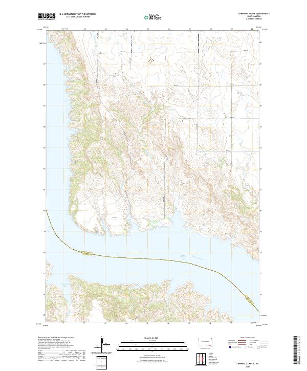
2021 Map of Campbell Creek
USGS Topo · Published 2021About this map
Missouri River water levels define the modern geography of this South Dakota landscape, where the vast Lake Francis Case reservoir dominates the southern portion of the quadrangle. The map reveals the intricate network of drainage systems feeding the Missouri, including the winding Campbell Creek and Benge Creek, which carve through the high prairie bluffs. The administrative boundary between Charles Mix and Gregory counties follows the submerged old river channel, visible beneath the reservoir's surface. On the northern banks, Odenbach Bay provides a sheltered inlet near the rugged shorelines. The upland areas are strictly organized by a section-line road grid, including 367th Ave and 286th St, reflecting the persistent patterns of Great Plains land division and rural access routes like N Wheeler Rd that connect isolated homesteads to the river valley.
Find a feature on this map
24 named features on this map. Tap any name to fly to it.
Don’t see what you’re looking for? This feature index may not catch every label — zoom into the map to look around manually.
Map Details
Editions of this 2021 Campbell Creek Map
This is the sole edition of this map. No revisions or reprints were ever made.
Other maps of this area

1955 · Mitchell
USGS Topo · 1:250,000

1959 · Mitchell
USGS Topo · 1:250,000

1964 · Campbell Creek
USGS Topo · 1:24,000

1964 · Whetstone Bay
USGS Topo · 1:24,000

1964 · Lake Andes NW
USGS Topo · 1:24,000

1964 · Lake Andes SW
USGS Topo · 1:24,000
1964 · South Scalp Creek
USGS Topo · 1:24,000
1964 · Bonesteel
USGS Topo · 1:24,000

1977 · Lake Andes NW
USGS Topo · 1:24,000
1977 · Lake Andes SW
USGS Topo · 1:24,000