1970s Maps of Corson County, South Dakota
Explore 29 historic maps of Corson County from the 1970s. These maps offer a rare glimpse into what life looked like during the 1970s — showing old roads, neighborhoods, homes, and landmarks that have changed or disappeared over time.
Whether you're researching your family's past, planning a metal detecting trip, or studying how Corson County's landscape evolved across the 1970s, these high-resolution maps are a powerful tool for exploring the history of this region.
- Focus on a specific era: All maps on this page are from the 1970s, giving you a focused view of this time period.
- See what’s changed: Compare century-old streets, trails, and buildings to today's modern landscape using overlays and satellite layers.
- Research with precision: Use these maps for genealogy, historical research, land use analysis, or educational projects.
- View, download, or print: Maps are fully viewable online in high resolution, and can be downloaded or printed for your own records.
Start exploring Corson County's history through authentic maps from the 1970s. This is your window into the past.
Corson County, SD maps
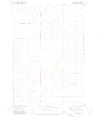
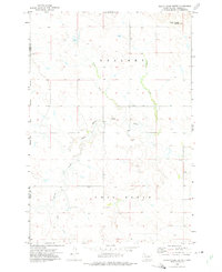
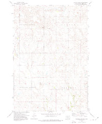
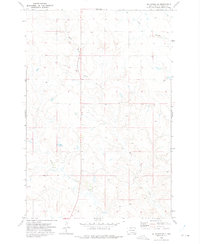
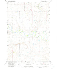
(29)- 1971 Map of McLaughlin SW, 1974 Print
 1971 McLaughlin SW1974 Print · USGSCorson County's wide-open prairie and township lines are captured here in the early 1970s. Genealogists and rail historians can trace the path of the Chicago Milwaukee St Paul and Pacific through the Lincoln and Cadillac districts.
 - 1971 Map of Maple Leaf, 1974 Print
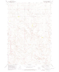
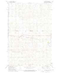
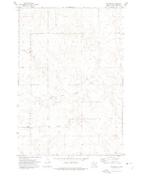
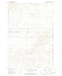
 1971 Maple Leaf1974 Print · USGSThe northern plains borderland comes into focus in the early 1970s as the rail line still threads through the Standing Rock reservation. Researchers can trace the path of the Chicago Milwaukee St Paul and Pacific railroad through the settlement of Maple Leaf and along the banks of Oak Creek.
 - 1972 Map of McIntosh SW, 1975 Print
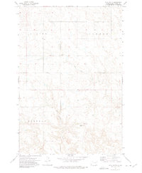
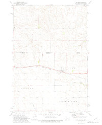
 1972 McIntosh SW1975 Print · USGSThe Standing Rock Indian Reservation is documented here in the early 1970s, showing a remote landscape of open range and winding coulees. Genealogists and historians can trace the paths of Hump Creek and Little Soldier Creek past a lone mine and local wells.
 - 1972 Map of Morristown, 1975 Print
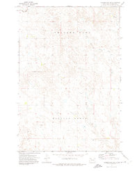
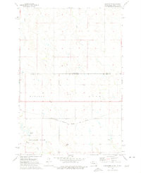
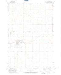
 1972 Morristown1975 Print · USGSMorristown and the surrounding Standing Rock Indian Reservation are documented here in the early 1970s. Trace the paths of the Milwaukee St Paul and Pacific railroad as it passes by Morristown Lake and landmarks like Peaked Butte.
 - 1972 Map of Walker, 1975 Print
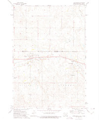
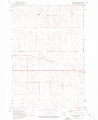
 1972 Walker1975 Print · USGSThe borderlands of South and North Dakota in the early 1970s are defined here by isolated prairie settlements and long-haul rail lines. Genealogists and historians can trace the community of Walker along the Chicago Milwaukee St Paul and Pacific railroad near Pamplin Rock.
 - 1972 Map of Black Horse Butte NW, 1975 Print
 1972 Black Horse Butte NW1975 Print · USGSThe Standing Rock Indian Reservation in the early seventies is shown here as a landscape of broad plateaus and winding prairie rivers. You can trace early water crossings at the Ford on the Grand River or locate landmarks like River View and Delaney.
 - 1972 Map of Black Horse Butte, 1975 Print
 1972 Black Horse Butte1975 Print · USGSThe western edge of the Standing Rock Indian Reservation in the early seventies reveals a landscape of high plains and isolated settlements. Researchers can locate the community of Athboy and trace the drainage of Black Horse Butte Creek near Black Horse Butte.
 - 1972 Map of Morristown SE, 1975 Print
 1972 Morristown SE1975 Print · USGSThe open rangelands of the Standing Rock Indian Reservation are captured in the early seventies, showing a quiet landscape of prairie draws and high-point benchmarks. Trace the drainage of Red Willow Creek and Dirt Lodge Creek alongside the lonely outpost at Prairie View.
 - 1972 Map of Skull Butte, 1975 Print
 1972 Skull Butte1975 Print · USGSCorson County land within the Standing Rock Indian Reservation is documented here in the early 1970s. Local researchers can trace old ranch boundaries and field lines near Skull Butte, the settlement of Duncan, and Dirt Lodge Creek.
 - 1972 Map of Thunder Hawk SW, 1975 Print
 1972 Thunder Hawk SW1975 Print · USGSCorson County in the early 1970s shows a vast landscape within the Standing Rock Indian Reservation. Researchers can trace the drainage patterns of Willow Creek and locate the small settlement of Paris alongside a local mine.
 - 1972 Map of Thunder Hawk SE, 1975 Print
 1972 Thunder Hawk SE1975 Print · USGSThe Standing Rock Indian Reservation in the early seventies is shown here through the lens of its northern townships and creek systems. Researchers can trace land divisions across Thunder Hawk and Custer, following the path of Willow Creek past several scattered Well sites.
 - 1972 Map of Keldron, 1975 Print
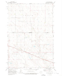
 1972 Keldron1975 Print · USGSThe Dakota plains meet along the state line in the early seventies, centered on the rail-side community of Keldron. Local historians can trace the rural infrastructure of Sioux and Corson Counties, including the Knoke Sch and the Milwaukee Road line.
 - 1972 Map of Watauga, 1975 Print
 1972 Watauga1975 Print · USGSCorson County, South Dakota, is captured in the early 1970s as a high-plains rail corridor within the Standing Rock Indian Reservation. Local historians can trace the path of the Chicago Milwaukee St Paul and Pacific through the settlements of Watauga and Bigham.
 - 1972 Map of Hump Butte, 1975 Print
 1972 Hump Butte1975 Print · USGSThe Standing Rock Indian Reservation borderland is captured in the early seventies, showing a landscape defined by the Chicago Milwaukee St Paul and Pacific railroad. Researchers can trace land use patterns around Hump Butte and local water sources like Seilers Dam.
 - 1972 Map of McIntosh SE, 1975 Print
 1972 McIntosh SE1975 Print · USGSNorth-central South Dakota's open plains are captured here in the early seventies, entirely within the Standing Rock Indian Reservation. Researchers can trace the courses of White Shirt Creek and Hump Creek or locate a specific Mine near the township lines.
 - 1972 Map of Twin Butte, 1975 Print
 1972 Twin Butte1975 Print · USGSThe Standing Rock Indian Reservation in the early seventies shows a landscape of high buttes and sparse ranching settlements. Researchers can locate Gopher, the Black Horse Arena, and local landmarks like Twin Butte or the community Cem.
 - 1972 Map of McIntosh, 1975 Print
 1972 McIntosh1975 Print · USGSCorson County, South Dakota, is captured here in the early seventies as a vital rail and ranching crossroads on the Standing Rock Indian Reservation. Trace local family history at St Bonaventure Cemetery or follow the path of the Chicago Milwaukee St Paul and Pacific railroad.2 unique versions available
 - 1972 Map of Thunder Hawk, 1975 Print
 1972 Thunder Hawk1975 Print · USGSThe Dakota borderlands come into focus in the early 1970s as the Chicago Milwaukee St Paul and Pacific rail line connects small prairie outposts. Genealogists and historians can trace the tracks through Thunder Hawk and locate landmarks like Thunder Hawk Butte and the settlement of Wheatland.
 - 1972 Map of Tatanka Lake, 1975 Print
 1972 Tatanka Lake1975 Print · USGSThe borderlands of the Dakotas appear in the early 1970s, showing the intersection of Sioux and Corson counties. Researchers can trace the path of the Chicago Milwaukee St Paul and Pacific rail line as it passes Tatanka Lake and the heights of Leaf-on Hill.
 - 1972 Map of Black Horse Butte NE, 1975 Print
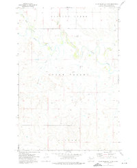
 1972 Black Horse Butte NE1975 Print · USGSCorson County rural life within the Standing Rock Indian Reservation is captured here in the early seventies. Genealogists and local historians can trace family land plots near Center Sch and follow the winding path of the Grand River through Riverside.
 - 1974 Map of Lemmon NE, 1978 Print
 1974 Lemmon NE1978 Print · USGSThe North and South Dakota borderlands are captured here in the 1970s, where the rail-and-ranch economy defines the landscape. Researchers can trace the path of the Chicago Milwaukee St Paul and Pacific railroad and the Standing Rock Indian Reservation Boundary.
 - 1975 Map of Laundreaux Butte, 1976 Print
 1975 Laundreaux Butte1976 Print · USGSThe South Dakota ridge country comes into focus in the 1970s at the intersection of two major tribal nations. Local historians and genealogists can trace the Standing Rock and Cheyenne River boundaries while locating landmarks like Laundreaux Butte and Flanagan.
 - 1975 Map of Glencross, 1978 Print
 1975 Glencross1978 Print · USGSDewey County, South Dakota, is captured here in the mid-1970s at the intersection of two major tribal lands. Researchers can trace the rail corridor of the Chicago Milwaukee St Paul and Pacific through Glencross and locate the Sacred Heart Cem.
 - 1975 Map of Trail City, 1978 Print
 1975 Trail City1978 Print · USGSTrail City in the mid-seventies occupies a unique position on the boundary between the Standing Rock and Cheyenne River Indian Reservations. Researchers can trace the path of the Chicago Milwaukee St Paul and Pacific railroad through the townsite and locate the Trail City Cem and Trail City Lake.
 - 1975 Map of Glencross NE, 1978 Print
 1975 Glencross NE1978 Print · USGSThe northern plains of South Dakota are captured in the mid-seventies, showing the intersection of tribal and county lands. Researchers can trace the path of the Chicago Milwaukee St Paul and Pacific rail line past Trail City RR Lake and the winding Handboy Creek.
Showing maps 1-25 of 29
Top cities of Corson County
Frequently asked questions
- What are the different types of historical maps available for Corson County?
- What is the oldest map of Corson County?
- Where can I purchase historical maps of Corson County for my home or office?
- Where can I download high-res historical maps of Corson County?
- Are there historical topographic maps available for Corson County?
- Is there historical aerial imagery available for Corson County?
- Where are historical maps of Corson County sourced from?