1980s Maps of Corson County, South Dakota
Explore 14 historic maps of Corson County from the 1980s. These maps offer a rare glimpse into what life looked like during the 1980s — showing old roads, neighborhoods, homes, and landmarks that have changed or disappeared over time.
Whether you're researching your family's past, planning a metal detecting trip, or studying how Corson County's landscape evolved across the 1980s, these high-resolution maps are a powerful tool for exploring the history of this region.
- Focus on a specific era: All maps on this page are from the 1980s, giving you a focused view of this time period.
- See what’s changed: Compare century-old streets, trails, and buildings to today's modern landscape using overlays and satellite layers.
- Research with precision: Use these maps for genealogy, historical research, land use analysis, or educational projects.
- View, download, or print: Maps are fully viewable online in high resolution, and can be downloaded or printed for your own records.
Start exploring Corson County's history through authentic maps from the 1980s. This is your window into the past.
Corson County, SD maps
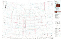
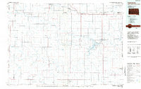
(14)- 1980 Map of McIntosh, 1981 Print
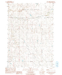
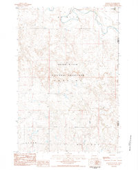
 1980 McIntosh1981 Print · USGSThe northern plains of the Standing Rock Indian Reservation are shown here as they appeared in the early 1980s. You can trace the railroad history of Corson County along the Chicago Milwaukee St Paul and Pacific line, connecting settlements like Watauga and Morristown.
 - 1982 Map of Glad Valley, 1983 Print
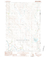
 1982 Glad Valley1983 Print · USGSGlad Valley and the northern South Dakota plains are captured in the early eighties as a crossroads of tribal and federal lands. Researchers can trace the section lines and remote landmarks like Glad Valley Dam, Twin Butte, and the local Cem.
 - 1982 Map of Glad Valley NW, 1983 Print
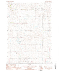
 1982 Glad Valley NW1983 Print · USGSZiebach County and the surrounding plains are captured in the early eighties as a intersection of tribal and federal lands. Researchers can trace boundary lines for the Standing Rock Indian Reservation and landmarks like Twin Butte.
 - 1982 Map of Irish Creek NW, 1983 Print
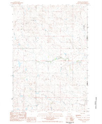
 1982 Irish Creek NW1983 Print · USGSThe open plains of Ziebach and Corson counties are captured here in the early eighties, where tribal lands meet at a quiet geographic boundary. Researchers can trace the path of Irish Creek across the Standing Rock Indian Reservation during this era of rural mapping.
 - 1983 Map of Irish Creek NE
 1983 Irish Creek NE1983 Print · USGSThe high plains of South Dakota are captured here in the early eighties at the meeting point of two major tribal lands. Genealogists and historians can trace the precise path of the Cheyenne River Indian Reservation Boundary and follow the routes of Firesteel Creek and Red Earth Creek.2 unique versions available
 - 1983 Map of Lemmon Lake, 1984 Print
 1983 Lemmon Lake1984 Print · USGSThe Perkins County plains were transitioning toward modern conservation management in the early eighties. Researchers can trace the water network from Thunder Hawk Creek to the Grand River and locate the Lemmon Lake State Game Production Area.
 - 1983 Map of Coal Springs, 1984 Print
 1983 Coal Springs1984 Print · USGSPerkins County in the early eighties is captured here as a landscape of remote ranches and expansive prairie drainages. Researchers can trace the legacy of rural flight and land use through landmarks like Coal Springs Dam, Nelson Airstrip, and the namesake Coal Springs settlement.
 - 1983 Map of Meadow SE, 1984 Print
 1983 Meadow SE1984 Print · USGSPerkins County at the start of the 1980s remains a landscape of open range and winding prairie streams. Genealogists and local historians can trace the intersection of Athboy Road and the vast Grand River Nat Grassland alongside Black Horse Butte Creek.
 - 1983 Map of Meadow NE, 1984 Print
 1983 Meadow NE1984 Print · USGSPerkins County at the start of the 1980s reveals a vast landscape managed for conservation and ranching. Genealogists and historians can trace property boundaries across Dewitt and Hudgins or locate landmarks like Spade and the Grand River.
 - 1984 Map of Faith
 1984 Faith1984 Print · USGSWestern South Dakota's open plains and river breaks appear here in the mid-1980s, centered on the ranching country around Faith. Researchers can trace remote settlements and essential water infrastructure like Sorum, Bixby Gaging Station, and Mourine Lake.3 unique versions available
 - 1984 Map of Lemmon
 1984 Lemmon1984 Print · USGSThe High Plains borderlands of South Dakota and North Dakota are documented here in the mid-1980s, centered on the Lemmon and Hettinger rail corridor. Genealogists and historians can trace local landmarks like Strool, the Shadehill Reservoir shoreline, and isolated buttes including White Butte and Square Top Butte.2 unique versions available
 - 1985 Map of Mobridge
 1985 Mobridge1985 Print · USGSCrossing the Missouri River in the mid-1980s, this landscape reveals the intersection of the Standing Rock Indian Reservation and the rising waters of Lake Oahe. Researchers can locate significant historical markers such as Sitting Bulls Grave, St Elizabeth Mission Home, and the Leavenworth Monument.2 unique versions available
 - 1985 Map of La Plant, 1986 Print
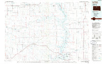 1985 La Plant1986 Print · USGSThe Cheyenne River and Standing Rock Indian Reservations meet here in the mid-eighties as Lake Oahe reshapes the Missouri River valley. Genealogists and local historians can trace the Old RR Gr and locate community landmarks like La Plant, Whitehorse, and Rabenberg Cemetery.2 unique versions available
 - 1986 Map of Timber Lake
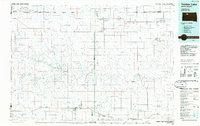 1986 Timber Lake1986 Print · USGSNorth-central South Dakota in the mid-eighties reveals a landscape of ranching hubs and indigenous lands shaped by the Moreau River and Grand River. Researchers can trace old rail routes near Red Elm and locate remote prairie landmarks like St Patrick Butte or Glad Valley.2 unique versions available
End of results
Showing maps 1-14 of 14
Top cities of Corson County
Frequently asked questions
- What are the different types of historical maps available for Corson County?
- What is the oldest map of Corson County?
- Where can I purchase historical maps of Corson County for my home or office?
- Where can I download high-res historical maps of Corson County?
- Are there historical topographic maps available for Corson County?
- Is there historical aerial imagery available for Corson County?
- Where are historical maps of Corson County sourced from?