1900s (20th Century) Maps of Wakpala, South Dakota
Explore 20 historic maps of Wakpala from the 1900s (20th Century). These maps offer a rare glimpse into what life looked like during the 1900s — showing old roads, neighborhoods, homes, and landmarks that have changed or disappeared over time.
Whether you're researching your family's past, planning a metal detecting trip, or studying how Wakpala's landscape evolved across the 1900s, these high-resolution maps are a powerful tool for exploring the history of this region.
- Focus on a specific era: All maps on this page are from the 1900s, giving you a focused view of this time period.
- See what’s changed: Compare century-old streets, trails, and buildings to today's modern landscape using overlays and satellite layers.
- Research with precision: Use these maps for genealogy, historical research, land use analysis, or educational projects.
- View, download, or print: Maps are fully viewable online in high resolution, and can be downloaded or printed for your own records.
Start exploring Wakpala's history through authentic maps from the 1900s. This is your window into the past.
Wakpala, SD maps
(20)- 1953 Map of McIntosh, 1965 Print
 1953 McIntosh1965 Print · USGSThe north-central Dakota prairie is captured here during the mid-fifties, showing the vast Standing Rock Indian Reservation and the newly formed Oah E Reservoir. Genealogists and historians can trace the Chicago Milwaukee St Paul and Pacific rail line through stops like McIntosh, Walker, and Eagle Butte.3 unique versions available
 - 1956 Map of Wakpala NW, 1957 Print
 1956 Wakpala NW1957 Print · USGSCorson County land along the Grand River is captured here in the mid-1950s during a period of Missouri River Basin development. Genealogists and local historians can locate Sacred Heart Cem, Long Hill Cem, and the path of the Chicago Milwaukee St Paul and Pacific railroad.2 unique versions available
 - 1956 Map of Wakpala SE, 1957 Print
 1956 Wakpala SE1957 Print · USGSThe Grand River valley in Corson County is shown here during the mid-fifties, dominated by the sweeping high country and the river's winding path. Researchers can trace the route of the Chicago Milwaukee St Paul and Pacific railroad and the drainages of Snake Creek and Claymore Creek.2 unique versions available
 - 1956 Map of Wakpala SW, 1957 Print
 1956 Wakpala SW1957 Print · USGSCorson County’s dissected landscape is captured here in the mid-fifties, showing the rugged breaks of the Missouri River Basin. Trace the path of the Chicago Milwaukee St Paul and Pacific railroad as it winds past Skull Peak and follows Snake Creek.2 unique versions available
 - 1956 Map of Wakpala, 1957 Print
 1956 Wakpala1957 Print · USGSIn the mid-1950s, the railroad and river systems of northern South Dakota converged near Wakpala before the creation of the Oahe Reservoir. Genealogists and historians can trace community landmarks like the St Elizabeth Mission Home and St Bedes Cem along the winding Oak Creek.2 unique versions available
 - 1958 Map of McIntosh
 1958 McIntosh1958 Print · USGSThe north-central Dakotas appear here in the mid-1950s as massive engineering projects and rail lines shaped the plains. Researchers can trace tribal lands within the Standing Rock Indian Reservation and locate local landmarks like the Keller Mine or the Virginia Siding.
 - 1965 Map of Pollock SE, 1967 Print
 1965 Pollock SE1967 Print · USGSThe Missouri River and Oahe Reservoir dominate the landscape of Campbell County in the mid-1960s. Researchers can trace the Standing Rock Indian Reservation Boundary across the water or locate family history at Gale Cem and Kvarness Cem.2 unique versions available
 - 1966 Map of Mahto, 1967 Print
 1966 Mahto1967 Print · USGSCorson County's rolling prairie landscape is captured here in the mid-sixties, centered on the small siding at Mahto. Local historians can trace the path of the Chicago Milwaukee St Paul and Pacific railroad as it follows Oak Creek past a local Gravel Pit.
 - 1966 Map of Kenel, 1967 Print
 1966 Kenel1967 Print · USGSThe Missouri River breaks along the eastern edge of the Standing Rock Indian Reservation during the mid-1960s. Genealogists and historians can trace the local community at Kenel through landmarks like St Benedict Ch and the Kenel Sch.2 unique versions available
 - 1966 Map of Kline Buttes, 1967 Print
 1966 Kline Buttes1967 Print · USGSCorson County land during the mid-sixties reveals a landscape defined by its high prairie terrain and isolated rural institutions. Researchers can trace early school district locations like Butte Sch and topographical landmarks such as Lonesome Butte or Kellers Dam.
 - 1967 Map of Glenham, 1968 Print
 1967 Glenham1968 Print · USGSWalworth County in the late sixties reveals a landscape transformed by the Missouri River's damming and the steady pulse of the rail line. Genealogists and researchers can trace the rural Habenberg Sch, the rail siding at Ridgeland, and the shoreline of the Oahe Reservoir.
 - 1967 Map of Mobridge NE, 1969 Print
 1967 Mobridge NE1969 Print · USGSThe Missouri River valley undergoes a massive transformation in the late sixties as the reservoir fills the canyon between Campbell and Corson Counties. Trace the historical Standing Rock Indian Reservation Boundary and the upland terrain of Wakpala above the Oahe Reservoir.2 unique versions available
 - 1967 Map of Mobridge NW, 1969 Print
 1967 Mobridge NW1969 Print · USGSThe Missouri River breaks in the late sixties reveal a landscape transformed by the Oahe Reservoir along the Standing Rock Indian Reservation Boundary. Trace the shoreline to find the Leavenworth Monument, Fisher Creek, and the upland terrain of Wakpala.
 - 1967 Map of Mobridge, 1969 Print
 1967 Mobridge1969 Print · USGSMobridge and the Missouri River corridor are captured here during the late sixties as the reservoir transformed the regional landscape. Researchers can locate Sitting Bulls Grave, trace the Chicago Milwaukee St Paul and Pacific rail line, and find local landmarks like Greenwood Cem or Beadle Sch.2 unique versions available
 - 1968 Map of Moreau NW, 1970 Print
 1968 Moreau NW1970 Print · USGSThe Missouri and Moreau River valleys are captured in the late sixties as the landscape adjusted to the rising waters of Lake Oahe. Researchers can trace the shifting shorelines of Lake Missouri and follow the boundary between the Standing Rock and Cheyenne River Indian Reservations.
 - 1968 Map of Moreau NE, 1970 Print
 1968 Moreau NE1970 Print · USGSThe Missouri River breaks of Walworth and Dewey counties appear in the late sixties as the waters of Lake Oahe reshape the valley. Genealogists and researchers can trace the boundaries of the Standing Rock and Cheyenne River reservations or locate the settlement at Ridgeland.
 - 1975 Map of Laundreaux Butte, 1976 Print
 1975 Laundreaux Butte1976 Print · USGSThe South Dakota ridge country comes into focus in the 1970s at the intersection of two major tribal nations. Local historians and genealogists can trace the Standing Rock and Cheyenne River boundaries while locating landmarks like Laundreaux Butte and Flanagan.
 - 1975 Map of Trail City, 1978 Print
 1975 Trail City1978 Print · USGSTrail City in the mid-seventies occupies a unique position on the boundary between the Standing Rock and Cheyenne River Indian Reservations. Researchers can trace the path of the Chicago Milwaukee St Paul and Pacific railroad through the townsite and locate the Trail City Cem and Trail City Lake.
 - 1985 Map of Mobridge
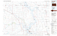 1985 Mobridge1985 Print · USGSCrossing the Missouri River in the mid-1980s, this landscape reveals the intersection of the Standing Rock Indian Reservation and the rising waters of Lake Oahe. Researchers can locate significant historical markers such as Sitting Bulls Grave, St Elizabeth Mission Home, and the Leavenworth Monument.2 unique versions available
 - 1985 Map of La Plant, 1986 Print
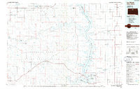 1985 La Plant1986 Print · USGSThe Cheyenne River and Standing Rock Indian Reservations meet here in the mid-eighties as Lake Oahe reshapes the Missouri River valley. Genealogists and local historians can trace the Old RR Gr and locate community landmarks like La Plant, Whitehorse, and Rabenberg Cemetery.2 unique versions available
End of results
Showing maps 1-20 of 20
Top cities near Wakpala
Top neighborhoods of Wakpala
Frequently asked questions
- What are the different types of historical maps available for Wakpala?
- What is the oldest map of Wakpala?
- Where can I purchase historical maps of Wakpala for my home or office?
- Where can I download high-res historical maps of Wakpala?
- Are there historical topographic maps available for Wakpala?
- Is there historical aerial imagery available for Wakpala?
- Where are historical maps of Wakpala sourced from?