
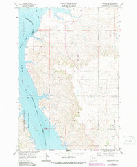
1965 Map of Pollock SE
USGS Topo · Published 1967About this map
The Missouri River corridor defines this 1965 survey, marking the western edge of Corson and Campbell counties. This mid-century view documents the landscape following the creation of the Oahe Reservoir, showing the resulting inundation and the new shoreline that reshaped local geography. The Standing Rock Indian Reservation Boundary runs through the reservoir waters, maintaining a legal line through the flooded river valley.
Find a feature on this map
8 named features on this map. Tap any name to fly to it.
Don’t see what you’re looking for? This feature index may not catch every label — zoom into the map to look around manually.
Map Details
Editions of this 1965 Pollock SE Map
2 editions found
Other maps of this area

1953 · McIntosh
USGS Topo · 1:250,000

1958 · McIntosh
USGS Topo · 1:250,000

1965 · Herreid NW
USGS Topo · 1:24,000

1965 · Herreid SW
USGS Topo · 1:24,000

1965 · Pollock
USGS Topo · 1:24,000

1966 · Kenel
USGS Topo · 1:24,000

1966 · Pollock NW
USGS Topo · 1:24,000

1967 · Mobridge NE
USGS Topo · 1:24,000

1967 · Mobridge NW
USGS Topo · 1:24,000

1967 · Selby NW
USGS Topo · 1:24,000