Old Maps of Gregory County, South Dakota for Genealogy
Trace your family roots with 210 historic maps of Gregory County. These high-res maps reveal old neighborhoods, homesites, landmarks, and streets — helping you uncover where your ancestors lived and how the area evolved over time.
- Explore historic neighborhoods: Identify where your relatives may have lived in the 1800s or 1900s.
- Compare maps over time: Trace the changes in streets, buildings, and landmarks for multi-generational research.
- Perfect for genealogy & ancestry research: Used by family historians and researchers to map out lineage and migration.
These maps are an incredible resource for exploring your personal connection to Gregory County's past.
Gregory County, SD maps
(210)- 1951 Map of Butte NW
 1951 Butte NW1951 Print · USGSBoyd County agriculture and rural life are preserved here at the turn of the 1950s, showing the Nebraska-South Dakota borderlands. Researchers can trace the placement of historic country schoolhouses like School No 49 and School No 3 near the Niobrara River.2 unique versions available
 - 1951 Map of Naper
 1951 Naper1951 Print · USGSNaper and the Boyd County ranchlands are captured here in the early fifties, showing a rural landscape defined by river valleys and the state line. Researchers can locate several country schoolhouses, from Basin Sch to Point Sch, and the local Knoll Crest Cem.2 unique versions available
 - 1955 Map of Mitchell, 1973 Print
 1955 Mitchell1973 Print · USGSThe Missouri River valley undergoes a massive transformation in the mid-1950s as the Fort Randall Dam creates Lake Francis Case. You can trace the rail lines of the Chicago Milwaukee St Paul and Pacific through Mitchell or locate local landmarks like Butler Town Hall.2 unique versions available
 - 1955 Map of O'Neill, 1974 Print
 1955 O'Neill1974 Print · USGSNorth-central Nebraska in the 1950s reveals a vast cattle-ranching landscape transitioning from the Missouri River breaks to the iconic Sand Hills. Researchers can trace the path of the Chicago and North Western rail line and locate rural landmarks like the Dustin Post Office and St Johns Lake Ch.2 unique versions available
 - 1959 Map of O'Neill
 1959 O'Neill1959 Print · USGSNorth-central Nebraska in the late fifties is defined by the vast Sand Hills and the vital Chicago and North Western rail line. Genealogists and researchers can trace family roots through settlements like Atkinson, Bassett, and Stuart or follow the waters of the Niobrara River.2 unique versions available
 - 1959 Map of Mitchell
 1959 Mitchell1959 Print · USGSSouth Dakota’s river and rail corridors come alive in the late fifties as the Missouri River valley undergoes dramatic change. Genealogists and historians can trace family roots through numerous small towns and schools such as Academy, Stickney, and Gregory.2 unique versions available
 - 1964 Map of Gregory SE, 1965 Print
 1964 Gregory SE1965 Print · USGSSouth Dakota's rural school districts and winding creek bottoms are captured here in the mid-1960s. Genealogists can locate family landmarks like McCumber Sch, Klug Sch, and Star Lake across the sectioned prairie.
 - 1964 Map of Campbell Creek, 1965 Print
 1964 Campbell Creek1965 Print · USGSThe Missouri River valley in the early 1960s shows a landscape reshaped by the Missouri River Basin development program and the creation of the Fort Randall reservoir. Genealogists and local historians can trace legacy land divisions along the Fort Randall Military Reservation Boundary and find early recreation sites like Pease Creek Recreation Area.
 - 1964 Map of Herrick NW, 1965 Print
 1964 Herrick NW1965 Print · USGSThe rural landscape of Gregory County comes alive in the mid-1960s, showing the intersection of the Chicago and North Western rail line and the Butte Valley ranch lands. Researchers can locate the Butte Valley Sch and trace the winding courses of Peters Creek and Coon Creek.
 - 1964 Map of Butte, 1965 Print
 1964 Butte1965 Print · USGSThe Nebraska and South Dakota borderlands come into focus in the mid-sixties, centered on the Boyd County seat. Researchers can trace the Chicago and North Western rail line through Anoka and locate historic burial sites like Old Settlers Cem.
 - 1964 Map of Herrick NE, 1965 Print
 1964 Herrick NE1965 Print · USGSSouthern Gregory County in the early sixties remains a landscape of isolated ranching and rural education. Genealogists and historians can locate the Hornbeck Sch and trace the many artesian Flowing Well sites along Petes Cr.
 - 1964 Map of St. Charles, 1965 Print
 1964 St. Charles1965 Print · USGSGregory County in the mid-1960s shows a landscape defined by the Chicago and North Western railroad and the winding Ponca Creek. Genealogists and researchers can trace local boundaries through ST CHARLES, ELLSTON, and PLEASANT VALLEY townships.
 - 1964 Map of Mills, 1965 Print
 1964 Mills1965 Print · USGSThe Keya Paha River valley at the South Dakota and Nebraska border is captured here in the mid-sixties. Local researchers can trace the settlement at Mills, locate the Olive Branch Cem, and follow the Rosebud Indian Reservation Boundary.
 - 1964 Map of Whetstone Bay, 1965 Print
 1964 Whetstone Bay1965 Print · USGSThe Missouri River breaks of Gregory County are captured here in the mid-1960s following the creation of the Fort Randall Reservoir. Researchers can trace the Rosebud Indian Reservation Boundary and locate landmarks like Mulehead Ranch and the Whetstone Bay Recreation Area.
 - 1964 Map of Gregory, 1965 Print
 1964 Gregory1965 Print · USGSGregory thrived as a railroad and ranching hub in the mid-sixties, serving as the focal point for the surrounding prairie townships. Genealogists and local historians can trace the community's footprint through sites like IOOF Cem, the Chicago and North Western rail line, and the Gordon Sch.
 - 1964 Map of Lake Andes NW, 1965 Print
 1964 Lake Andes NW1965 Print · USGSCharles Mix County is captured in the mid-sixties as the Missouri River reservoir system transforms the landscape. Genealogists and historians can trace the Old Fort Randall Military Road and locate family sites near St Anns Cem and Geddes.2 unique versions available
 - 1964 Map of Dallas, 1965 Print
 1964 Dallas1965 Print · USGSGregory County in the mid-1960s reveals a structured prairie landscape centered on the rail-side town of Dallas. Local historians and genealogists can trace the distribution of early rural education through sites like Melrose Sch, North Lincoln Sch, and Pleasant Valley Sch.
 - 1964 Map of Fort Randall Dam, 1965 Print
 1964 Fort Randall Dam1965 Print · USGSThe Missouri River and Lake Francis Case are captured here during the mid-sixties, highlighting the newly completed dam and the town of Pickstown. Researchers can locate the Fort Randall Historic Site, Old Fort Randall Cem, and the St Francis Ch.
 - 1964 Map of Paxton, 1965 Print
 1964 Paxton1965 Print · USGSTripp and Gregory Counties are captured here in the mid-sixties, showcasing a landscape of small-town centers and distributed rural school districts. Genealogists can trace family footprints near Paxton, the Paxton Church, and several local landmarks like South Lincoln Sch.
 - 1964 Map of Burton, 1965 Print
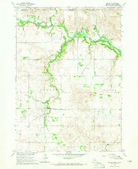 1964 Burton1965 Print · USGSThe Nebraska-South Dakota borderlands come into focus in the mid-1960s, showing the intersection of the Rosebud Reservation and rural Keya Paha County. Genealogists and researchers can trace the community around Burton, identifying local family landmarks like the Burton Cem and Roadside Sch.
 - 1964 Map of Gross, 1965 Print
 1964 Gross1965 Print · USGSBoyd County, Nebraska, and Gregory County, South Dakota, are captured in the mid-1960s as the rural landscape follows the Missouri River Basin. Genealogists and historians can trace the Old Fort Randall Military Road and locate the Rosedale Ch, Pleasant View Sch, and the settlement of Gross.
 - 1964 Map of Lake Andes SW, 1965 Print
 1964 Lake Andes SW1965 Print · USGSThe Missouri River valley appears here in the mid-1960s as a newly formed reservoir landscape following the Fort Randall Dam project. Researchers can trace the sprawling Lake Francis Case and identify critical land divisions like the Yankton Indian Reservation Boundary and the historic Fort Randall grounds.
 - 1964 Map of South Scalp Creek, 1965 Print
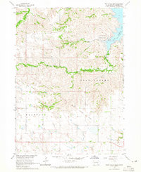 1964 South Scalp Creek1965 Print · USGSGregory County, South Dakota, is captured in the mid-1960s as the Missouri River Basin development transformed the local landscape. Researchers can trace the Fort Randall Military Reservation Boundary and locate landmarks like Bethelem Cem and Fairfax Lake.
 - 1964 Map of Herrick, 1965 Print
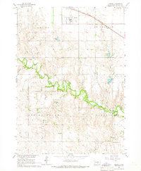 1964 Herrick1965 Print · USGSThe town of Herrick and the surrounding Gregory County prairies are captured here in the mid-1960s. Genealogists can locate family landmarks like Miller Sch, Ponca Creek Cem, and the community at Milks Camp.
 - 1964 Map of Carlock, 1965 Print
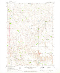 1964 Carlock1965 Print · USGSGregory County was a patchwork of prairie townships and rural school districts during the mid-sixties. Genealogists and local historians can trace the foundations of this community through landmarks like Carlock, Fairmont Ch, and the Congregational Cem.
Showing maps 1-25 of 210
Top cities of Gregory County
- Gregory historical maps
- Burke historical maps
- Bonesteel historical maps
- Dallas historical maps
- Fairfax historical maps
- Dixon historical maps
See more
Frequently asked questions
- What are the different types of historical maps available for Gregory County?
- What is the oldest map of Gregory County?
- Where can I purchase historical maps of Gregory County for my home or office?
- Where can I download high-res historical maps of Gregory County?
- Are there historical topographic maps available for Gregory County?
- Is there historical aerial imagery available for Gregory County?
- Where are historical maps of Gregory County sourced from?