1900s (20th Century) Maps of Big Bend District, South Dakota
Explore 12 historic maps of Big Bend District from the 1900s (20th Century). These maps offer a rare glimpse into what life looked like during the 1900s — showing old roads, neighborhoods, homes, and landmarks that have changed or disappeared over time.
Whether you're researching your family's past, planning a metal detecting trip, or studying how Big Bend District's landscape evolved across the 1900s, these high-resolution maps are a powerful tool for exploring the history of this region.
- Focus on a specific era: All maps on this page are from the 1900s, giving you a focused view of this time period.
- See what’s changed: Compare century-old streets, trails, and buildings to today's modern landscape using overlays and satellite layers.
- Research with precision: Use these maps for genealogy, historical research, land use analysis, or educational projects.
- View, download, or print: Maps are fully viewable online in high resolution, and can be downloaded or printed for your own records.
Start exploring Big Bend District's history through authentic maps from the 1900s. This is your window into the past.
Big Bend District, SD maps
(12)- 1953 Map of Huron, 1959 Print
 1953 Huron1959 Print · USGSCentral South Dakota comes alive in the mid-1950s as a thriving rail and agricultural corridor between the Missouri and James Rivers. Trace the legacy of family farms and prairie towns like Huron, Faulkton, and Wessington Springs along the historic Chicago and North Western rail lines.3 unique versions available
 - 1954 Map of Huron, 1977 Print
 1954 Huron1977 Print · USGSCentral South Dakota was a landscape of grain elevators and river bends during the mid-fifties. Genealogists and historians can trace the development of the James River valley through railroad towns like Redfield and the sprawling Crow Creek Indian Reservation.
 - 1966 Map of Lower Brule NW, 1967 Print
 1966 Lower Brule NW1967 Print · USGSThe Missouri River valley in the mid-1960s shows a landscape transformed by the waters of Lake Sharpe. Researchers can locate rural landmarks like the Boot Bar Sch and Hidden Valley Sch alongside the West Bend Recreation Area.
 - 1966 Map of Joe Creek, 1967 Print
 1966 Joe Creek1967 Print · USGSThe Missouri River and the newly formed Lake Sharpe dominate the landscape in the mid-1960s, showing the intersection of tribal lands and new reservoirs. Genealogists and local historians can trace rural school locations like Riverdale Sch and Busy Bee Sch along the Joe Creek drainage.
 - 1966 Map of Joe Creek NW, 1967 Print
 1966 Joe Creek NW1967 Print · USGSThe Missouri River valley in the mid-1960s reveals a landscape transformed by the waters of Lake Sharpe along the reservation borders. Genealogists and historians can trace local landmarks like Holy Faith Cem, La Roche Sch, and the Clark Ranch.
 - 1966 Map of Lower Brule SW, 1967 Print
 1966 Lower Brule SW1967 Print · USGSLyman County, South Dakota is captured in the mid-sixties during the development of the Missouri River Basin. Genealogists and historians can trace local landmarks like Messiah Ch, Black Dog Sch, and the winding Medicine Creek.
 - 1966 Map of Joe Creek SE, 1967 Print
 1966 Joe Creek SE1967 Print · USGSLyman County ranchlands meet the rising waters of the Missouri River in the mid-sixties, just as the regional geography was being reshaped. Genealogists can trace the Lower Brule Indian Reservation Boundary and drainage basins like Bad Horse Creek and Dorman.
 - 1966 Map of Lower Brule NE, 1967 Print
 1966 Lower Brule NE1967 Print · USGSThe Missouri River valley in the mid-sixties reveals a landscape reshaped by the rising waters of Missouri River Lake Sharpe. Local historians can trace the borders of the Lower Brule Indian Reservation Boundary and locate a small Cem near the bluffs.
 - 1966 Map of Lower Brule, 1967 Print
 1966 Lower Brule1967 Print · USGSThe Missouri River breaks and the waters of Lake Sharpe define this mid-1960s look at the Lower Brule community. Researchers can locate the Council House, Christ Ch, and early recreation sites like the Counselor Creek Recreation Area.2 unique versions available
 - 1973 Map of De Grey SE, 1976 Print
 1973 De Grey SE1976 Print · USGSHughes County in the 1970s is shown as a rural landscape defined by the winding paths of Chapelle Creek and the southern plains. Local history researchers can trace the locations of the Raber Sch, Chapelle Cem, and the Crow Creek Indian Reservation Boundary.
 - 1973 Map of Chapelle Lake SW, 1976 Print
 1973 Chapelle Lake SW1976 Print · USGSThe central South Dakota prairie and the Crow Creek Indian Reservation meet here during the mid-1970s. Trace old township life through the Snake Butte Sch, the settlement of Shaber, and landmarks like Pratt Butte.
 - 1985 Map of Big Bend Dam, 1986 Print
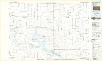 1985 Big Bend Dam1986 Print · USGSThe Missouri River landscape of the mid-1980s is defined by the massive Big Bend Dam and the sprawling waters of Lake Sharpe. Genealogists and historians can trace reservation boundaries and rural outposts like Fort Thompson, Stephan, and the Miller Dale Colony.2 unique versions available
End of results
Showing maps 1-12 of 12
Top neighborhoods of Big Bend District
Frequently asked questions
- What are the different types of historical maps available for Big Bend District?
- What is the oldest map of Big Bend District?
- Where can I purchase historical maps of Big Bend District for my home or office?
- Where can I download high-res historical maps of Big Bend District?
- Are there historical topographic maps available for Big Bend District?
- Is there historical aerial imagery available for Big Bend District?
- Where are historical maps of Big Bend District sourced from?