
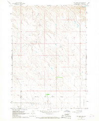
1966 Map of Joe Creek NW
USGS Topo · Published 1967About this map
Lake Sharpe dominates this mid-1960s landscape, representing the altered Missouri River valley following the completion of the Big Bend Dam. This reservoir reaches its Normal Pool Elevation 1420 here, significantly reshaping the shoreline where the Crow Creek Indian Reservation and Lower Brule Indian Reservation meet. The map documents the rural infrastructure of the era, including the Landing Strip near the northern bluffs and the La Roche Sch situated near the mouth of La Roche Creek.
Find a feature on this map
26 named features on this map. Tap any name to fly to it.
Don’t see what you’re looking for? This feature index may not catch every label — zoom into the map to look around manually.
Map Details
Editions of this 1966 Joe Creek NW Map
This is the sole edition of this map. No revisions or reprints were ever made.
Other maps of this area

1934 · Canning
USGS Topo · 1:48,000

1937 · Canning
USGS Topo · 1:62,500

1953 · Huron
USGS Topo · 1:250,000

1954 · Pierre
USGS Topo · 1:250,000

1954 · Huron
USGS Topo · 1:250,000

1958 · Pierre
USGS Topo · 1:250,000

1966 · Joe Creek
USGS Topo · 1:24,000

1966 · Ft. George Butte SE
USGS Topo · 1:24,000

1966 · Joe Creek SE
USGS Topo · 1:24,000
1966 · Joe Creek SW
USGS Topo · 1:24,000