1900s (20th Century) Maps of Ward 2, Spearfish
Explore 12 historic maps of Ward 2 from the 1900s (20th Century). These maps offer a rare glimpse into what life looked like during the 1900s — showing old roads, neighborhoods, homes, and landmarks that have changed or disappeared over time.
Whether you're researching your family's past, planning a metal detecting trip, or studying how Ward 2's landscape evolved across the 1900s, these high-resolution maps are a powerful tool for exploring the history of this region.
- Focus on a specific era: All maps on this page are from the 1900s, giving you a focused view of this time period.
- See what’s changed: Compare century-old streets, trails, and buildings to today's modern landscape using overlays and satellite layers.
- Research with precision: Use these maps for genealogy, historical research, land use analysis, or educational projects.
- View, download, or print: Maps are fully viewable online in high resolution, and can be downloaded or printed for your own records.
Start exploring Ward 2's history through authentic maps from the 1900s. This is your window into the past.
Ward 2, Spearfish maps
(12)- 1900 Map of Spearfish
 1900 Spearfish1900 Print · USGSThe Black Hills gold and timber country comes alive in this late nineteenth-century survey of Lawrence County. Trace the early railroad networks of the Deadwood Central and locate mountain camps like Greenmont P.O. and Terry.
 - 1901 Map of Deadwood
 1901 Deadwood1901 Print · USGSThe Black Hills gold mining region and the bustling camps of Lawrence County are captured here just before the modern era. Genealogists and historians can trace the early rail networks of the Burlington and Missouri River Railroad through remote outposts like Bulldog Ranch and Rochford.2 unique versions available
 - 1907 Map of Belle Fourche
 1907 Belle Fourche1907 Print · USGSEarly ranching and rail development in the Black Hills foothills appear here in the first decade of the 1900s. Researchers can trace the legacy of cattle country through family-named sites like O Connors Ranch and the early settlements of Minnesela and Saint Onge.2 unique versions available
 - 1907 Map of Redwater
 1907 Redwater1907 Print · USGSBelle Fourche and the surrounding Black Hills foothills are documented here at the height of the early rail era. Researchers can trace the original routes of the Chicago and Northwestern RR and locate early sites like Minnesela and Concordia.2 unique versions available
 - 1915 Map of Spearfish
 1915 Spearfish1915 Print · USGSLawrence County in the early twentieth century is a landscape of gold mining camps and mountain railroads. Genealogists and historians can trace the foundations of Lead and Spearfish, or find now-quiet locations like Homestake Camp and Carbonate.2 unique versions available
 - 1916 Map of Deadwood
 1916 Deadwood1916 Print · USGSThe Black Hills mining district at the peak of its early industrial era shows a dense network of rail and timber camps. Researchers can trace the narrow-gauge C B & Q RR lines to the Queen Bee Mine and the Fort Meade Military Reservation.3 unique versions available
 - 1953 Map of Rapid City, 1964 Print
 1953 Rapid City1964 Print · USGSWestern South Dakota's transition from the Black Hills to the open prairie is captured here during the mid-fifties. Researchers can trace the development of Ellsworth Air Force Base alongside historic landmarks like Bear Butte and the Lower Alkali School.3 unique versions available
 - 1954 Map of Jolly, 1956 Print
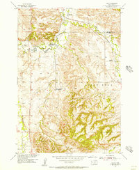 1954 Jolly1956 Print · USGSThe Black Hills foothills in the mid-fifties show a landscape of rural industry and changing education patterns along the Butte County line. Genealogists can locate several decommissioned schoolhouses, including White Sch (Abandoned) and Todd Sch (Abandoned), alongside the Chicago North Western tracks.4 unique versions available
 - 1957 Map of Rapid City
 1957 Rapid City1957 Print · USGSWestern South Dakota in the mid-fifties reveals a landscape of high-altitude forests and growing military installations. Researchers can trace the development of Ellsworth Air Force Base, locate the Theodore Roosevelt Monument, and find rural landmarks like Lower Alkali School.
 - 1958 Map of Belle Fourche, 1960 Print
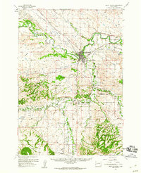 1958 Belle Fourche1960 Print · USGSBelle Fourche at the end of the 1950s shows the convergence of the Black Hills river systems and the railroad economy. Genealogists and researchers can trace the locations of Middle Creek Sch, Minnesota Cem, and the small settlement of Jolly.2 unique versions available
 - 1961 Map of Spearfish, 1963 Print
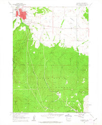 1961 Spearfish1963 Print · USGSSpearfish and the northern Black Hills are captured here in the early sixties, showing a landscape of college town growth and forested backcountry. Trace local history through the Black Hills Teachers College campus or find the Mount Theodore Roosevelt Monument and Maitland settlement.6 unique versions available
 - 1983 Map of Belle Fourche
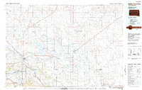 1983 Belle Fourche1983 Print · USGSWestern South Dakota's ranching and irrigation systems are well-established in this early 1980s survey. Researchers can trace historic family holdings like McClure Ranch and the path of the Chicago and North Western railroad near Belle Fourche.
End of results
Showing maps 1-12 of 12
Top cities near Ward 2
- Spearfish historical maps
- Belle Fourche historical maps
- Lead historical maps
- North Spearfish historical maps
- Deadwood historical maps
- Whitewood historical maps
See more
Top neighborhoods of Ward 2
Frequently asked questions
- What are the different types of historical maps available for Ward 2?
- What is the oldest map of Ward 2?
- Where can I purchase historical maps of Ward 2 for my home or office?
- Where can I download high-res historical maps of Ward 2?
- Are there historical topographic maps available for Ward 2?
- Is there historical aerial imagery available for Ward 2?
- Where are historical maps of Ward 2 sourced from?