1980s Maps of Lyman County, South Dakota
Explore 5 historic maps of Lyman County from the 1980s. These maps offer a rare glimpse into what life looked like during the 1980s — showing old roads, neighborhoods, homes, and landmarks that have changed or disappeared over time.
Whether you're researching your family's past, planning a metal detecting trip, or studying how Lyman County's landscape evolved across the 1980s, these high-resolution maps are a powerful tool for exploring the history of this region.
- Focus on a specific era: All maps on this page are from the 1980s, giving you a focused view of this time period.
- See what’s changed: Compare century-old streets, trails, and buildings to today's modern landscape using overlays and satellite layers.
- Research with precision: Use these maps for genealogy, historical research, land use analysis, or educational projects.
- View, download, or print: Maps are fully viewable online in high resolution, and can be downloaded or printed for your own records.
Start exploring Lyman County's history through authentic maps from the 1980s. This is your window into the past.
Lyman County, SD maps
(5)- 1985 Map of Big Bend Dam, 1986 Print
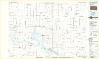 1985 Big Bend Dam1986 Print · USGSThe Missouri River landscape of the mid-1980s is defined by the massive Big Bend Dam and the sprawling waters of Lake Sharpe. Genealogists and historians can trace reservation boundaries and rural outposts like Fort Thompson, Stephan, and the Miller Dale Colony.2 unique versions available
 - 1985 Map of White River, 1986 Print
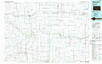 1985 White River1986 Print · USGSSouth-central South Dakota comes into focus during the mid-eighties as a critical junction of rail and river life. Researchers can trace the Chicago and North Western line through high-plains towns like Murdo and Presho or locate rural landmarks such as Stony Butte and Fate Dam.2 unique versions available
 - 1986 Map of Winner
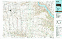 1986 Winner1986 Print · USGSTripp and Gregory Counties are captured in the mid-eighties as the agricultural heartland centered on the Chicago and North Western line. Genealogists can trace family footprints near St Charles, Paxton, and Winner, or explore the shoreline of Lake Francis Case.2 unique versions available
 - 1986 Map of Chamberlain
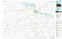
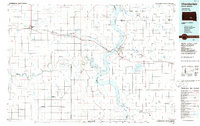 1986 Chamberlain1986 Print · USGSCentral South Dakota during the mid-eighties shows a landscape shaped by the Missouri River and the rise of Interstate 90. Researchers can trace the development of river towns like Chamberlain and Oacoma or locate remote landmarks like Bijou Hills and Hamill.2 unique versions available
 - 1986 Map of Pierre
 1986 Pierre1986 Print · USGSCentral South Dakota comes into focus during the mid-eighties as the Missouri River reservoirs reshape the landscape around the state capital. Genealogists and historians can trace rail stops along the Chicago and North Western and locate landmarks like the Old Indian Treaty Boundary and Medicine Knoll.2 unique versions available
End of results
Showing maps 1-5 of 5
Top cities of Lyman County
- Presho historical maps
- Oacoma historical maps
- Kennebec historical maps
- Reliance historical maps
- Iona historical maps
Frequently asked questions
- What are the different types of historical maps available for Lyman County?
- What is the oldest map of Lyman County?
- Where can I purchase historical maps of Lyman County for my home or office?
- Where can I download high-res historical maps of Lyman County?
- Are there historical topographic maps available for Lyman County?
- Is there historical aerial imagery available for Lyman County?
- Where are historical maps of Lyman County sourced from?