1960s Maps of McPherson County, South Dakota
Explore 10 historic maps of McPherson County from the 1960s. These maps offer a rare glimpse into what life looked like during the 1960s — showing old roads, neighborhoods, homes, and landmarks that have changed or disappeared over time.
Whether you're researching your family's past, planning a metal detecting trip, or studying how McPherson County's landscape evolved across the 1960s, these high-resolution maps are a powerful tool for exploring the history of this region.
- Focus on a specific era: All maps on this page are from the 1960s, giving you a focused view of this time period.
- See what’s changed: Compare century-old streets, trails, and buildings to today's modern landscape using overlays and satellite layers.
- Research with precision: Use these maps for genealogy, historical research, land use analysis, or educational projects.
- View, download, or print: Maps are fully viewable online in high resolution, and can be downloaded or printed for your own records.
Start exploring McPherson County's history through authentic maps from the 1960s. This is your window into the past.
McPherson County, SD maps
(10)- 1968 Map of Long Lake, 1970 Print
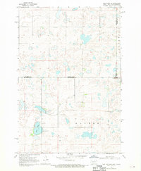
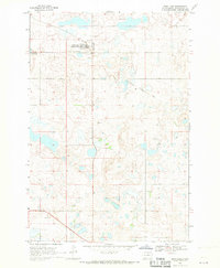 1968 Long Lake1970 Print · USGSMcPherson County, South Dakota, is captured here in the late sixties as a rural landscape of scattered cemeteries and vanished rail lines. Researchers can trace family history at Emmanuel Cem or follow the path of the Old Railroad Grade near Long Lake.
 - 1968 Map of Long Lake SE, 1970 Print
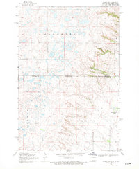
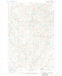 1968 Long Lake SE1970 Print · USGSMcPherson County is captured in the late sixties as a landscape of prairie potholes and quiet township centers. Researchers can trace the Old Railroad Grade or locate family roots at Hoffnungs Gemeinde Cem and the local Townhall.
 - 1968 Map of Long Lake NW, 1970 Print
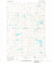 1968 Long Lake NW1970 Print · USGSThe northern reaches of the Missouri Plateau come into focus in the late sixties as they cross the state line. Genealogists can trace rural family roots at Johannasthal Cem, Jewell Cem, and Emmanuel Cem among the prairie potholes.
 - 1968 Map of Frederick NW, 1970 Print
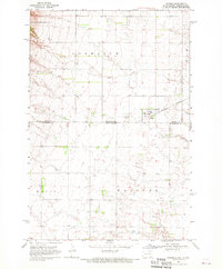
 1968 Frederick NW1970 Print · USGSThe borderlands of the Dakotas are captured in the late sixties as the prairie landscape centers on the waters of Elm Lake. Researchers can locate rural landmarks like the Aurdal Ch, the Great Northern rail line, and local Townhall sites.
 - 1968 Map of Forbes, 1970 Print
 1968 Forbes1970 Print · USGSThe borderlands of Dickey and McPherson counties are captured here in the late sixties, centered on the village of Forbes. Genealogists and local historians can trace the Great Northern rail line and locate the Forbes Cem near the state line.
 - 1968 Map of Long Lake NE, 1970 Print
 1968 Long Lake NE1970 Print · USGSThe North Dakota and South Dakota borderlands come into focus in the late sixties, showing a prairie landscape of glacial potholes and section-line roads. Genealogists can locate several family-named landmarks including St Lucas Cem, Ehresman Cem, and Rath Lake.
 - 1968 Map of Forbes SE, 1970 Print
 1968 Forbes SE1970 Print · USGSMcPherson County, South Dakota, is captured in the late sixties as a landscape of structured townships and prairie drainage. Genealogists can locate family landmarks like St Hyacinth Cem and the local Townhall near the banks of Willow Creek.
 - 1968 Map of Forbes NW, 1970 Print
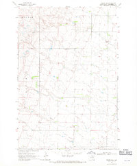
 1968 Forbes NW1970 Print · USGSThe high plains of the Dakotas borderland are seen here in the late sixties, where small prairie lakes and township lines define the landscape. Genealogists can locate family landmarks such as St Peters Cem, the Spring Creek Colony, and Townhall.
 - 1968 Map of Forbes SW, 1970 Print
 1968 Forbes SW1970 Print · USGSThe northern reaches of McPherson County are documented here in the late sixties, showing a landscape of prairie potholes and intermittent water. Genealogists and local historians can find family names tied to the terrain, including Wacker and Hoffman, alongside a solitary Gravel Pit.
 - 1968 Map of Frederick SW, 1970 Print
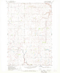
 1968 Frederick SW1970 Print · USGSBrown County’s rural townships are documented here in the late sixties as the agricultural landscape remained tied to the winding Elm River. Researchers can trace historic property boundaries and find local landmarks like the Townhall and the Spillway at Elm Lake.
End of results
Showing maps 1-10 of 10
Top cities of McPherson County
- Eureka historical maps
- Leola historical maps
- Long Lake historical maps
- Wetonka historical maps
- Hillsview historical maps
Frequently asked questions
- What are the different types of historical maps available for McPherson County?
- What is the oldest map of McPherson County?
- Where can I purchase historical maps of McPherson County for my home or office?
- Where can I download high-res historical maps of McPherson County?
- Are there historical topographic maps available for McPherson County?
- Is there historical aerial imagery available for McPherson County?
- Where are historical maps of McPherson County sourced from?