Old Maps of Five Points, South Dakota for Metal Detecting
Plan your next treasure hunt with 11 historic maps of Five Points. Find old homesites, ghost towns, trails, and gathering spots that may be lost to time — perfect for identifying promising metal detecting locations.
- Locate forgotten sites: Uncover places like long-lost settlements, abandoned rail lines, or gathering spots.
- Plan better hunts: Use map overlays combined with LiDAR or satellite views to narrow in on historically rich areas.
- Made for detectorists: Thousands of hobbyists use these maps to discover relics, coins, and hidden history.
Use these historic maps to boost your research and find new opportunities beneath the surface of Five Points.
Five Points, SD maps
(11)- 1896 Map of Harney Peak
 1896 Harney Peak1896 Print · USGSThe Black Hills were at the height of their early development in the 1890s as railroads and mining settlements reshaped the mountains. Genealogists and historians can trace the early tracks of the Burlington and Missouri River and locate the original town sites of Hill City, Custer, and Pringle.
 - 1901 Map of Harney Peak
 1901 Harney Peak1901 Print · USGSThe Black Hills at the dawn of the twentieth century was a hub of hard-rock mining and frontier ranching. Genealogists and historians can trace dozens of family-named homesteads like Hawks Ranch alongside significant early mines such as the Storm Hill Mine and Grizzly Bear Mine.4 unique versions available
 - 1954 Map of Hill City, 1955 Print
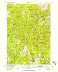
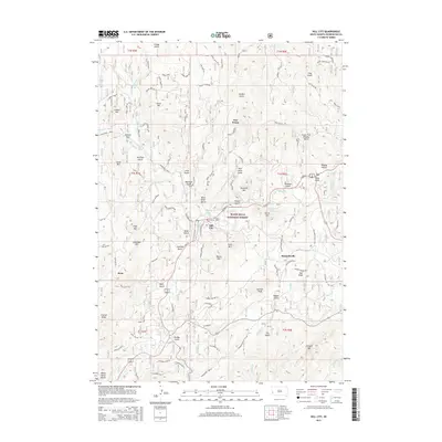
 1954 Hill City1955 Print · USGSHill City and the surrounding Black Hills were centers of intense mineral exploration during the mid-fifties. Genealogists and historians can trace the old rail lines of the Chicago Burlington and Quincy and locate specific sites like the Hidden Treasure Mine, Canadaville, and the Reder Ranger Station.5 unique versions available
 - 1955 Map of Hot Springs, 1958 Print
 1955 Hot Springs1958 Print · USGSThe Black Hills and South Dakota badlands are captured here in the mid-fifties, during a peak of military and industrial activity. Researchers can locate the Black Hills Ordnance Depot, early Uranium Mines, and historic rail stops like Pringle or Oglala.5 unique versions available
 - 1956 Map of Custer
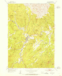
 1956 Custer1956 Print · USGSThe Black Hills region around Custer and Hill City appears here during the mid-fifties, showing a landscape defined by timber, tourism, and hard-rock mining. You can locate family-named landmarks and remote sites like the Crazy Horse Carving, South Slate Sch, and the Western Star Mine.2 unique versions available
 - 1977 Map of Mount Rushmore, 1978 Print
 1977 Mount Rushmore1978 Print · USGSThe Black Hills landscape of the late 1970s is shown here at a moment when historic mining and modern tourism converged. Genealogists and researchers can trace the rail lines of the Burlington Northern and find sites like Spokane Mine or the town of Pringle.2 unique versions available
 - 1998 Map of Hill City, 2001 Print
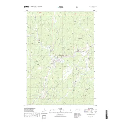
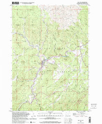 1998 Hill City2001 Print · USGSHill City and the surrounding Black Hills peaks appear here during the late 1990s, revealing a landscape defined by deep mining roots. Local researchers can trace dozens of named prospects and workings, including the Hidden Treasure Mine, Sunnyside Mine, and the small settlement of Kennedyville.
 - 2012 Map of Hill City, 2012 Print
 2012 Hill City2012 Print · USGSCovers Five Points, including Hill City, Reno, and other nearby areas
 - 2015 Map of Hill City, 2015 Print
 2015 Hill City2015 Print · USGSCovers Five Points, including Hill City, Reno, and other nearby areas
 - 2017 Map of Hill City, 2017 Print
 2017 Hill City2017 Print · USGSCovers Five Points, including Hill City, Reno, and other nearby areas
 - 2021 Map of Hill City, 2021 Print
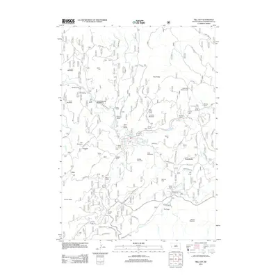
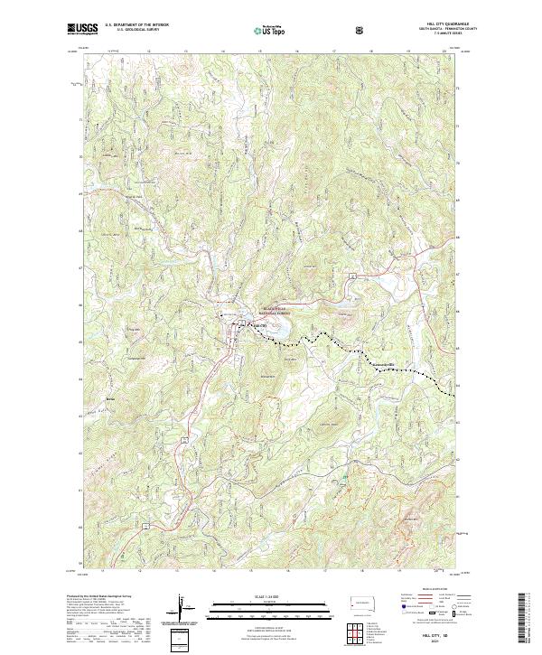 2021 Hill City2021 Print · USGSHill City and the surrounding Black Hills highlands appear here in the early twenty-first century as a landscape of timber, trails, and deep-cut gulches. Researchers can locate the Hill City Cem, trace the George S. Mickelson Trl, and explore the terrain around Kennedyville and Major Lake.
End of results
Showing maps 1-11 of 11
Top cities near Five Points
- Rapid City historical maps
- Summerset historical maps
- Custer historical maps
- Hill City historical maps
- Keystone historical maps
Frequently asked questions
- What are the different types of historical maps available for Five Points?
- What is the oldest map of Five Points?
- Where can I purchase historical maps of Five Points for my home or office?
- Where can I download high-res historical maps of Five Points?
- Are there historical topographic maps available for Five Points?
- Is there historical aerial imagery available for Five Points?
- Where are historical maps of Five Points sourced from?