1970s Maps of Gettysburg, South Dakota
Explore 2 historic maps of Gettysburg from the 1970s. These maps offer a rare glimpse into what life looked like during the 1970s — showing old roads, neighborhoods, homes, and landmarks that have changed or disappeared over time.
Whether you're researching your family's past, planning a metal detecting trip, or studying how Gettysburg's landscape evolved across the 1970s, these high-resolution maps are a powerful tool for exploring the history of this region.
- Focus on a specific era: All maps on this page are from the 1970s, giving you a focused view of this time period.
- See what’s changed: Compare century-old streets, trails, and buildings to today's modern landscape using overlays and satellite layers.
- Research with precision: Use these maps for genealogy, historical research, land use analysis, or educational projects.
- View, download, or print: Maps are fully viewable online in high resolution, and can be downloaded or printed for your own records.
Start exploring Gettysburg's history through authentic maps from the 1970s. This is your window into the past.
Gettysburg, SD maps
(2)- 1978 Map of Gettysburg Muni. Airport
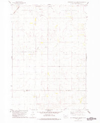 1978 Gettysburg Muni. Airport1978 Print · USGSPotter and Sully Counties are captured in the late seventies as the agricultural landscape surrounds the growing town of Gettysburg. Researchers can trace the Chicago and North Western rail line and locate rural landmarks like Sacred Heart Cem and Elida.
 - 1978 Map of Gettysburg
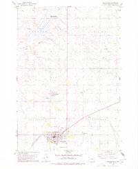 1978 Gettysburg1978 Print · USGSGettysburg was a thriving railroad and agricultural hub in Potter County during the late seventies. Researchers can trace the town's social fabric through landmarks like the Fairground, the local Drive-in Theater, and the Chicago and North Western rail line.
End of results
Showing maps 1-2 of 2
Top cities near Gettysburg
Frequently asked questions
- What are the different types of historical maps available for Gettysburg?
- What is the oldest map of Gettysburg?
- Where can I purchase historical maps of Gettysburg for my home or office?
- Where can I download high-res historical maps of Gettysburg?
- Are there historical topographic maps available for Gettysburg?
- Is there historical aerial imagery available for Gettysburg?
- Where are historical maps of Gettysburg sourced from?