1970s Maps of Sanborn County, South Dakota
Explore 13 historic maps of Sanborn County from the 1970s. These maps offer a rare glimpse into what life looked like during the 1970s — showing old roads, neighborhoods, homes, and landmarks that have changed or disappeared over time.
Whether you're researching your family's past, planning a metal detecting trip, or studying how Sanborn County's landscape evolved across the 1970s, these high-resolution maps are a powerful tool for exploring the history of this region.
- Focus on a specific era: All maps on this page are from the 1970s, giving you a focused view of this time period.
- See what’s changed: Compare century-old streets, trails, and buildings to today's modern landscape using overlays and satellite layers.
- Research with precision: Use these maps for genealogy, historical research, land use analysis, or educational projects.
- View, download, or print: Maps are fully viewable online in high resolution, and can be downloaded or printed for your own records.
Start exploring Sanborn County's history through authentic maps from the 1970s. This is your window into the past.
Sanborn County, SD maps
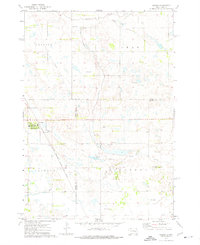
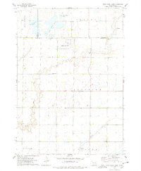
(13)- 1971 Map of Artesian NW, 1973 Print
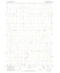 1971 Artesian NW1973 Print · USGSSanborn and Beadle counties are captured here in the early 1970s, showcasing a rural prairie landscape defined by isolated farmsteads and township boundaries. Genealogists can locate family sites near Immanuel Ch Cem or St Anthonys Cem along the Pearl Creek drainage.
 - 1971 Map of Fedora, 1973 Print
 1971 Fedora1973 Print · USGSMiner County's rural townships are captured here in the early 1970s as the rail-driven economy still shaped the plains. Researchers can locate family sites near Glen View Ch, Morgans Cem, or the Milwaukee Road corridor.
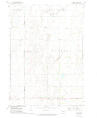
 - 1971 Map of Artesian, 1973 Print
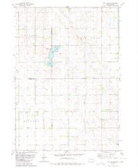
 1971 Artesian1973 Print · USGSArtesian and the surrounding Sanborn County townships are shown here in the early seventies, centered on the Milwaukee Road railroad. Genealogists and researchers can locate St Anthonys Cem, the local Townhall, and the winding path of Redstone Creek.
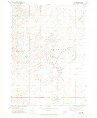
 - 1971 Map of Artesian NE, 1973 Print
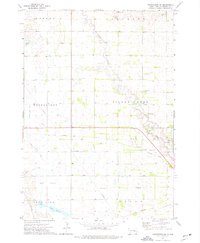
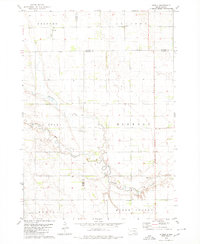
 1971 Artesian NE1973 Print · USGSFour counties converge in this South Dakota agricultural landscape during the early seventies, centered on the drainage of the Redstone forks. Genealogists and local historians can locate the old Townhall and trace the route of the Chicago and North Western railroad through Afton and Esmond.
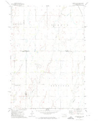
 - 1973 Map of Alpena, 1976 Print
 1973 Alpena1976 Print · USGSThe town of Alpena and the surrounding prairie are captured here in the early 1970s, as a vital rail-link hub. Researchers can locate the Rest Haven Cem and trace the Milwaukee Road railroad line as it cuts through Cain Creek country.
 - 1973 Map of Forestburg SW, 1976 Print
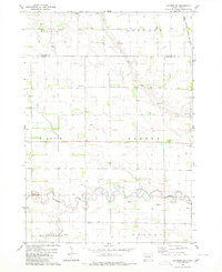
 1973 Forestburg SW1976 Print · USGSSanborn County's rural townships are documented here in the early 1970s, showcasing a landscape of drainage ditches and prairie water sources. Researchers can trace the Old Railroad Grade and locate local landmarks like the Silver Creek Cem and the Townhall.
 - 1973 Map of Woonsocket, 1976 Print
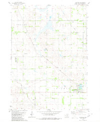
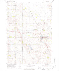 1973 Woonsocket1976 Print · USGSWoonsocket and the surrounding Sanborn County prairie are captured here in the early seventies as a hub of rail transport and rural industry. Researchers can trace family history at St Wilfrid Cem or locate the Lynch Ranch and McCoy Lake hunting grounds.
 - 1973 Map of Morris Lake, 1978 Print
 1973 Morris Lake1978 Print · USGSThe border of Sanborn and Miner Counties was a landscape of conservation and prairie agriculture in the 1970s. Researchers can locate landmarks like Beulah Ch and Farwell Cem, or trace the wetlands of O'Neal Lake and the Morris Lake shooting area.
 - 1973 Map of Ness Chain Lakes, 1978 Print
 1973 Ness Chain Lakes1978 Print · USGSThe tri-county borderlands of Sanborn, Miner, and Hanson counties are documented in the 1970s, showcasing a landscape of prairie potholes and wetlands. Researchers can trace the rural layout of Fairview and find local landmarks like Redstone Cem and Lake Leo.
 - 1979 Map of Letcher, 1980 Print
 1979 Letcher1980 Print · USGSLetcher and the surrounding Sanborn County prairies were defined by the rail lines and flowing wells of the late 1970s. Trace local family roots at West Lawn Cem or follow the path of the Chicago Milwaukee St Paul and Pacific railroad through Cuthbert.
 - 1979 Map of Letcher SW, 1980 Print
 1979 Letcher SW1980 Print · USGSThe South Dakota plains near the Sanborn and Davison county line appear here in the late seventies as a landscape of structured townships and prairie waterways. Researchers can locate artesian Flowing Wells, the path of the Chicago Milwaukee St Paul and Pacific railroad, and the winding course of Firesteel Creek.
 - 1979 Map of Storla, 1980 Print
 1979 Storla1980 Print · USGSThe crossroads of Aurora, Sanborn, and Davison counties are documented here in the late seventies. Family historians can trace the rural community of Storla and its surrounding landmarks like Trinity Ch, Blendon Sch, and Knutson Cem.
 - 1979 Map of Twin Lakes, 1980 Print
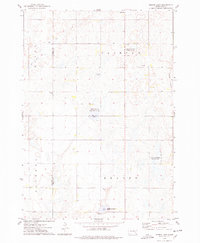
 1979 Twin Lakes1980 Print · USGSSanborn County and its neighboring borderlands appear here in the late seventies, centered on the vital prairie waters of the James River Valley region. Researchers can locate rural landmarks like Belford Sch, Elliott Sch, and the Twin Lakes State Recreation Area.
End of results
Showing maps 1-13 of 13
Frequently asked questions
- What are the different types of historical maps available for Sanborn County?
- What is the oldest map of Sanborn County?
- Where can I purchase historical maps of Sanborn County for my home or office?
- Where can I download high-res historical maps of Sanborn County?
- Are there historical topographic maps available for Sanborn County?
- Is there historical aerial imagery available for Sanborn County?
- Where are historical maps of Sanborn County sourced from?