1970s Maps of Spink County, South Dakota
Explore 8 historic maps of Spink County from the 1970s. These maps offer a rare glimpse into what life looked like during the 1970s — showing old roads, neighborhoods, homes, and landmarks that have changed or disappeared over time.
Whether you're researching your family's past, planning a metal detecting trip, or studying how Spink County's landscape evolved across the 1970s, these high-resolution maps are a powerful tool for exploring the history of this region.
- Focus on a specific era: All maps on this page are from the 1970s, giving you a focused view of this time period.
- See what’s changed: Compare century-old streets, trails, and buildings to today's modern landscape using overlays and satellite layers.
- Research with precision: Use these maps for genealogy, historical research, land use analysis, or educational projects.
- View, download, or print: Maps are fully viewable online in high resolution, and can be downloaded or printed for your own records.
Start exploring Spink County's history through authentic maps from the 1970s. This is your window into the past.
Spink County, SD maps
(8)- 1971 Map of Doland NW, 1974 Print
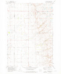
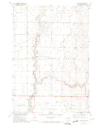 1971 Doland NW1974 Print · USGSSpink County agriculture and drainage patterns are on display here in the early 1970s. Genealogists and historians can trace the path of Timber Creek and locate the Old Railroad Grade as it passes through Belle Plaine.
 - 1971 Map of Doland, 1974 Print
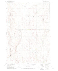
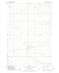
 1971 Doland1974 Print · USGSThe township of Doland is captured here during the early seventies, showing a classic South Dakota rail-and-grid landscape. Genealogists and local historians can trace the Chicago and North Western line, an Old Railroad Grade, and the Doland Cem.
 - 1971 Map of Doland SE, 1974 Print
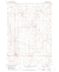
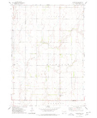
 1971 Doland SE1974 Print · USGSSpink County in the early 1970s reveals a vast grid of prairie townships shaped by the Missouri River Basin development program. Researchers can locate private aviation sites like Hofer Landing Field or trace the shoreline of Mirage Lake along the base of Doland Ridge.
 - 1971 Map of Bloomfield, 1974 Print
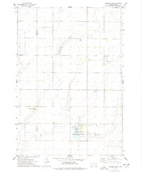
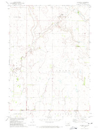 1971 Bloomfield1974 Print · USGSAgricultural life in eastern South Dakota comes into focus during the early seventies, spanning the Beadle and Spink county line. Researchers can locate specific homestead sites and landmarks like Hillside Colony, La Delle, and Hutterthal Ch.
 - 1973 Map of Crocker SW, 1975 Print
 1973 Crocker SW1975 Print · USGSSpink and Clark Counties are captured here in the early 1970s, showcasing the rural township structure of the South Dakota prairie. Genealogists can locate civic landmarks like the Townhall and the Chicago and North Western rail line.
 - 1973 Map of Raymond, 1978 Print
 1973 Raymond1978 Print · USGSSpink and Clark counties appear in the early 1970s as a structured landscape of prairie townships and rail-oriented settlement. Researchers can trace local history at the Prairie Valley Cem or follow the Chicago and North Western rail line through Raymond.
 - 1973 Map of Carpenter, 1978 Print
 1973 Carpenter1978 Print · USGSEastern South Dakota’s agricultural heartland is documented here in the early seventies, showing a landscape defined by township grids and scattered rural communities. Genealogists and local historians can locate early burial sites at Union Cem and Richland Cem, or trace the small settlements of Richland and Carpenter.
 - 1973 Map of Fordham Dam, 1978 Print
 1973 Fordham Dam1978 Print · USGSThe prairie landscape of eastern South Dakota in the 1970s reveals a unique pattern of communal settlement and water management. Genealogists and researchers can locate Clark Colony, the Logan Cem, and the vast Fordham State Public Shooting Area.
End of results
Showing maps 1-8 of 8
Top cities of Spink County
Frequently asked questions
- What are the different types of historical maps available for Spink County?
- What is the oldest map of Spink County?
- Where can I purchase historical maps of Spink County for my home or office?
- Where can I download high-res historical maps of Spink County?
- Are there historical topographic maps available for Spink County?
- Is there historical aerial imagery available for Spink County?
- Where are historical maps of Spink County sourced from?