Old Maps of Spink County, South Dakota for Academic Research
Study the evolution of Spink County with 192 high-resolution historic maps. Whether you're teaching, researching, or modeling changes in land use, these maps provide essential visual documentation of urban, environmental, and geographic change.
- Analyze long-term change: Track patterns in development, transportation, and natural features.
- Ideal for environmental or urban studies: Support academic projects with primary historical map data.
- Use in the classroom or lab: Educators and researchers rely on these maps to bring historical context to life.
These maps are a powerful tool for teaching, research, and visualizing how Spink County has changed over the decades.
Spink County, SD maps
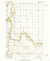
(192)- 1894 Map of Conde
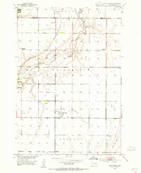
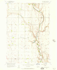
 1894 Conde1894 Print · USGSThe James River Valley region during the pioneer era of the 1890s reveals a landscape defined by the arrival of the rails. Trace the early township developments of Benton and Tetonka and locate early railway stops at Conde, Turton, and Verdon.
 - 1895 Map of Byron
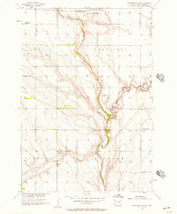
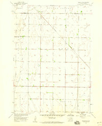
 1895 Byron1895 Print · USGSEastern South Dakota was rapidly organizing into townships when this survey was conducted. You can trace the path of the Chicago and Northwestern R. R. through early settlements like Frankfort, Doland, and Ashton.4 unique versions available
 - 1895 Map of Aberdeen
 1895 Aberdeen1895 Print · USGSNortheastern South Dakota was rapidly evolving in the 1890s as a vital railroad corridor through the James River Valley. Local historians and genealogists can trace the early layout of rail-side towns like Warner, Groton, and the burgeoning hub of Aberdeen.4 unique versions available
 - 1899 Map of Northville
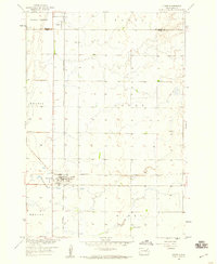
 1899 Northville1899 Print · USGSNortheastern South Dakota in the 1890s was a landscape defined by the expansion of the rails and the settlement of the prairie. You can trace the path of the Chicago and Northwestern RR through early townsites like Northville and Rudolph.2 unique versions available
 - 1899 Map of Redfield
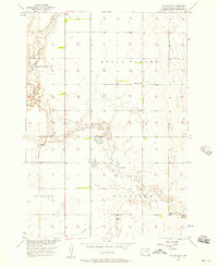
 1899 Redfield1899 Print · USGSAgricultural expansion across Spink and Hand Counties is in full swing here during the late nineteenth century. Genealogists can trace early rail-side settlements like Redfield, Rockham, and Tulare alongside prairie outposts such as Burdette and Florence.2 unique versions available
 - 1953 Map of Brentford, 1955 Print
 1953 Brentford1955 Print · USGSBrentford and the surrounding Spink County prairie are documented here in the early fifties during a period of rural school consolidation. Genealogists can trace the Plainview Cemetery and the sites of School No 3 and School No 1.
 - 1953 Map of Frankfort, 1955 Print
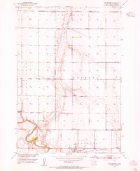 1953 Frankfort1955 Print · USGSSpink County agriculture and river-valley life are captured here in the early fifties. Genealogists and local historians can trace family roots at St Anne Cem, follow the Chicago and North Western rail line, or locate early schoolhouses like Witten Sch.
 - 1953 Map of Redfield North, 1955 Print
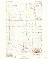 1953 Redfield North1955 Print · USGSRedfield was a bustling prairie rail hub in the early fifties, anchored by the intersection of two major lines. Researchers can trace the layout of the Redfield State Hospital or locate rural landmarks like Marlette Sch and the Historical Monument along Snake Creek.
 - 1953 Map of Gallup, 1955 Print
 1953 Gallup1955 Print · USGSSpink County in the mid-fifties remains a landscape of river-bend farms and rural school districts. Researchers can trace the path of the Milwaukee Road railroad and locate local landmarks like Gallup Sch or the Flowing Well.
 - 1953 Map of Ashton, 1955 Print
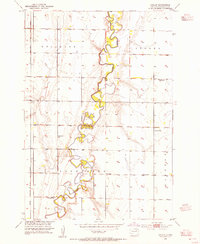
 1953 Ashton1955 Print · USGSIn the early 1950s, the prairie landscape of Spink County was defined by the winding James River and a busy network of namesake schoolhouses. Genealogists and local historians can trace the locations of Kurtz Sch, Ashton, and the artesian Flowing Wells that sustained these rural townships.
 - 1953 Map of Milbank, 1958 Print
 1953 Milbank1958 Print · USGSThe tri-state border region of South Dakota, North Dakota, and Minnesota is shown here during the early fifties, a landscape defined by glacial lakes and the Sisseton Indian Reservation. Researchers can trace the legacy of the western railroads, locating old stops along the Great Northern and settlements like Milbank, Webster, and Sisseton.3 unique versions available
 - 1953 Map of Huron, 1959 Print
 1953 Huron1959 Print · USGSCentral South Dakota comes alive in the mid-1950s as a thriving rail and agricultural corridor between the Missouri and James Rivers. Trace the legacy of family farms and prairie towns like Huron, Faulkton, and Wessington Springs along the historic Chicago and North Western rail lines.3 unique versions available
 - 1953 Map of Watertown, 1968 Print
 1953 Watertown1968 Print · USGSEastern South Dakota and the Minnesota borderlands are captured here during the mid-twentieth century as the region's agricultural and rail-service centers thrived. Genealogists and local historians can trace family-named sites across the Coteau des Prairies and find landmarks in Watertown, De Smet, and Brookings.3 unique versions available
 - 1954 Map of Mellette, 1955 Print
 1954 Mellette1955 Print · USGSThe Spink County prairies are captured here in the mid-1950s as the rural landscape underwent significant social changes. Researchers can trace the meandering James River and locate several community sites like Armadale Park and the Dunker Sch.
 - 1954 Map of Aberdeen, 1964 Print
 1954 Aberdeen1964 Print · USGSNortheastern South Dakota in the mid-fifties remains a world of rail-dependent prairie towns and sweeping waterfowl refuges. Genealogists can trace family roots through settlements like Eureka and Ipswich or locate rural landmarks near Richmond Lake.2 unique versions available
 - 1954 Map of Huron, 1977 Print
 1954 Huron1977 Print · USGSCentral South Dakota was a landscape of grain elevators and river bends during the mid-fifties. Genealogists and historians can trace the development of the James River valley through railroad towns like Redfield and the sprawling Crow Creek Indian Reservation.
 - 1956 Map of Aberdeen
 1956 Aberdeen1956 Print · USGSUpper South Dakota during the mid-fifties remains a landscape of rail-connected farming towns and expansive glacial lake basins. Genealogists and historians can trace the paths of the Minneapolis and St Louis railroad through Gettysburg or locate vanished stops near Elm Lake and Richmond Lake.
 - 1956 Map of Lake Byron NW, 1957 Print
 1956 Lake Byron NW1957 Print · USGSThe glacial till of eastern South Dakota is captured here during the mid-fifties as the Missouri River Basin development program was underway. Researchers can locate several rural school sites like Bluebell Sch and Sunshine Sch, as well as the Irving Cem.
 - 1956 Map of Glendale Colony, 1957 Print
 1956 Glendale Colony1957 Print · USGSSpink County agriculture and river life are captured here in the mid-fifties, centered on the James River. Genealogists can locate rural landmarks like Glendale Colony, Guttenberg Cem, and several schools including the Rosebud Sch.
 - 1956 Map of Spink Colony, 1957 Print
 1956 Spink Colony1957 Print · USGSThe James River valley at the Spink and Beadle county line appears in the mid-fifties as a landscape of rural townships and flowing wells. Genealogists can locate Hillestad Cem and trace the closure of country schools like Lincoln Sch (Abandoned).2 unique versions available
 - 1956 Map of Doland SW, 1957 Print
 1956 Doland SW1957 Print · USGSMid-century Spink County comes into focus in this detailed survey of its prairie townships and rural school districts. Genealogists and local historians can locate the Ebenezer Cem or trace the locations of the Lawrence Sch and Happy Hollow Sch.2 unique versions available
 - 1958 Map of Milbank
 1958 Milbank1958 Print · USGSThe northern Great Plains in the late fifties show a landscape of glacial lakes and reservation lands shaped by the Great Northern railroad. Genealogists and local historians can trace the grid of settlements from Britton to Milbank and locate landmarks like Enemy Swim Lake and the Sisseton Indian Reservation.
 - 1958 Map of Watertown
 1958 Watertown1958 Print · USGSThe eastern South Dakota prairie and the Minnesota borderlands are captured here in the late fifties, showcasing a landscape of terminal moraine lakes and burgeoning rail hubs. Genealogists and historians can trace the early paths of the Chicago and North Western railroad or locate family roots in Watertown, Clark, or the Sisseton Indian Reservation.2 unique versions available
 - 1958 Map of Randolph, 1959 Print
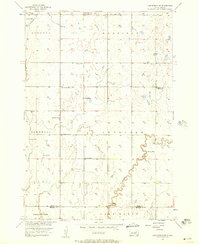
 1958 Randolph1959 Print · USGSSpink and Brown Counties are captured here in the late fifties, showing the rural structure of the South Dakota prairie. Genealogists and historians can trace the influence of the Minneapolis and St Louis railroad on local life near Randolph and Dry Run.
 - 1958 Map of Conde, 1960 Print
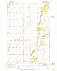
 1958 Conde1960 Print · USGSThe rail junction at Conde was a vital hub in the late fifties, where two major lines intersected in the heart of the prairie. Researchers can trace the layout of Verdon, locate the Verdon Cem, and see the path of the Minneapolis and St Louis railroad.
Showing maps 1-25 of 192
Top cities of Spink County
Frequently asked questions
- What are the different types of historical maps available for Spink County?
- What is the oldest map of Spink County?
- Where can I purchase historical maps of Spink County for my home or office?
- Where can I download high-res historical maps of Spink County?
- Are there historical topographic maps available for Spink County?
- Is there historical aerial imagery available for Spink County?
- Where are historical maps of Spink County sourced from?