Old Maps of Ideal Segment, South Dakota for Academic Research
Study the evolution of Ideal Segment with 134 high-resolution historic maps. Whether you're teaching, researching, or modeling changes in land use, these maps provide essential visual documentation of urban, environmental, and geographic change.
- Analyze long-term change: Track patterns in development, transportation, and natural features.
- Ideal for environmental or urban studies: Support academic projects with primary historical map data.
- Use in the classroom or lab: Educators and researchers rely on these maps to bring historical context to life.
These maps are a powerful tool for teaching, research, and visualizing how Ideal Segment has changed over the decades.
Ideal Segment, SD maps
(134)- 1951 Map of Presho 4 NE, 1953 Print
 1951 Presho 4 NE1953 Print · USGSThe White River valley in the early fifties shows a remote landscape of prairie townships divided between Lyman and Tripp counties. Local historians can trace the foundations of rural life at sites like Holy Rosary Ch, North Greenwood Sch, and the winding Mission Creek.4 unique versions available
 - 1951 Map of Ideal NW, 1953 Print
 1951 Ideal NW1953 Print · USGSThe rural breaks of the White River valley are captured here in the early fifties during the development of the Missouri River Basin. Genealogists and local historians can trace family land near the Christensen Ranch or locate the Nelson Sch (Abandoned) and Edna Sch.2 unique versions available
 - 1951 Map of Ideal NE, 1953 Print
 1951 Ideal NE1953 Print · USGSThe White River meanders through the Lyman and Tripp county line during the early fifties, showing the rural structure of the Missouri River Basin. Genealogists can locate landmarks like Red Hill Ch, Red Hill Cem, and the Lone Star Sch among the breaks of the White River.2 unique versions available
 - 1952 Map of Reliance SW, 1954 Print
 1952 Reliance SW1954 Print · USGSLyman County ranch lands meet the winding White River in the early fifties, showing a rural community defined by its remote schools and rugged terrain. Genealogists can locate family landmarks like the Nelson Ranch, Roosevelt Sch, and Trinity Cem.3 unique versions available
 - 1952 Map of Reliance SE, 1954 Print
 1952 Reliance SE1954 Print · USGSLyman County landscape in the early fifties shows the rural school system and river valleys before the Fort Randall Reservoir expansion. Genealogists can locate North Cooper Sch and West Cooper Sch, or trace the old Chicago Milwaukee St Paul and Pacific rail line.
 - 1952 Map of Hamill NW, 1954 Print
 1952 Hamill NW1954 Print · USGSThe ranchlands of Tripp and Lyman County are captured here in the early 1950s as the Missouri River Basin development program began. Researchers can trace historic family holdings like the Schooler Ranch or locate vanished rural schoolhouses such as Bellwood Sch and Gassman Sch.2 unique versions available
 - 1952 Map of Hamill NE, 1954 Print
 1952 Hamill NE1954 Print · USGSLyman County settlement along the White River is documented here in the early fifties, just as the regional landscape was being reshaped. Genealogists can locate family-named school sites like Lindgren Sch and Walcott Sch before the Missouri River Basin development.
 - 1955 Map of Martin, 1968 Print
 1955 Martin1968 Print · USGSTribal lands and rail corridors define the South Dakota plains in the mid-fifties, from the sand hills to the badlands. Genealogists and historians can trace the early layout of Pine Ridge Indian Reservation settlements and find small rail towns like Stamford and Witten.2 unique versions available
 - 1955 Map of Mitchell, 1973 Print
 1955 Mitchell1973 Print · USGSThe Missouri River valley undergoes a massive transformation in the mid-1950s as the Fort Randall Dam creates Lake Francis Case. You can trace the rail lines of the Chicago Milwaukee St Paul and Pacific through Mitchell or locate local landmarks like Butler Town Hall.2 unique versions available
 - 1958 Map of Martin
 1958 Martin1958 Print · USGSSouth Dakota's southern plains are documented here in the late fifties, showing the expansive Pine Ridge and Rosebud Indian Reservations. Genealogists and historians can locate early settlements along the Chicago Milwaukee St Paul and Pacific line or find family roots near Martin and the Indian Cemetery.
 - 1959 Map of Mitchell
 1959 Mitchell1959 Print · USGSSouth Dakota’s river and rail corridors come alive in the late fifties as the Missouri River valley undergoes dramatic change. Genealogists and historians can trace family roots through numerous small towns and schools such as Academy, Stickney, and Gregory.2 unique versions available
 - 1964 Map of Dallas NW, 1965 Print
 1964 Dallas NW1965 Print · USGSThe Tripp County prairie in the mid-1960s shows a landscape of steady agricultural settlement and rail infrastructure. Genealogists and local historians can trace community life through the Kansas Flat Sch, Calvary Chapel, and the path of the Chicago and North Western railroad.2 unique versions available
 - 1971 Map of Colome, 1974 Print
 1971 Colome1974 Print · USGSThe South Dakota prairie around Colome is captured here in the early seventies, showing the area as it appeared within the Rosebud Indian Reservation. Genealogists and local historians can trace the Chicago and North Western rail line and locate rural townships like Elliston and Plainview.
 - 1971 Map of Hamill, 1974 Print
 1971 Hamill1974 Print · USGSTripp County ranch lands and the Rosebud Indian Reservation are shown in detail during the early seventies. Genealogists and local historians can locate the Hamill settlement and trace rural landmarks like the Center Moss Sch and the Cem along No Moccasin Creek.2 unique versions available
 - 1971 Map of Rattlesnake Butte West, 1974 Print
 1971 Rattlesnake Butte West1974 Print · USGSTripp County and the Rosebud Indian Reservation are shown in the early seventies, capturing the isolated ranching life of the South Dakota plains. Researchers can locate remote rural features like the Plainview Sch and water landmarks such as Moccasin Creek and the Flowing Well.
 - 1982 Map of Wewela
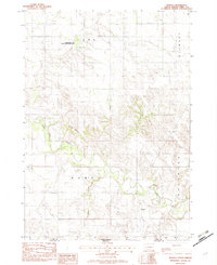 1982 Wewela1982 Print · USGSThe South Dakota and Nebraska borderlands are captured here in the early eighties, centered on the Wewela community. Researchers can trace rural landmarks like St Pauls Ch and Congregational Cem near the Keya Paha River.
 - 1982 Map of Presho 4 SE
 1982 Presho 4 SE1982 Print · USGSTripp County townships are documented during the late seventies, showing a quiet prairie landscape shaped by winding waterways. Researchers can trace the location of the Eden Sch and early road networks along Cottonwood Creek or near Owl Creek.2 unique versions available
 - 1982 Map of King Dam
 1982 King Dam1982 Print · USGSTripp County in the early eighties shows a sparse ranching landscape organized around essential water and wildlife areas. Genealogists and researchers can locate landmarks like Ideal Cem, the King Sch, and the winding Thunder Creek.
 - 1982 Map of Winner North
 1982 Winner North1982 Print · USGSThe town of Winner and the surrounding Tripp County prairie are captured in the early 1980s as the regional landscape transitioned. Local researchers can trace the Old RR Grade, find the Cem, and locate landmarks like Bradleyon Butte and Bob Wiley Field.
 - 1982 Map of Millboro
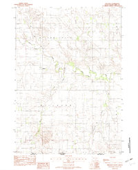 1982 Millboro1982 Print · USGSTripp County, South Dakota, and Nebraska’s northern edge are captured here in the early eighties as rural agriculture defined the state line. Genealogists and local historians can trace the Millboro townsite, the Keya Paha River valley, and family-associated landmarks like Cem and Rames.
 - 1982 Map of Keyapaha SE
 1982 Keyapaha SE1982 Print · USGSThe Keya Paha River valley in the early eighties shows a sparse ranching landscape along the South Dakota border. Genealogists and local historians can locate rural landmarks like the Church of God and the townships of Wortman and Huggins.
 - 1982 Map of Witten
 1982 Witten1982 Print · USGSTripp County life in the early 1980s centers around the small community of Witten and its surrounding farm sections. Researchers can locate St John the Baptist Cem and trace the winding paths of Cottonwood Creek and Jordan Junction.
 - 1982 Map of Winner South
 1982 Winner South1982 Print · USGSWinner and its southern rural townships are captured in the early eighties as the agricultural landscape of Tripp County. Researchers can trace local development through landmarks like the Reilly Sch, the Rodeo Arena, and the Beaulieu Lake conservation area.
 - 1982 Map of Miller Hill
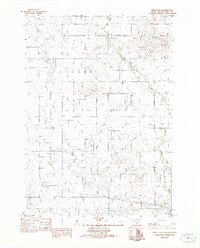 1982 Miller Hill1982 Print · USGSTripp County in the early eighties exhibits a blend of traditional ranch land and mid-century development. Researchers can trace the Old RR Grade through the prairie or locate local landmarks like the Drive-In Theater and Miller Hill.
 - 1982 Map of Wewela NE
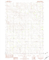 1982 Wewela NE1982 Print · USGSTripp County townships in the early eighties were defined by wide agricultural stretches and sparse rural roads. Genealogists and land researchers can trace property lines through Mc Neely, Pleasant View, and Lake townships or locate the early Gravel Pit.
Showing maps 1-25 of 134
Top cities near Ideal Segment
Frequently asked questions
- What are the different types of historical maps available for Ideal Segment?
- What is the oldest map of Ideal Segment?
- Where can I purchase historical maps of Ideal Segment for my home or office?
- Where can I download high-res historical maps of Ideal Segment?
- Are there historical topographic maps available for Ideal Segment?
- Is there historical aerial imagery available for Ideal Segment?
- Where are historical maps of Ideal Segment sourced from?