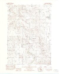
1982 Map of King Dam
USGS Topo · Published 1982About this map
Star Valley and the Lone Star region define the undulating plains of Tripp County in the early 1980s. This landscape is shaped by the winding course of Thunder Creek and the critical water management of King Dam and Covey Dam. These reservoirs serve as the centerpieces for the King Dam State Game Production Area and the Covey Dam State Game Production Area, reflecting the area's dedication to wildlife habitat and conservation in the late twentieth century.
Find a feature on this map
11 named features on this map. Tap any name to fly to it.
Don’t see what you’re looking for? This feature index may not catch every label — zoom into the map to look around manually.
Map Details
Editions of this 1982 King Dam Map
This is the sole edition of this map. No revisions or reprints were ever made.
Other maps of this area
1951 · Ideal NW
USGS Topo · 1:24,000
1951 · Ideal NE
USGS Topo · 1:24,000
1952 · Hamill NW
USGS Topo · 1:24,000

1955 · Mitchell
USGS Topo · 1:250,000
1959 · Mitchell
USGS Topo · 1:250,000
1971 · Hamill
USGS Topo · 1:24,000
1971 · Rattlesnake Butte West
USGS Topo · 1:24,000
1982 · Winner North
USGS Topo · 1:25,000
1982 · Miller Hill
USGS Topo · 1:25,000
1982 · Ideal
USGS Topo · 1:24,000