Old Maps of Friendsville, Tennessee for Academic Research
Study the evolution of Friendsville with 42 high-resolution historic maps. Whether you're teaching, researching, or modeling changes in land use, these maps provide essential visual documentation of urban, environmental, and geographic change.
- Analyze long-term change: Track patterns in development, transportation, and natural features.
- Ideal for environmental or urban studies: Support academic projects with primary historical map data.
- Use in the classroom or lab: Educators and researchers rely on these maps to bring historical context to life.
These maps are a powerful tool for teaching, research, and visualizing how Friendsville has changed over the decades.
Friendsville, TN maps
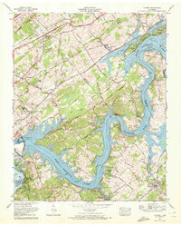
(42)- 1895 Map of Loudon
 1895 Loudon1895 Print · USGSEastern Tennessee is mapped here during a decade of rail expansion and river-based commerce. Genealogists and historians can trace family-named river crossings and early industry at Huff Ferry, Hiwassee College, and Brick Mill.6 unique versions available
 - 1935 Map of Binfield
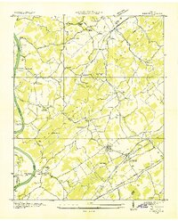
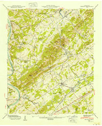
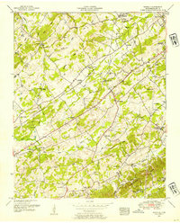
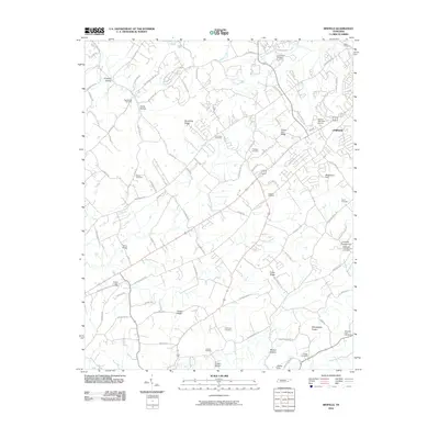
 1935 Binfield1935 Print · USGSBlount County in the mid-1930s is a landscape of rural schoolhouses and family-named ridges organized around the Louisville and Nashville Railroad. Researchers can trace the early layout of Brick Mill, locate the Carpenter Camp Ground, or find family roots at Seceded Cem.2 unique versions available
 - 1935 Map of Meadow
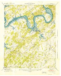
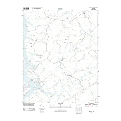
 1935 Meadow1935 Print · USGSThe Little Tennessee River riverfront was still defined by historic crossings in the mid-1930s before modern bridges changed the landscape. You can trace early family landholdings and community sites like Morganton Ferry, Unitia Sch, and Greenback.
 - 1936 Map of Louisville
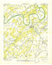 1936 Louisville1936 Print · USGSBlount County and the winding Tennessee River are captured here in the mid-thirties, showing a landscape defined by river bends and railroad stops. Genealogists can trace family roots through landmarks like Holston College, Lowe Ferry, and the settlement at Miser.
 - 1936 Map of Friendship
 1936 Friendship1936 Print · USGSEast Tennessee in the mid-1930s is documented here at a turning point for the river and rail landscape of Knox and Blount counties. Genealogists can trace family names at Mt Zion Ch, Martel Sch, and the riverside settlement of Louisville before the valley landscape was transformed.
 - 1936 Map of Concord
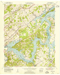
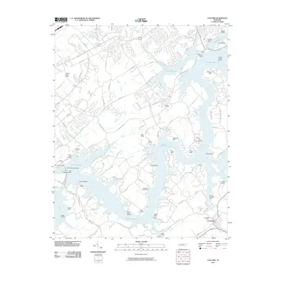
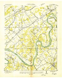 1936 Concord1936 Print · USGSThe Tennessee and Little Tennessee rivers wind through the borders of Knox, Loudon, and Blount counties in the mid-1930s. Researchers can locate early family landmarks like Long Tom Cem, Burnett Sch, and the riverside hamlet of Unitia.
 - 1940 Map of Concord
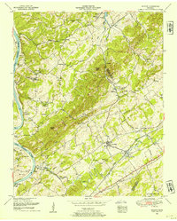
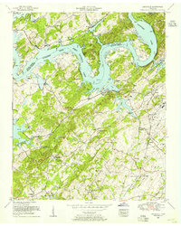
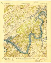 1940 Concord1940 Print · USGSThe Tennessee River valley near Concord and Friendsville is captured here just as the TVA was transforming the local landscape. Researchers can locate early family sites like Prater Cem, the historic Ft Loudoun site, and the Leeper Ferry (Abandoned).4 unique versions available
 - 1940 Map of Meadow
 1940 Meadow1940 Print · USGSLoudon and Blount Counties appear here in the early 1940s, just as the local river-and-rail economy defined daily life. Genealogists and researchers can trace historic river crossings like Morganton Ferry or find rural landmarks like Axley Chapel and Greenback.
 - 1941 Map of Louisville
 1941 Louisville1941 Print · USGSBlount and Knox counties are captured in the early 1940s as the Tennessee River valley prepared for the flooding of the Fort Loudoun Reservoir. Genealogists and historians can trace family locations near Miser Station, Mahoney Mill, and Pumpkin Center.
 - 1941 Map of Binfield
 1941 Binfield1941 Print · USGSBlount County’s rural valleys are shown at the dawn of the 1940s, highlighting a landscape of family farms and local schools. Researchers can trace the Louisville and Nashville rail line past CCC Camp No. 47 and locate ancestral sites like Baker Creek Ch or Seceder Cem.2 unique versions available
 - 1952 Map of Meadow, 1954 Print
 1952 Meadow1954 Print · USGSThe river valleys of East Tennessee are captured here in the early fifties, showing a landscape defined by ferry crossings and hilltop family cemeteries. Trace historic sites like the National Camp Ground, the settlement of Morganton, and the LOUISVILLE AND NASHVILLE rail line.3 unique versions available
 - 1952 Map of Binfield, 1954 Print
 1952 Binfield1954 Print · USGSBlount County in the early fifties is captured here as a landscape of rural community centers and family farms along the Louisville and Nashville railroad. Genealogists and local historians can locate dozens of landmarks including Brick Mill, Carpenter Campground, and the Seceder Cemetery.4 unique versions available
 - 1953 Map of Chattanooga
 1953 Chattanooga1953 Print · USGSSoutheast Tennessee in the early fifties shows a landscape reshaped by river management and rail power. Trace the rail lines of the Southern Ry through riverside towns or locate the preserved grounds of the Chickamauga and Chattanooga National Military Park.
 - 1953 Map of Louisville, 1955 Print
 1953 Louisville1955 Print · USGSBlount and Knox counties meet along the sprawling waters of the Tennessee River in the early fifties. Genealogists can trace family names at Louisville Cemetery and Jones Cemetery or find old rail stops at Miser Station and Pumpkin Center.
 - 1953 Map of Concord, 1955 Print
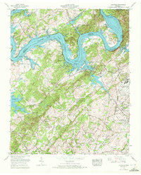
 1953 Concord1955 Print · USGSEast Tennessee's river valleys were undergoing a profound transformation in the early fifties as new reservoirs reshaped the landscape. Researchers can trace the flooded bends of the Tennessee River, locate family sites like Leeper Cemetery, and explore crossroads like Dixie Lee Junction or the rail town of Concord.3 unique versions available
 - 1957 Map of Chattanooga, 1966 Print
 1957 Chattanooga1966 Print · USGSEast Tennessee in the mid-1960s shows a landscape of massive hydroelectric reservoirs and emerging industrial sites like the Atomic Energy Commission (Oak Ridge Area). Trace the rail networks of the Southern Ry through Chattanooga or locate family-named ridges across the Cumberland Plateau.3 unique versions available
 - 1959 Map of Chattanooga
 1959 Chattanooga1959 Print · USGSSoutheast Tennessee is shown here during a decade of industrial growth and hydroelectric development. Trace the regional rail networks of the Southern Ry and find landmark sites like Lookout Mountain, Fall Creek Falls State Park, and Chattanooga.
 - 1960 Map of Chattanooga
 1960 Chattanooga1960 Print · USGSSoutheast Tennessee and the southern Appalachians are shown here at the height of the river-management era. You can trace the valley rail lines and locate Lookout Mountain and the expansive waters of Chickamauga Reservoir.
 - 1964 Map of Chattanooga
 1964 Chattanooga1964 Print · USGSSoutheast Tennessee and the western Carolinas appear in the mid-sixties as a powerhouse of river-driven industry and mountain wilderness. Genealogists and historians can trace rail-town lineages along the Southern Ry or locate family landmarks near Watts Bar Lake and Tellico Plains.
 - 1968 Map of Louisville, 1972 Print
 1968 Louisville1972 Print · USGSThe Blount and Knox county borderlands are captured here in the late sixties, where the rising waters of Fort Loudoun Lake met established rail and military hubs. Trace family history at Miser Station, Mahoney Mill, or the Louisville Cem.5 unique versions available
 - 1968 Map of Concord, 1972 Print
 1968 Concord1972 Print · USGSThe Tennessee River corridor in the late sixties reveals a landscape shaped by massive TVA projects, including the construction of Tellico Lake. Trace the roots of local communities at Dixie Lee Junction, Unitia, and Beals Chapel, or locate old river landmarks like Saltpeter Bluff.2 unique versions available
 - 1981 Map of Watts Bar Lake, 1984 Print
 1981 Watts Bar Lake1984 Print · USGSEast Tennessee's river valleys and industrial corridors are captured here during the expansion of the TVA power system in the early eighties. Researchers can trace the legacy of the Southern Railway and the development of Watts Bar Lake and Tellico Lake.2 unique versions available
 - 2010 Map of Binfield, 2010 Print
 2010 Binfield2010 Print · USGSCovers Friendsville, including Maryville, Cherokee Heights, and other nearby areas
 - 2010 Map of Concord, 2010 Print
 2010 Concord2010 Print · USGSCovers Friendsville, including Farragut, Lenoir City, and other nearby areas
 - 2010 Map of Meadow, 2010 Print
 2010 Meadow2010 Print · USGSCovers Friendsville, including Tellico Village, Greenback, and other nearby areas
Showing maps 1-25 of 42
Top cities near Friendsville
- Knoxville historical maps
- Maryville historical maps
- Oak Ridge historical maps
- Farragut historical maps
- Alcoa historical maps
- Lenoir City historical maps
See more
Top neighborhoods of Friendsville
Frequently asked questions
- What are the different types of historical maps available for Friendsville?
- What is the oldest map of Friendsville?
- Where can I purchase historical maps of Friendsville for my home or office?
- Where can I download high-res historical maps of Friendsville?
- Are there historical topographic maps available for Friendsville?
- Is there historical aerial imagery available for Friendsville?
- Where are historical maps of Friendsville sourced from?