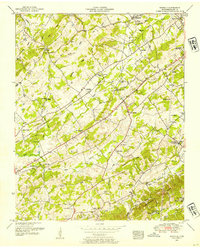
1952 Map of Binfield
USGS Topo · Published 1954About this map
Louisville and Nashville rail lines cut a diagonal path through this 1952 topographic study of Blount County, connecting the small settlements of Binfield and Alnwick. The landscape is defined by a dense network of country churches and small schools that served the rural population during the early fifties, including Rush Strong School and Christie Hill School. Many of these centers of community life are accompanied by family and church burial grounds such as Hamil Cemetery and Lambert Cemetery.
Find a feature on this map
62 named features on this map. Tap any name to fly to it.
Don’t see what you’re looking for? This feature index may not catch every label — zoom into the map to look around manually.
Map Details
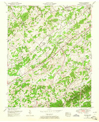
Editions of this 1952 Binfield Map
4 editions found
Other maps of this area

1886 · Knoxville
USGS Topo · 1:125,000

1892 · Knoxville
USGS Topo · 1:125,000

1894 · Knoxville
USGS Topo · 1:125,000

1895 · Loudon
USGS Topo · 1:125,000

1895 · Knoxville
USGS Topo · 1:125,000

1901 · Knoxville
USGS Topo · 1:125,000

1935 · Binfield
USGS Topo · 1:24,000

1935 · Knoxville
USGS Topo · 1:48,000

1935 · Meadow
USGS Topo · 1:24,000

1935 · Maryville
USGS Topo · 1:24,000