2020s Maps of Ashland City, Tennessee
Explore 3 historic maps of Ashland City from the 2020s. These maps offer a rare glimpse into what life looked like during the 2020s — showing old roads, neighborhoods, homes, and landmarks that have changed or disappeared over time.
Whether you're researching your family's past, planning a metal detecting trip, or studying how Ashland City's landscape evolved across the 2020s, these high-resolution maps are a powerful tool for exploring the history of this region.
- Focus on a specific era: All maps on this page are from the 2020s, giving you a focused view of this time period.
- See what’s changed: Compare century-old streets, trails, and buildings to today's modern landscape using overlays and satellite layers.
- Research with precision: Use these maps for genealogy, historical research, land use analysis, or educational projects.
- View, download, or print: Maps are fully viewable online in high resolution, and can be downloaded or printed for your own records.
Start exploring Ashland City's history through authentic maps from the 2020s. This is your window into the past.
Ashland City, TN maps
(3)- 2022 Map of Ashland City, 2022 Print
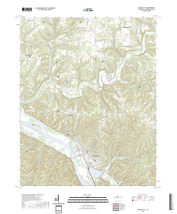 2022 Ashland City2022 Print · USGSAshland City and the surrounding Cheatham County hills are documented here in the early twenty-first century as the landscape maintains its traditional river-and-hollow character. Researchers can pinpoint family burial sites like Teasley Cem and Hunt Cem or locate the historic Cheatham County Courthouse near the Cumberland River.
 - 2022 Map of Lillamay, 2022 Print
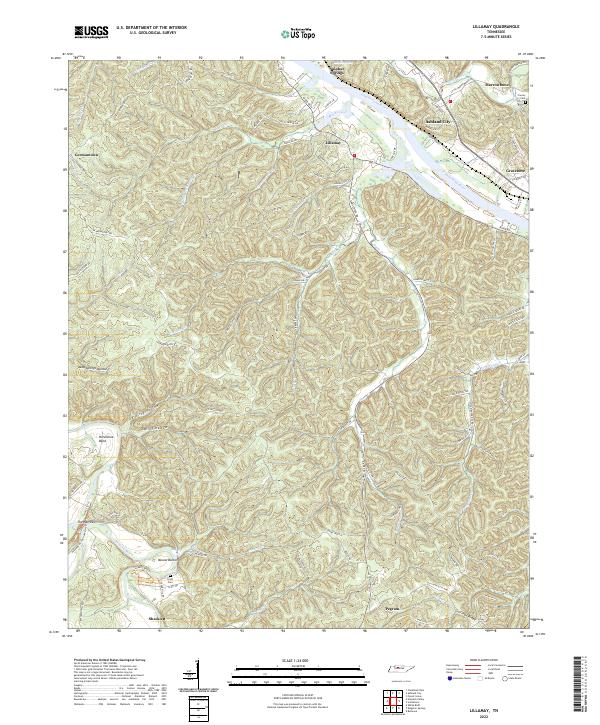 2022 Lillamay2022 Print · USGSCheatham County settlement patterns are preserved here as they appeared in the early 2020s, defined by the winding Cumberland River and prehistoric Mound Bottom. Researchers can trace local lineage through Scott Cem or locate the historic river settlements of Lillamay and Gravelotte.
 - 2022 Map of Scottsboro, 2022 Print
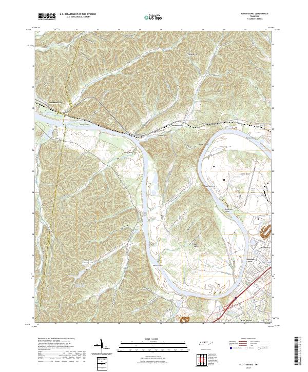 2022 Scottsboro2022 Print · USGSThe western edges of Nashville and the Cumberland River bends come into focus in this early 2020s study. Genealogists and historians can trace the landscape from established neighborhoods like Charlotte Park to the river landmarks of Whartons Bar and Robertson Island.
End of results
Showing maps 1-3 of 3
Top cities near Ashland City
- Nashville historical maps
- Clarksville historical maps
- Brentwood historical maps
- North Nashville historical maps
- Springfield historical maps
- Fairview historical maps
See more
Top neighborhoods of Ashland City
Frequently asked questions
- What are the different types of historical maps available for Ashland City?
- What is the oldest map of Ashland City?
- Where can I purchase historical maps of Ashland City for my home or office?
- Where can I download high-res historical maps of Ashland City?
- Are there historical topographic maps available for Ashland City?
- Is there historical aerial imagery available for Ashland City?
- Where are historical maps of Ashland City sourced from?