Old Maps of Coffee County, Tennessee for Genealogy
Trace your family roots with 140 historic maps of Coffee County. These high-res maps reveal old neighborhoods, homesites, landmarks, and streets — helping you uncover where your ancestors lived and how the area evolved over time.
- Explore historic neighborhoods: Identify where your relatives may have lived in the 1800s or 1900s.
- Compare maps over time: Trace the changes in streets, buildings, and landmarks for multi-generational research.
- Perfect for genealogy & ancestry research: Used by family historians and researchers to map out lineage and migration.
These maps are an incredible resource for exploring your personal connection to Coffee County's past.
Coffee County, TN maps
(140)- 1893 Map of Mc Minnville
 1893 Mc Minnville1893 Print · USGSThe river-and-rail economy of Warren and DeKalb counties is captured here in the 1890s. Researchers can trace old ferry crossings like Pin Hook Ferry and local industry at Daly Mill or Magness Mills.
 - 1895 Map of Mc Minnville
 1895 Mc Minnville1895 Print · USGSWarren and DeKalb Counties in the 1890s are defined by the winding Collins River and the early rail lines connecting the Highland Rim. Genealogists can trace family footprints near Magness Mills, White Seminary, or old river crossings like Bailiff Old Ferry.5 unique versions available
 - 1895 Map of Sewanee
 1895 Sewanee1895 Print · USGSThe Cumberland Plateau and Sequatchie Valley come alive in the late nineteenth century, showing a landscape shaped by coal, iron, and the rails. Genealogists and historians can trace family-named coves and industrial sites like the Cowan Tunnel, Beersheba Springs, and the Stone Quarry.6 unique versions available
 - 1913 Map of Hollow Springs
 1913 Hollow Springs1913 Print · USGSThe Tennessee highland plateau meets the Central Basin in the years before the Great War, showing a landscape of family-run stores and district schools. Genealogists can trace ancestral homes near Hollow Springs, Patmos Chapel, and the McMahan School district.4 unique versions available
 - 1936 Map of Ovoca
 1936 Ovoca1936 Print · USGSCoffee County's rural landscape is captured here in the mid-1930s as the Tennessee Valley Authority mapped the region's complex river systems. Genealogists can locate family landmarks such as the Ovoca Orphans Home, the Holland Hill Cem, and numerous Duck River crossings like Richardson Ford.
 - 1936 Map of Alto
 1936 Alto1936 Print · USGSThe Elk River valley at the Coffee and Franklin County line was a landscape of small settlements and river crossings in the mid-1930s. Genealogists can trace family roots through landmarks like Patton Sch, Bells Mill, and the Abernathy Cem.
 - 1936 Map of Fredonia
 1936 Fredonia1936 Print · USGSCoffee County in the mid-1930s shows a landscape of small farmsteads and schools clustered along the Duck River and its many branches. Genealogists can trace family roots at Elam Cem or locate the old Forest Mill Sch and Strauss Mill.
 - 1936 Map of Manchester
 1936 Manchester1936 Print · USGSCoffee County during the mid-1930s shows a landscape of river-fed industry and deep history near the Old Stone Fort. Genealogists can trace family names at Hickerson Cem or locate rural landmarks like Logan Chapel Sch and Belmont.
 - 1936 Map of Cumberland Springs
 1936 Cumberland Springs1936 Print · USGSMoore County and Lynchburg are captured in the mid-1930s as a land of narrow hollows and high ridges. Researchers can trace the early layout of Lynchburg and find community centers like Raysville Sch, Smith Chapel, and Cumberland Springs.
 - 1936 Map of Burrow Cove
 1936 Burrow Cove1936 Print · USGSThe Cumberland Plateau of Tennessee is shown in the mid-1930s, featuring the deep hollows and high points of Grundy County. Researchers can trace historic landmarks like Wonder Cave, CCC Camp No 1476, and rural centers such as Piedmont and Summerfield.
 - 1936 Map of Beech Grove
 1936 Beech Grove1936 Print · USGSCoffee County rural life in the mid-1930s is detailed here along the winding Garrison Fork and Duck River. Researchers can trace family ties at the Barnes Store, Union Ch, and numerous burial grounds like the Arnold Cem.
 - 1936 Map of Petty Gap
 1936 Petty Gap1936 Print · USGSMiddle Tennessee’s highland terrain is captured during the mid-1930s expansion of the Tennessee Valley Authority. Local researchers can trace the specific watershed boundaries of the Tennessee Basin Divide and the course of Perry and Greek creeks.
 - 1936 Map of Noah
 1936 Noah1936 Print · USGSCoffee County and the Bedford border are captured here in the mid-1930s as rural life centered on the forks and ridges. Genealogists can locate family burial grounds like Alley Cem and Riley Creek Cem or local school sites such as Model Sch and Beech Grove Sch.
 - 1936 Map of Morrison
 1936 Morrison1936 Print · USGSThe Barren Plateau in the mid-1930s shows a landscape of upland drainage and early utility expansion. Local researchers can trace the Tennessee River Basin Divide and early infrastructure like the T E P C O Trans Line and Grassy Pond.
 - 1936 Map of Hillsboro
 1936 Hillsboro1936 Print · USGSCoffee and Grundy counties appear here during the mid-1930s, showing the rural landscape where the Tennessee Basin meets the plateau. Genealogists can locate family landmarks like Price Cem, Zion Hill Ch, and schools such as Stephenson Sch.
 - 1936 Map of Camp Peay
 1936 Camp Peay1936 Print · USGSIn the mid-1930s, the area around Tullahoma and Estill Springs was a hub of military and rail activity. Genealogists and historians can trace the National Guard Reservation at Camp Peay, family burial sites like Maplewood Cem, and local landmarks including the Girls Vocational Sch.
 - 1936 Map of Capitol Hill
 1936 Capitol Hill1936 Print · USGSThe Tennessee Valley during the mid-1930s shows a landscape of river-dependent industry and small rural crossroads. Genealogists can trace family roots through landmarks like Knight Ch, Call Sch, and the riverside operations at Dixon Mill.
 - 1936 Map of Cane Hollow
 1936 Cane Hollow1936 Print · USGSThe Cumberland Plateau in the mid-1930s is captured here just as modern aerial surveying began to detail its complex drainage basins. Trace the old path of State Highway No 108 and locate landmarks like the Altamont Fire Tower and the headwaters of the Elk River at Burrows Cove.
 - 1936 Map of Normandy
 1936 Normandy1936 Print · USGSBedford and Moore counties come to life in the 1930s as the rail-and-river economy centers on the town of Normandy. Genealogists and historians can trace family locations at Bugscuffle, locate Jenkins Sch, or find industrial landmarks like Cortners Mill.
 - 1941 Map of Capitol Hill, 1942 Print
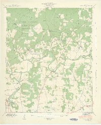 1941 Capitol Hill1942 Print · USGSFranklin County at the start of the war shows a landscape transitioning between rural life and military expansion. Genealogists can trace family roots through Capitol Hill, Paynes, and Buncombe, or locate landmarks like the Estill Springs Power Plant.3 unique versions available
 - 1941 Map of Ovoca, 1943 Print
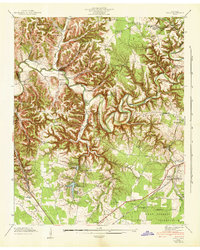 1941 Ovoca1943 Print · USGSCoffee County in the early 1940s reflects a rural landscape undergoing rapid change as the military expanded its footprint. Genealogists can locate family-named crossings like Richardson Ford and local landmarks such as the Ovoca Orphans Home or Hickerson Station.2 unique versions available
 - 1941 Map of Cumberland Springs, 1943 Print
 1941 Cumberland Springs1943 Print · USGSMoore County and the Highland Rim are captured in the early 1940s, just as the nearby military expansion began to transform the local landscape. Genealogists can trace family footprints through community sites like Lynchburg, Bakertown, and Hickory Hill Sch.5 unique versions available
 - 1941 Map of Camp Forrest, 1943 Print
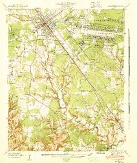 1941 Camp Forrest1943 Print · USGSThe Tennessee mobilization of the early 1940s is on full display as the Camp Forrest Military Reservation rises near Tullahoma. Genealogists and historians can trace family-named sites like Holt Cem and Pylant Springs before the landscape was fully altered by military expansion.2 unique versions available
 - 1941 Map of Manchester, 1943 Print
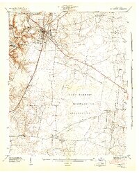 1941 Manchester1943 Print · USGSCoffee County is captured during a period of massive change as the military arrives in the early 1940s. Genealogists and historians can trace the rural landscape before the base expansion, locating family landmarks like Hickerson Cem, Old Stone Fort, and Seminary Hill Sch.3 unique versions available
 - 1943 Map of Mc Minnville, 1944 Print
 1943 Mc Minnville1944 Print · USGSMid-Tennessee is captured here during the mobilization of the early 1940s, showing the vast Camp Forrest Military Reservation and thriving rail towns. Trace the N C & ST L line through Mcminnville or locate smaller rural hubs like Morrison and Hickerson Station.
Showing maps 1-25 of 140
Top cities of Coffee County
Frequently asked questions
- What are the different types of historical maps available for Coffee County?
- What is the oldest map of Coffee County?
- Where can I purchase historical maps of Coffee County for my home or office?
- Where can I download high-res historical maps of Coffee County?
- Are there historical topographic maps available for Coffee County?
- Is there historical aerial imagery available for Coffee County?
- Where are historical maps of Coffee County sourced from?