Old Maps of Rutledge, Tennessee for Metal Detecting
Plan your next treasure hunt with 40 historic maps of Rutledge. Find old homesites, ghost towns, trails, and gathering spots that may be lost to time — perfect for identifying promising metal detecting locations.
- Locate forgotten sites: Uncover places like long-lost settlements, abandoned rail lines, or gathering spots.
- Plan better hunts: Use map overlays combined with LiDAR or satellite views to narrow in on historically rich areas.
- Made for detectorists: Thousands of hobbyists use these maps to discover relics, coins, and hidden history.
Use these historic maps to boost your research and find new opportunities beneath the surface of Rutledge.
Rutledge, TN maps
(40)- 1883 Map of Morristown
 1883 Morristown1883 Print · USGSEast Tennessee in the 1880s is defined by the convergence of mountain ridges and the vital rail corridor through Morristown. Researchers can trace the early industrial landscape of the region through landmarks like Witt's Foundry, Tate's Springs, and the historic Bean's Station.
 - 1893 Map of Morristown
 1893 Morristown1893 Print · USGSEast Tennessee in the 1890s was a landscape of deep mountain ridges and vital rail junctions centered around Morristown. Researchers can trace the nineteenth-century river economy through numerous crossings like Cloud Ferry and find early industry at Lotspeachy Mill.
 - 1895 Map of Morristown
 1895 Morristown1895 Print · USGSThe East Tennessee ridge-and-valley country comes alive in the late nineteenth century as a hub of rail and river transit. Trace the routes of old Evans Ferry or locate vanished stops along the Southern R.R. near Morristown and Bull Gap.5 unique versions available
 - 1897 Map of Maynardville
 1897 Maynardville1897 Print · USGSEast Tennessee in the late nineteenth century was a landscape of high ridges and vital river fords. Genealogists and historians can trace old homesteads and transit hubs like Nances Ferry, the Lead Mine at New Prospect, and Massongills Mill.
 - 1900 Map of Maynardville
 1900 Maynardville1900 Print · USGSEast Tennessee was a world of river fords and mountain gaps at the turn of the century, dominated by the winding Clinch and Powell rivers. Genealogists can trace family roots through specific landmarks like Massongills Mill, Church Grove, and Sharps Chapel.4 unique versions available
 - 1935 Map of Tate Springs
 1935 Tate Springs1935 Print · USGSThe river valleys of Grainger County are captured here in the mid-1930s as the Tennessee Valley Authority began planning the reservoir. Trace family history through local landmarks like Lawson Mill, Swan Island Ferry, and the community at Tate Springs.
 - 1935 Map of Straw Plains
 1935 Straw Plains1935 Print · USGSEast Tennessee life in the mid-1930s is centered on the winding Holston River and the bustling Southern railroad corridor. Researchers can trace family roots at Hickle Cem, find the site of Massengale Mill, or locate Indian Cave.
 - 1935 Map of Joppa
 1935 Joppa1935 Print · USGSThe rural Holston River valley comes to life in the mid-1930s, showing a landscape defined by family-named stores and river crossings. Genealogists and historians can trace local life through sites like Indian Cave Ferry, Haworth Cem, and CCC Camp No 8.
 - 1935 Map of Avondale
 1935 Avondale1935 Print · USGSGrainger County is captured here in the mid-1930s as the rising Norris Reservoir began to reshape the landscape. Local historians can locate vanished landmarks like Avondale Sch, Shields Cem, and the original crossing at Turley Bridge.
 - 1936 Map of Rutledge
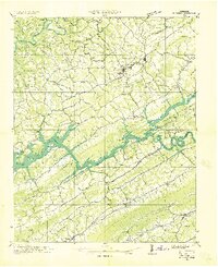 1936 Rutledge1936 Print · USGSClinch River communities faced a major transformation in the mid-1930s as the new reservoir began to fill the valley. You can trace the pre-inundation landscape through landmarks like Beeler Mill, the Straight Creek Mines Sch, and Lone Mountain.
 - 1936 Map of Dutch Valley
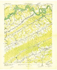 1936 Dutch Valley1936 Print · USGSGrainger County emerges in the mid-1930s as the Tennessee Valley Authority reshapes the landscape with the rising waters of Norris Reservoir. Genealogists and local historians can trace the foundations of Rutledge and Washburn alongside rural landmarks like Beeler Mill and Noe Chapel.
 - 1938 Map of Joppa, 1954 Print
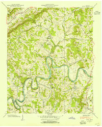 1938 Joppa1954 Print · USGSGrainger and Jefferson counties are captured here in the late 1930s, as the winding HOLSTON RIVER dictates the rhythm of rural life. Researchers can locate family roots at HAWORTH CEM, visit New Corinth Ch, or trace the legacy of CCC Camp No 8.
 - 1938 Map of Avondale, 1954 Print
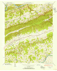 1938 Avondale1954 Print · USGSEast Tennessee's ridge-and-valley landscape is frozen in time during the late 1930s as the Tennessee Valley Authority began transforming the region's river systems. Researchers can trace ancestral locations through the Avondale Cem, local schools like Prospect Sch, and landmarks including Turley Mill and Idol Cross Roads.
 - 1939 Map of Joppa
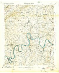 1939 Joppa1939 Print · USGSGrainger and Jefferson counties come alive in the late 1930s as the river economy and conservation projects shape the landscape. Researchers can trace family homesteads near Massengill Mill, visit the grounds of CCC Camp No 8, or locate the site of Indian Cave.
 - 1939 Map of Avondale
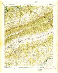 1939 Avondale1939 Print · USGSGrainger County in the late thirties shows a landscape shaped by the new Norris Reservoir and ancient Appalachian ridges. Family historians can locate dozens of specific sites including Avondale Cem, Turley Mill, and schools like Clinch Mtn Sch.2 unique versions available
 - 1941 Map of Dutch Valley, 1963 Print
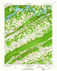 1941 Dutch Valley1963 Print · USGSGrainger County is captured here in the early 1940s, just as the regional landscape was being reshaped by the Clinch River Reservoir. Genealogists and historians can locate numerous family sites like Bunchtown Cem and Rooker Cem alongside rural landmarks like Beeler Mill and Noe Chapel Sch.4 unique versions available
 - 1942 Map of Dutch Valley
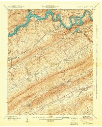 1942 Dutch Valley1942 Print · USGSEastern Tennessee at the start of the 1940s reveals a landscape of tight-knit valley communities and rugged ridges. Researchers can locate dozens of family cemeteries like Kitts Cem and schools such as Dutch Valley Sch along the Southern Railway.
 - 1955 Map of Johnson City
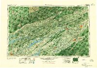 1955 Johnson City1955 Print · USGSEast Tennessee and the bordering highlands of Virginia and Kentucky appear here during the post-war industrial boom. You can trace the complex network of mountain ridges and new TVA lakes, from Johnson City to the coalfields near Middlesboro and Lynch.
 - 1957 Map of Johnson City, 1966 Print
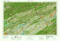 1957 Johnson City1966 Print · USGSUpper East Tennessee and Southwest Virginia are shown here during the mid-sixties transition of the Appalachians. Researchers can trace the industrial rail hubs of Kingsport, the sprawling waters of Cherokee Lake, and the historic Cumberland Gap.
 - 1960 Map of Johnson City
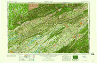 1960 Johnson City1960 Print · USGSUpper East Tennessee and the surrounding tri-state area are shown in the mid-fifties during the height of the TVA reservoir era. Trace the industrial rail lines of the Southern and Louisville and Nashville between Kingsport and Johnson City.
 - 1960 Map of Avondale, 1962 Print
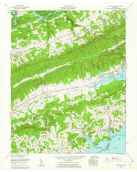 1960 Avondale1962 Print · USGSGrainger County is shown here at the start of the 1960s, defined by the towering ridges and the rising waters of the TVA reservoirs. Researchers can trace rural lineages through the numerous family cemeteries and local landmarks like Thorn Hill Sch, Avondale Springs, and Dotson.
 - 1961 Map of Joppa, 1962 Print
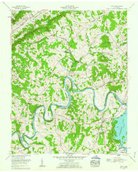 1961 Joppa1962 Print · USGSGrainger and Jefferson counties in the early sixties reveal a landscape of deep river bends and established family homesteads. Researchers can trace ancestral sites like the Massengill Mill, Fielden Store, and numerous burial sites including Sulphur Spring Cem.3 unique versions available
 - 1963 Map of Johnson City
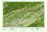 1963 Johnson City1963 Print · USGSThe Tri-Cities and the surrounding Appalachian ridges are shown in detail during the early sixties, highlighting the era's vital rail and river networks. Genealogists and historians can trace the routes of the Clinchfield RR and locate settlements from Rogersville to Elizabethton.
 - 1979 Map of Avondale, 1980 Print
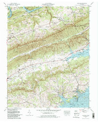 1979 Avondale1980 Print · USGSGrainger County is captured here in the late seventies, showing the traditional farming communities and ridges between the Clinch and Holston Rivers. Trace family roots and local landmarks through dozens of sites like the Dotson Campground Church, Avondale Lookout Tower, and Slave Cem.2 unique versions available
 - 1981 Map of Morristown
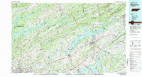 1981 Morristown1981 Print · USGSEast Tennessee's ridge-and-valley corridor is captured here in the early eighties, showing the region's transformation by TVA reservoirs. Genealogists and historians can trace family locations near Alpha Ch, follow the Southern Railway, or locate the Young Mine.
Showing maps 1-25 of 40
Top cities near Rutledge
- Knoxville historical maps
- Morristown historical maps
- Jefferson City historical maps
- Maynardville historical maps
- Bean Station historical maps
- New Tazewell historical maps
See more
Top neighborhoods of Rutledge
Frequently asked questions
- What are the different types of historical maps available for Rutledge?
- What is the oldest map of Rutledge?
- Where can I purchase historical maps of Rutledge for my home or office?
- Where can I download high-res historical maps of Rutledge?
- Are there historical topographic maps available for Rutledge?
- Is there historical aerial imagery available for Rutledge?
- Where are historical maps of Rutledge sourced from?