Old Maps of Jackson County, Tennessee for Academic Research
Study the evolution of Jackson County with 94 high-resolution historic maps. Whether you're teaching, researching, or modeling changes in land use, these maps provide essential visual documentation of urban, environmental, and geographic change.
- Analyze long-term change: Track patterns in development, transportation, and natural features.
- Ideal for environmental or urban studies: Support academic projects with primary historical map data.
- Use in the classroom or lab: Educators and researchers rely on these maps to bring historical context to life.
These maps are a powerful tool for teaching, research, and visualizing how Jackson County has changed over the decades.
Jackson County, TN maps
(94)- 1897 Map of Standingstone
 1897 Standingstone1897 Print · USGSThe Upper Cumberland Plateau at the end of the 19th century shows a landscape of deep coves and rising rail towns. Trace the early tracks of the Nashville and Knoxville railroad or find family roots near Livingston, Standingstone, and the Cedar Springs church.
 - 1898 Map of Standingstone
 1898 Standingstone1898 Print · USGSThe Cumberland Plateau of Middle Tennessee comes alive in the late nineteenth century, showing the isolated settlements and early industry of the western mountains. Trace the route of the Nashville and Knoxville RR through Monterey or locate family-named coves like Johnson Cove and Deck Cove.8 unique versions available
 - 1925 Map of Gainesboro, 1954 Print
 1925 Gainesboro1954 Print · USGSJackson County, Tennessee, is captured here in the mid-1920s when the river and hollows defined every community boundary. Genealogists can trace family landmarks and vanished river crossings like Gainesboro Ferry, Cummins Mill, and the Free State Sch.
 - 1928 Map of Gordonsville
 1928 Gordonsville1928 Print · USGSMiddle Tennessee in the late twenties was a landscape defined by the winding bends of the Caney Fork and the rise of rural river settlements. Genealogists can locate family-named landmarks like Walker Creek Sch and Hurst Chapel, or trace old river crossings at Greenmoos Ferry and Loves Ferry.2 unique versions available
 - 1929 Map of Gainesboro
 1929 Gainesboro1929 Print · USGSJackson County in the late twenties was defined by its river-and-rail economy and upland settlements. Researchers can trace historic river crossings like Gainesboro Ferry and find family-named landmarks such as Cummins Mill and Butlers Landing.2 unique versions available
 - 1929 Map of Tompkinsville
 1929 Tompkinsville1929 Print · USGSThe Kentucky-Tennessee borderlands appear here in the late 1920s, showing a river-centered economy before modern infrastructure. Trace family ties through dozens of rural landmarks like Mulkey Meeting House, Bennett Ferry, and Moores Mill.4 unique versions available
 - 1931 Map of Red Boiling Springs
 1931 Red Boiling Springs1931 Print · USGSCrossing the state line during the late twenties, this survey captures a landscape of ridge-top schools and creek-side settlements. Genealogists can trace family footprints through numerous rural landmarks like Sadlers Chapel, Akersville, and Hermitage Springs PO.3 unique versions available
 - 1932 Map of Carthage
 1932 Carthage1932 Print · USGSNorth Central Tennessee comes alive in the early 1930s as the Cumberland River winds past the county seat of Carthage. Genealogists and researchers can trace family roots through numerous country schools and landmarks like Holliman Ferry and Difficult.3 unique versions available
 - 1942 Map of Statesville
 1942 Statesville1942 Print · USGSMid-century Tennessee comes alive in this survey of the river valleys and rail lines east of Nashville. Researchers can trace the path of the Tennessee Central Railway and locate historic points like Denny Seminary and Tuckers Crossroads.
 - 1943 Map of Cookeville
 1943 Cookeville1943 Print · USGSMiddle Tennessee during the early 1940s reveals a landscape defined by the Tennessee Central Railroad and the ascent to the Cumberland Plateau. Trace local heritage through rural settlements like Silver Point and Bloomington Springs or the river crossing at Hodge Ferry.
 - 1944 Map of Cookeville
 1944 Cookeville1944 Print · USGSUpper Tennessee during the war years shows a landscape shaped by deep river gorges and the rising Cumberland Plateau. Researchers can trace old mountain settlements like Bon Air or locate river landmarks such as Hodge Ferry and Burgess Falls Dam.
 - 1951 Map of Windle, 1989 Print
 1951 Windle1989 Print · USGSOverton County’s rural character is preserved in this mid-century survey of the rugged plateau and river valleys. Researchers can trace historic family-named cemeteries and schools like Oneal Sch, Mathew Cem, and the settlement at Rickman.
 - 1953 Map of Cookeville West, 1955 Print
 1953 Cookeville West1955 Print · USGSPutnam County's mid-century landscape is centered here on the growth of Cookeville and its surrounding hill country. Genealogists and historians can trace family homesteads through numerous landmarks like the Junior Military Academy, Mc Broom Chapel, and Pilot Knob.6 unique versions available
 - 1955 Map of Hilham, 1956 Print
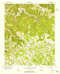 1955 Hilham1956 Print · USGSThe Tennessee Highland Rim comes into focus during the mid-fifties, centered on the historic crossroads of Hilham. Genealogists and historians can trace the foundations of this community through landmarks like Fisk Academy, the Standing Stone Lookout Tower, and Maxwell Chapel.2 unique versions available
 - 1955 Map of Windle, 1956 Print
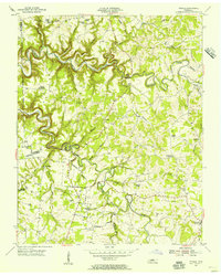 1955 Windle1956 Print · USGSMid-century life in rural Overton County centered on small creek-side settlements and high-ridge community churches. You can trace family roots through numerous local landmarks like Rickman, Lynns Chapel Sch, and the Camp Ground Cem.
 - 1955 Map of Baxter, 1956 Print
 1955 Baxter1956 Print · USGSMid-century Putnam County and the Jackson County line come alive in this detailed survey of the Highland Rim. Genealogists and researchers can trace family lands through dozens of named burials like Odd Fellows Cem or locate community hubs like Baxter Seminary and Philadelphia Sch.3 unique versions available
 - 1956 Map of Corbin, 1966 Print
 1956 Corbin1966 Print · USGSThe Kentucky and Tennessee borderlands are captured here in the mid-fifties, showing the region's shift toward modern interstate travel and reservoir development. Genealogists and historians can trace old community lines near Albany and Monticello or locate early rail junctions along the Southern and Tennessee Central lines.3 unique versions available
 - 1958 Map of Corbin
 1958 Corbin1958 Print · USGSThe Upper Cumberland borderlands appear in the late 1950s as massive reservoirs and early atomic-era growth reshape the region. Trace family roots and vanished landmarks near Lake Cumberland, Oak Ridge, and the Cumberland National Forest.
 - 1962 Map of Buffalo Valley, 1964 Print
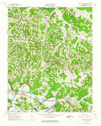 1962 Buffalo Valley1964 Print · USGSUpper Middle Tennessee in the early sixties was a landscape of river-bend bottoms and tight ridge-top settlements. Genealogists and historians can trace family land across Caney Fork and Lancaster, or locate old landmarks like Harris Chapel and Maddux Cem.3 unique versions available
 - 1968 Map of Dodson Branch, 1970 Print
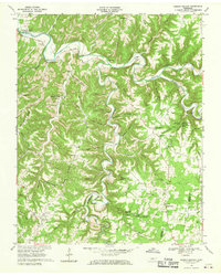 1968 Dodson Branch1970 Print · USGSJackson County and Putnam County rural life is captured here in the late sixties, just as the new reservoir began to reach into the river valleys. Genealogists can locate family landmarks like Stafford Cem and community hubs such as Dodson Branch Sch and Mount Union.
 - 1968 Map of Willette, 1970 Print
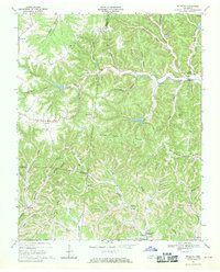 1968 Willette1970 Print · USGSThe hills of Jackson and Macon counties are shown here in the late sixties just before the landscape was changed by the Cordell Hull Reservoir. Genealogists can trace family sites like Thomas Cem, Hayden, and the Wartrace Sch among the winding hollows.
 - 1968 Map of Burristown, 1970 Print
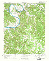 1968 Burristown1970 Print · USGSThe Cumberland River valley is captured here in the late sixties, just as the Cordell Hull Reservoir was beginning to reshape the Jackson County landscape. Researchers can trace family roots through landmarks like Butlers Landing, Fairview Sch, and Lynn Cem.3 unique versions available
 - 1968 Map of Whitleyville, 1970 Print
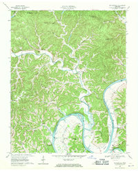 1968 Whitleyville1970 Print · USGSJackson County and Clay County communities are captured here in the late sixties along the winding Cumberland. Trace family roots and local landmarks from Whitleyville to Haydenburg, including Willow Grove Ch and the Draper-Naff Cem.2 unique versions available
 - 1968 Map of Gainesboro, 1970 Print
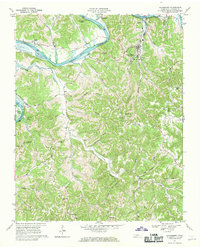 1968 Gainesboro1970 Print · USGSJackson County is shown here in the late sixties, where the winding Cumberland River meets the rural highlands. Local historians can trace family roots through settlements like Nameless and Flynns Lick, or locate the old Poorhouse and Richmond Chapel.3 unique versions available
 - 1968 Map of Granville, 1970 Print
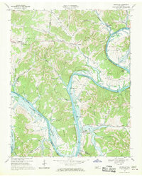 1968 Granville1970 Print · USGSJackson and Smith County river life is captured here as the Cordell Hull Reservoir begins to shape the valley. Trace family sites and land ownership near Granville, Kempville, and the many cemeteries tucked into Stillhouse Hollow.3 unique versions available
Showing maps 1-25 of 94
Top cities of Jackson County
Frequently asked questions
- What are the different types of historical maps available for Jackson County?
- What is the oldest map of Jackson County?
- Where can I purchase historical maps of Jackson County for my home or office?
- Where can I download high-res historical maps of Jackson County?
- Are there historical topographic maps available for Jackson County?
- Is there historical aerial imagery available for Jackson County?
- Where are historical maps of Jackson County sourced from?