Old Maps of New Market, Tennessee for Hiking & Exploration
Hike through history with 26 historic maps of New Market. Explore old trails, ghost towns, and forgotten backroads — perfect for outdoor adventurers and local explorers.
- Rediscover forgotten places: Map out old mining camps, roads, and footpaths that no longer exist on modern maps.
- Layer with modern tools: Combine with LiDAR or satellite views to plan hikes through historical terrain.
- Made for exploration: Popular among hikers, overlanders, and local history lovers.
Use these maps to find adventure and explore the hidden past of New Market.
New Market, TN maps
(26)- 1897 Map of Maynardville
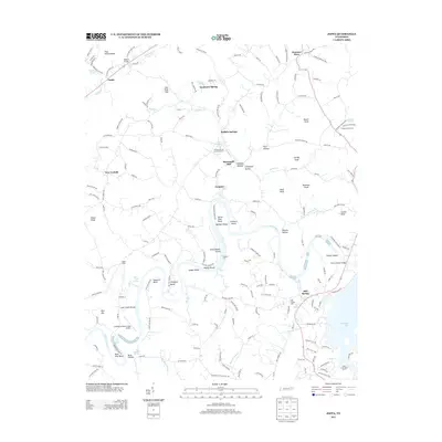
 1897 Maynardville1897 Print · USGSEast Tennessee in the late nineteenth century was a landscape of high ridges and vital river fords. Genealogists and historians can trace old homesteads and transit hubs like Nances Ferry, the Lead Mine at New Prospect, and Massongills Mill.
 - 1900 Map of Maynardville
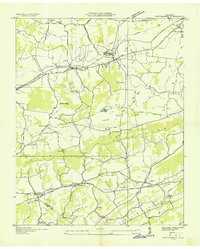
 1900 Maynardville1900 Print · USGSEast Tennessee was a world of river fords and mountain gaps at the turn of the century, dominated by the winding Clinch and Powell rivers. Genealogists can trace family roots through specific landmarks like Massongills Mill, Church Grove, and Sharps Chapel.4 unique versions available
 - 1935 Map of Straw Plains
 1935 Straw Plains1935 Print · USGSEast Tennessee life in the mid-1930s is centered on the winding Holston River and the bustling Southern railroad corridor. Researchers can trace family roots at Hickle Cem, find the site of Massengale Mill, or locate Indian Cave.
 - 1935 Map of Joppa
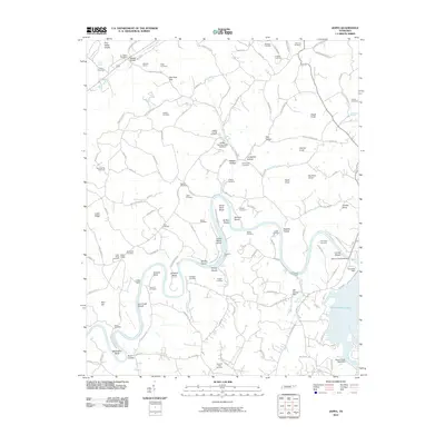
 1935 Joppa1935 Print · USGSThe rural Holston River valley comes to life in the mid-1930s, showing a landscape defined by family-named stores and river crossings. Genealogists and historians can trace local life through sites like Indian Cave Ferry, Haworth Cem, and CCC Camp No 8.
 - 1935 Map of New Market
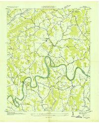
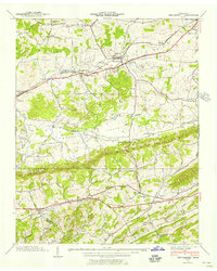
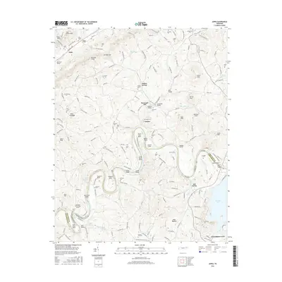
 1935 New Market1935 Print · USGSJefferson County was undergoing significant modernization in the mid-1930s as the Tennessee Valley Authority mapped its growing infrastructure. Researchers can trace old family sites and industrial history through Dinwoody Mill, the SOUTHERN rail stops at Friends Station, and the Shrader Chapel Sch.
 - 1938 Map of Joppa, 1954 Print
 1938 Joppa1954 Print · USGSGrainger and Jefferson counties are captured here in the late 1930s, as the winding HOLSTON RIVER dictates the rhythm of rural life. Researchers can locate family roots at HAWORTH CEM, visit New Corinth Ch, or trace the legacy of CCC Camp No 8.
 - 1939 Map of Joppa
 1939 Joppa1939 Print · USGSGrainger and Jefferson counties come alive in the late 1930s as the river economy and conservation projects shape the landscape. Researchers can trace family homesteads near Massengill Mill, visit the grounds of CCC Camp No 8, or locate the site of Indian Cave.
 - 1939 Map of New Market, 1956 Print
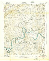
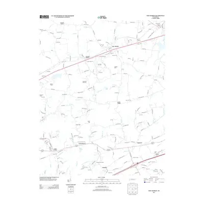
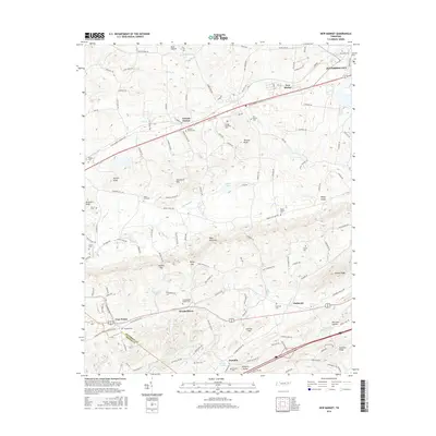
 1939 New Market1956 Print · USGSJefferson County was an active landscape of zinc mining and valley farming just before the mid-century. Researchers can trace ancestral locations like Nances Grove, family-run landmarks like French Mill, and local burial sites including Westview Cem.
 - 1940 Map of New Market
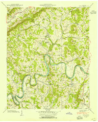
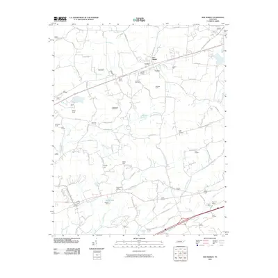
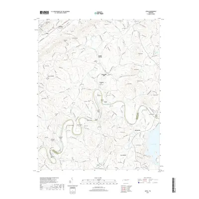
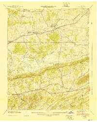 1940 New Market1940 Print · USGSJefferson County's rural and industrial landscape is captured here in the years before the war, centered on the New Market rail corridor. Genealogists and historians can locate family landmarks like Dinwoody Mill, trace the SOUTHERN railroad line, and find old burial grounds such as Caldwell Cem.2 unique versions available
 - 1955 Map of Johnson City
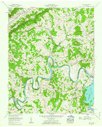
 1955 Johnson City1955 Print · USGSEast Tennessee and the bordering highlands of Virginia and Kentucky appear here during the post-war industrial boom. You can trace the complex network of mountain ridges and new TVA lakes, from Johnson City to the coalfields near Middlesboro and Lynch.
 - 1957 Map of Johnson City, 1966 Print
 1957 Johnson City1966 Print · USGSUpper East Tennessee and Southwest Virginia are shown here during the mid-sixties transition of the Appalachians. Researchers can trace the industrial rail hubs of Kingsport, the sprawling waters of Cherokee Lake, and the historic Cumberland Gap.
 - 1960 Map of Johnson City
 1960 Johnson City1960 Print · USGSUpper East Tennessee and the surrounding tri-state area are shown in the mid-fifties during the height of the TVA reservoir era. Trace the industrial rail lines of the Southern and Louisville and Nashville between Kingsport and Johnson City.
 - 1961 Map of Joppa, 1962 Print
 1961 Joppa1962 Print · USGSGrainger and Jefferson counties in the early sixties reveal a landscape of deep river bends and established family homesteads. Researchers can trace ancestral sites like the Massengill Mill, Fielden Store, and numerous burial sites including Sulphur Spring Cem.3 unique versions available
 - 1961 Map of New Market, 1963 Print
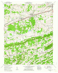 1961 New Market1963 Print · USGSJefferson County in the early sixties was a landscape of deep-rooted settlements and active industry. Genealogists can locate family landmarks such as French Mill, Wooten Chapel, and numerous cemeteries including Loy Memorial Cem and Piedmont Cem.3 unique versions available
 - 1963 Map of Johnson City
 1963 Johnson City1963 Print · USGSThe Tri-Cities and the surrounding Appalachian ridges are shown in detail during the early sixties, highlighting the era's vital rail and river networks. Genealogists and historians can trace the routes of the Clinchfield RR and locate settlements from Rogersville to Elizabethton.
 - 1981 Map of Morristown
 1981 Morristown1981 Print · USGSEast Tennessee's ridge-and-valley corridor is captured here in the early eighties, showing the region's transformation by TVA reservoirs. Genealogists and historians can trace family locations near Alpha Ch, follow the Southern Railway, or locate the Young Mine.
 - 2010 Map of Joppa, 2010 Print
 2010 Joppa2010 Print · USGSCovers New Market, including Jefferson City, Rutledge, and other nearby areas
 - 2010 Map of New Market, 2010 Print
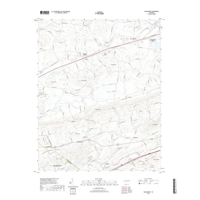
 2010 New Market2010 Print · USGSCovers New Market, including Sevierville, Jefferson City, and other nearby areas
 - 2013 Map of New Market, 2013 Print
 2013 New Market2013 Print · USGSCovers New Market, including Sevierville, Jefferson City, and other nearby areas
 - 2013 Map of Joppa, 2013 Print
 2013 Joppa2013 Print · USGSCovers New Market, including Jefferson City, Rutledge, and other nearby areas
 - 2016 Map of Joppa, 2016 Print
 2016 Joppa2016 Print · USGSCovers New Market, including Jefferson City, Rutledge, and other nearby areas
 - 2016 Map of New Market, 2016 Print
 2016 New Market2016 Print · USGSCovers New Market, including Sevierville, Jefferson City, and other nearby areas
 - 2019 Map of Joppa, 2019 Print
 2019 Joppa2019 Print · USGSCovers New Market, including Jefferson City, Rutledge, and other nearby areas
 - 2019 Map of New Market, 2019 Print
 2019 New Market2019 Print · USGSCovers New Market, including Sevierville, Jefferson City, and other nearby areas
 - 2022 Map of New Market, 2022 Print
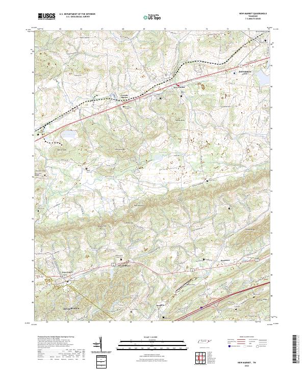 2022 New Market2022 Print · USGSJefferson and Sevier counties are shown here in modern detail, where ridge-and-valley terrain shapes the historic settlements of New Market and Friends Station. Researchers can trace family roots through numerous local sites like McCampbells Chapel Cem and Piedmont.
Showing maps 1-25 of 26
Top cities near New Market
- Knoxville historical maps
- Morristown historical maps
- Sevierville historical maps
- Jefferson City historical maps
- Maynardville historical maps
- Bean Station historical maps
See more
Frequently asked questions
- What are the different types of historical maps available for New Market?
- What is the oldest map of New Market?
- Where can I purchase historical maps of New Market for my home or office?
- Where can I download high-res historical maps of New Market?
- Are there historical topographic maps available for New Market?
- Is there historical aerial imagery available for New Market?
- Where are historical maps of New Market sourced from?