Old Maps of Lauderdale County, Tennessee for Genealogy
Trace your family roots with 140 historic maps of Lauderdale County. These high-res maps reveal old neighborhoods, homesites, landmarks, and streets — helping you uncover where your ancestors lived and how the area evolved over time.
- Explore historic neighborhoods: Identify where your relatives may have lived in the 1800s or 1900s.
- Compare maps over time: Trace the changes in streets, buildings, and landmarks for multi-generational research.
- Perfect for genealogy & ancestry research: Used by family historians and researchers to map out lineage and migration.
These maps are an incredible resource for exploring your personal connection to Lauderdale County's past.
Lauderdale County, TN maps
(140)- 1939 Map of Hales Point, 1943 Print
 1939 Hales Point1943 Print · USGSThe riverine borders of the Mississippi and Obion Rivers come alive in the late 1930s, showing a landscape of landings, islands, and flood control projects. Genealogists can trace family footprints through sites like Buckner Cem, Hickman, and Henning Grove Ch & Sch.
 - 1939 Map of Halls, 1943 Print
 1939 Halls1943 Print · USGSLauderdale and Dyer Counties are mapped here during the late 1930s as the river-and-rail economy shaped West Tennessee life. Genealogists and researchers can trace the rural communities of Unionville, Fowlkes, and Key Corner, alongside landmark sites like Charles Chapel and the Nankipoo Sch.
 - 1939 Map of Blytheville, 1944 Print
 1939 Blytheville1944 Print · USGSMississippi County at the end of the Depression reveals a landscape of engineered drainage and thriving rail junctions. Genealogists and local historians can trace family locations near Blytheville, Cards Chapel & Cem, and the river landing at Ashport.
 - 1952 Map of Hales Point
 1952 Hales Point1952 Print · USGSThe Mississippi River borderlands of Tennessee and Arkansas are captured here in the early fifties, showing a landscape defined by cut-offs and island formations. Researchers can trace rural life through community landmarks like Walnut Grove Church and Cem, Chic School, and the Needham Cut-Off.4 unique versions available
 - 1952 Map of Gates, 1953 Print
 1952 Gates1953 Print · USGSLauderdale and Haywood Counties are shown in the early fifties as the rural landscape centered on the ILLINOIS CENTRAL rail line. Genealogists can trace family footprints through numerous small landmarks like Nelson Chapel, Woodville Sch, and Crossroads Cem.3 unique versions available
 - 1952 Map of Bonicord, 1953 Print
 1952 Bonicord1953 Print · USGSDyer and Crockett counties are captured here in the early fifties, showing a rural landscape defined by the river forks and small country crossroads. Genealogists can trace family names through numerous burial sites like St Peter Cem and churches such as Palestine Ch or Zion Hill Ch.2 unique versions available
 - 1952 Map of Chestnut Bluff, 1953 Print
 1952 Chestnut Bluff1953 Print · USGSCrockett County and its river-carved borders are captured here in the early fifties, before modern highway expansion altered the rural landscape. Researchers can locate family landmarks and community anchors like Hellens Bluff Sch, Archer Chapel, and the Young Cem.2 unique versions available
 - 1952 Map of Fowlkes, 1954 Print
 1952 Fowlkes1954 Print · USGSDyer and Lauderdale counties in the early fifties reveal a landscape defined by the winding South Fork Forked Deer River and the Illinois Central rail line. Researchers can trace rural lineages through sites like Williams Chapel, King Cem, and the expansive U S Military Reservation.2 unique versions available
 - 1955 Map of Blytheville
 1955 Blytheville1955 Print · USGSMid-century Mississippi County, Arkansas, is shown here as a landscape of reclaimed delta land and bustling rail towns. Genealogists can trace family names through rural landmarks like Number Nine, Promised Land, and the O'Donald Bend Community.
 - 1956 Map of Blytheville, 1964 Print
 1956 Blytheville1964 Print · USGSWest Tennessee and the Arkansas Delta come alive in this mid-century survey of the river-and-rail corridor connecting Memphis to Jackson. Genealogists and historians can trace the rail lines of the Louisville and Nashville RR and locate landmarks like Western State Hospital or Fort Pillow State Prison Farm.2 unique versions available
 - 1959 Map of Blytheville
 1959 Blytheville1959 Print · USGSWest Tennessee and Northeast Arkansas meet along the river in the late fifties, during a period of steady industrial and agricultural growth. Genealogists can trace the rail corridors of the Illinois Central through Jackson or explore landmarks like Shiloh National Military Park and Fort Pillow State Prison.
 - 1961 Map of Hales Point, 1963 Print
 1961 Hales Point1963 Print · USGSThe Tennessee-Arkansas river borderland is captured here in the early sixties, showing the complex hydrology of the Mississippi River. Researchers can trace old community foundations and rural heritage through landmarks like Henning Grove Ch & Sch, Ashport Cem, and Hales Point.2 unique versions available
 - 1961 Map of Rialto, 1963 Print
 1961 Rialto1963 Print · USGSWest Tennessee in the early sixties was a landscape of river-bottom farms and interconnected parish life along the Hatchie River. Researchers can trace the heritage of Covington and Ripley, alongside rural landmarks like the Fort Pillow State Prison Farm and Plumer Grove Ch & Sch.
 - 1961 Map of Halls, 1965 Print
 1961 Halls1965 Print · USGSLauderdale and Dyer counties are shown in the early sixties as the West Tennessee landscape hummed with activity along the Illinois Central tracks. Researchers can trace rural lineages through dozens of named sites like Miller Chapel Cem, Benton Sch, and the U. S. Military Reservation.
 - 1962 Map of Rialto
 1962 Rialto1962 Print · USGSTipton and Lauderdale counties are mapped here in the early sixties, showing a landscape defined by the Hatchie River and the Illinois Central line. Genealogists can locate many local landmarks, including Rialto Ch & Sch, Canaan Cem, and the Fort Pillow State Prison Farm.
 - 1962 Map of Hales Point
 1962 Hales Point1962 Print · USGSThe Tennessee-Arkansas borderlands come alive in the early sixties as the Mississippi River carves through Lauderdale County. Researchers can trace family roots at St Luke Cem, locate the Matthews Ch & Sch, or explore the riverfront at Hales Point.
 - 1963 Map of Osceola, 1966 Print
 1963 Osceola1966 Print · USGSThe river borders of Tennessee and Arkansas meet along the bends of the Mississippi in the early sixties. Genealogists and historians can trace riverside settlements like Golddust and Randolph, or locate rural landmarks like Raven Cross Cem and St Johns Ch.
 - 1964 Map of Turnpike, 1965 Print
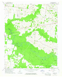 1964 Turnpike1965 Print · USGSThe Hatchie River lowlands of West Tennessee are captured here in the mid-sixties, showing a landscape defined by river bends and wetland basins. Researchers can locate vanished landmarks like New Hope School, Turnpike, and family sites such as Estes Cemetery and Walker School.2 unique versions available
 - 1964 Map of Durhamville, 1965 Print
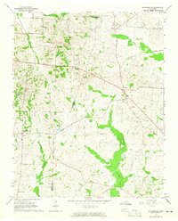 1964 Durhamville1965 Print · USGSThe West Tennessee borderlands of Haywood and Lauderdale counties are documented here in the mid-1960s. Genealogists and local historians can trace family locations near Durhamville, Nutbush, and landmarks such as St Pauls Ch or Holmes Cem.2 unique versions available
 - 1965 Map of Osceola
 1965 Osceola1965 Print · USGSOsceola and the Mississippi River bottomlands are captured here in the mid-sixties, showing the complex boundary between Arkansas and Tennessee. Researchers can trace family roots through numerous rural landmarks like Golddust Ch & Sch, Grider, and Smyrna Ch.
 - 1970 Map of Brownsville
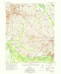 1970 Brownsville1970 Print · USGSHaywood County in the late sixties and early seventies is defined by its deep river bottomlands and scattered rural crossroads. Genealogists and researchers can trace family landmarks and vanished schools like Nutbush, Durhamville, and the Flag Grove Sch.
 - 1972 Map of Ripley North, 1974 Print
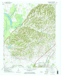 1972 Ripley North1974 Print · USGSLauderdale County, Tennessee, is captured here in the early 1970s, showcasing the transition from the Forked Deer River bottomlands to rural ridge settlements. Genealogists can trace family connections at New Hope Cemetery or follow the historic Illinois Central Gulf rail line past the old Arp School.2 unique versions available
 - 1972 Map of Ripley South, 1974 Print
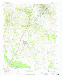 1972 Ripley South1974 Print · USGSLauderdale County in the early seventies centers on the growing communities of Ripley and Henning along the rail corridor. Genealogists can trace family names at Poplar Grove Cem, Bethlehem Cem, or rural landmarks like Hurricane Hill.2 unique versions available
 - 1972 Map of Fort Pillow, 1974 Print
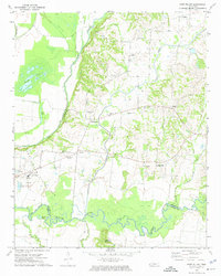 1972 Fort Pillow1974 Print · USGSThe bluffs above the Hatchie River and the rural communities of Lauderdale County are frozen in time during the early 1970s. Local researchers can trace old family names and community centers through landmarks like Pilgrim Rest Cem, New Hope Ch, and the Fort Pillow State Farm.
 - 1972 Map of Knob Creek, 1974 Print
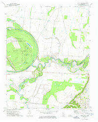 1972 Knob Creek1974 Print · USGSWest Tennessee river bottoms come into focus in the 1970s as the Obion River snakes toward its confluence. Genealogists and local historians can trace small settlements like Stinger and Hunning Grove or find the remote Helm Ch tucked away from the river's edge.
Showing maps 1-25 of 140
Top cities of Lauderdale County
Frequently asked questions
- What are the different types of historical maps available for Lauderdale County?
- What is the oldest map of Lauderdale County?
- Where can I purchase historical maps of Lauderdale County for my home or office?
- Where can I download high-res historical maps of Lauderdale County?
- Are there historical topographic maps available for Lauderdale County?
- Is there historical aerial imagery available for Lauderdale County?
- Where are historical maps of Lauderdale County sourced from?