Old Maps of Ripley, Tennessee
Explore 23 old maps of Ripley, spanning from 1939 to today. These high-resolution historic maps reveal how streets, neighborhoods, landmarks, and natural features evolved over time — perfect for genealogy, metal detecting, research, and local history exploration.
What you can do with these maps:
- See how Ripley changed over time: Compare historical maps to modern-day views to trace roads, homesites, rail lines & more.
- View detailed metadata: Each map includes creators, publishers, year, scale, and archive source.
- Overlay maps with satellite & LiDAR: Visualize the past alongside modern tools to explore terrain & human change.
- Trusted historical sources: Maps sourced from the USGS, Library of Congress, and other archives.
- Access maps your way: View online, download high-res files, or order prints for personal or research use.
Start exploring old maps of Ripley to uncover forgotten places, hidden landmarks, and the deep history beneath your feet.
Ripley, TN maps
(23)- 1939 Map of Hales Point, 1943 Print
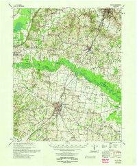
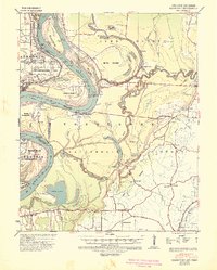 1939 Hales Point1943 Print · USGSThe riverine borders of the Mississippi and Obion Rivers come alive in the late 1930s, showing a landscape of landings, islands, and flood control projects. Genealogists can trace family footprints through sites like Buckner Cem, Hickman, and Henning Grove Ch & Sch.
 - 1952 Map of Hales Point
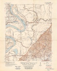 1952 Hales Point1952 Print · USGSThe Mississippi River borderlands of Tennessee and Arkansas are captured here in the early fifties, showing a landscape defined by cut-offs and island formations. Researchers can trace rural life through community landmarks like Walnut Grove Church and Cem, Chic School, and the Needham Cut-Off.4 unique versions available
 - 1956 Map of Blytheville, 1964 Print
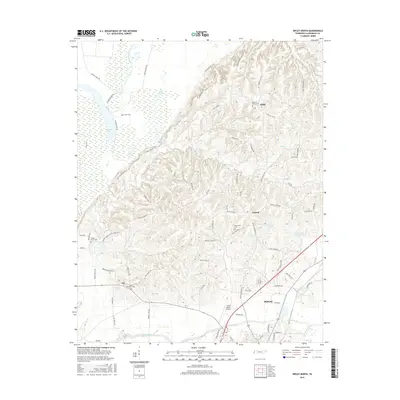
 1956 Blytheville1964 Print · USGSWest Tennessee and the Arkansas Delta come alive in this mid-century survey of the river-and-rail corridor connecting Memphis to Jackson. Genealogists and historians can trace the rail lines of the Louisville and Nashville RR and locate landmarks like Western State Hospital or Fort Pillow State Prison Farm.2 unique versions available
 - 1959 Map of Blytheville
 1959 Blytheville1959 Print · USGSWest Tennessee and Northeast Arkansas meet along the river in the late fifties, during a period of steady industrial and agricultural growth. Genealogists can trace the rail corridors of the Illinois Central through Jackson or explore landmarks like Shiloh National Military Park and Fort Pillow State Prison.
 - 1961 Map of Hales Point, 1963 Print
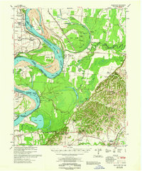
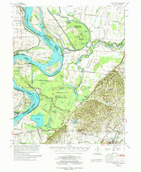
 1961 Hales Point1963 Print · USGSThe Tennessee-Arkansas river borderland is captured here in the early sixties, showing the complex hydrology of the Mississippi River. Researchers can trace old community foundations and rural heritage through landmarks like Henning Grove Ch & Sch, Ashport Cem, and Hales Point.2 unique versions available
 - 1961 Map of Rialto, 1963 Print
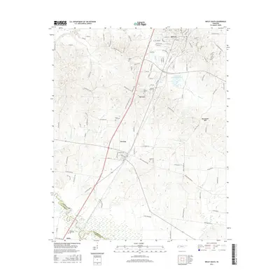
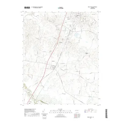
 1961 Rialto1963 Print · USGSWest Tennessee in the early sixties was a landscape of river-bottom farms and interconnected parish life along the Hatchie River. Researchers can trace the heritage of Covington and Ripley, alongside rural landmarks like the Fort Pillow State Prison Farm and Plumer Grove Ch & Sch.
 - 1962 Map of Rialto
 1962 Rialto1962 Print · USGSTipton and Lauderdale counties are mapped here in the early sixties, showing a landscape defined by the Hatchie River and the Illinois Central line. Genealogists can locate many local landmarks, including Rialto Ch & Sch, Canaan Cem, and the Fort Pillow State Prison Farm.
 - 1962 Map of Hales Point
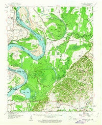
 1962 Hales Point1962 Print · USGSThe Tennessee-Arkansas borderlands come alive in the early sixties as the Mississippi River carves through Lauderdale County. Researchers can trace family roots at St Luke Cem, locate the Matthews Ch & Sch, or explore the riverfront at Hales Point.
 - 1972 Map of Ripley North, 1974 Print
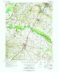
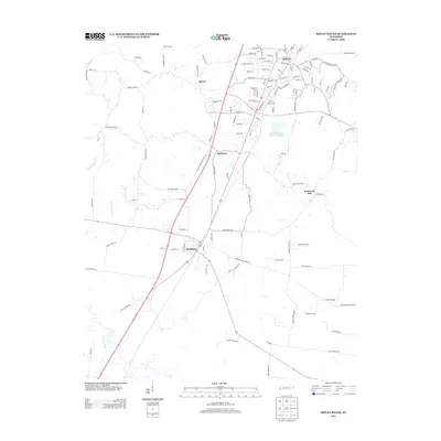
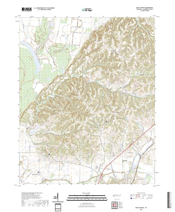
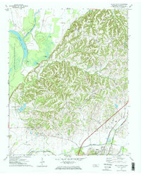 1972 Ripley North1974 Print · USGSLauderdale County, Tennessee, is captured here in the early 1970s, showcasing the transition from the Forked Deer River bottomlands to rural ridge settlements. Genealogists can trace family connections at New Hope Cemetery or follow the historic Illinois Central Gulf rail line past the old Arp School.2 unique versions available
 - 1972 Map of Ripley South, 1974 Print
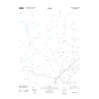
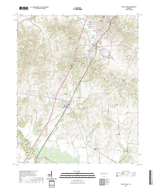
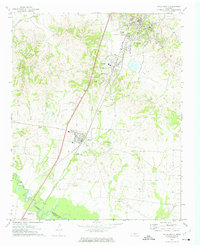 1972 Ripley South1974 Print · USGSLauderdale County in the early seventies centers on the growing communities of Ripley and Henning along the rail corridor. Genealogists can trace family names at Poplar Grove Cem, Bethlehem Cem, or rural landmarks like Hurricane Hill.2 unique versions available
 - 1977 Map of Rialto
 1977 Rialto1977 Print · USGSTipton and Lauderdale counties are documented here in the late seventies, showing the traditional river-and-rail corridor along the Hatchie River. Genealogists can trace family landmarks across dozens of sites, including Leighs Chapel, Pilgrims Rest Cem, and the Henning Sch.
 - 1977 Map of Hales Point
 1977 Hales Point1977 Print · USGSLauderdale County, Tennessee, is mapped here in the mid-seventies, showing a landscape shaped by the Mississippi River and its historic shifts. Researchers can trace the heritage of local communities like Hales Point, locate family plots at Buckner Cem, and find old rural landmarks including Arp Sch and Marys Chapel.
 - 1986 Map of Blytheville
 1986 Blytheville1986 Print · USGSThe Arkansas-Tennessee borderlands appear here in the mid-eighties, centered on the mighty Mississippi River and its shifting islands. Trace the footprints of Blytheville Air Force Base, old river towns like Golddust, and the extensive grounds of the Fort Pillow State Prison Farm.2 unique versions available
 - 2010 Map of Ripley South, 2010 Print
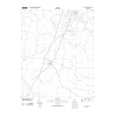 2010 Ripley South2010 Print · USGSCovers Ripley, including Henning, Hurricane Hill, and other nearby areas
 - 2010 Map of Ripley North, 2010 Print
 2010 Ripley North2010 Print · USGSCovers Ripley, including Edith, Arp, and other nearby areas
 - 2013 Map of Ripley South, 2013 Print
 2013 Ripley South2013 Print · USGSCovers Ripley, including Henning, Hurricane Hill, and other nearby areas
 - 2013 Map of Ripley North, 2013 Print
 2013 Ripley North2013 Print · USGSCovers Ripley, including Edith, Arp, and other nearby areas
 - 2016 Map of Ripley South, 2016 Print
 2016 Ripley South2016 Print · USGSCovers Ripley, including Henning, Hurricane Hill, and other nearby areas
 - 2016 Map of Ripley North, 2016 Print
 2016 Ripley North2016 Print · USGSCovers Ripley, including Edith, Arp, and other nearby areas
 - 2019 Map of Ripley South, 2019 Print
 2019 Ripley South2019 Print · USGSCovers Ripley, including Henning, Hurricane Hill, and other nearby areas
 - 2019 Map of Ripley North, 2019 Print
 2019 Ripley North2019 Print · USGSCovers Ripley, including Edith, Arp, and other nearby areas
 - 2022 Map of Ripley North, 2022 Print
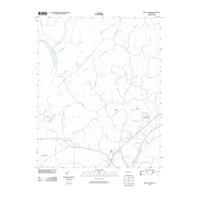
 2022 Ripley North2022 Print · USGSLauderdale County's agricultural and wetland landscape is captured here in detail, showing the rural communities of the 2020s. Researchers can trace family history through numerous sites like Walnut Grove Cem, the settlement of Edith, and the community at Arp.
 - 2022 Map of Ripley South, 2022 Print
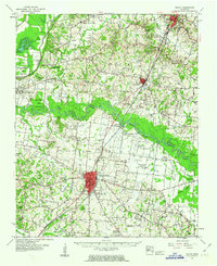
 2022 Ripley South2022 Print · USGSLauderdale County comes into sharp focus during the early twenty-first century, spanning the area from the southern edge of Ripley down to the Hatchie River. Genealogists can trace family names at the Alex Haley Grave Site or search for roots at the Poplar Grove Cem and Bethlehem Cem.
End of results
Showing maps 1-23 of 23
Top cities near Ripley
- Covington historical maps
- Halls historical maps
- Henning historical maps
- Gates historical maps
- Burlison historical maps
- Garland historical maps
See more
Top neighborhoods of Ripley
Frequently asked questions
- What are the different types of historical maps available for Ripley?
- What is the oldest map of Ripley?
- Where can I purchase historical maps of Ripley for my home or office?
- Where can I download high-res historical maps of Ripley?
- Are there historical topographic maps available for Ripley?
- Is there historical aerial imagery available for Ripley?
- Where are historical maps of Ripley sourced from?