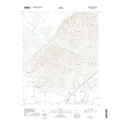
2019 Map of Ripley North
USGS Topo · Published 2019About this map
The Old Bed Forked Deer River meanders across the northwestern corner of this landscape, its former channel marked by wetlands and isolated waters like Long Pond and Gum Pond. The area is defined by a dense network of country roads named for local families, including Gus Hargett Rd, Jeff Webb Rd, and Chambers Rd, reflecting the deep-rooted settlement patterns of Lauderdale County. Small communities and rural junctions such as Edith, Central, and Arp serve as historic focal points, often centered around local congregations and burial grounds like the Mount Pleasant Methodist Church Cem and Pleasant Grove Cem.
Find a feature on this map
89 named features on this map. Tap any name to fly to it.
Don’t see what you’re looking for? This feature index may not catch every label — zoom into the map to look around manually.
Map Details
Editions of this 2019 Ripley North Map
This is the sole edition of this map. No revisions or reprints were ever made.
Other maps of this area

1939 · Hales Point
USGS Topo · 1:62,500

1939 · Halls
USGS Topo · 1:62,500

1952 · Hales Point
USGS Topo · 1:62,500

1952 · Gates
USGS Topo · 1:24,000

1952 · Fowlkes
USGS Topo · 1:24,000

1956 · Blytheville
USGS Topo · 1:250,000

1959 · Blytheville
USGS Topo · 1:250,000

1961 · Hales Point
USGS Topo · 1:62,500

1961 · Rialto
USGS Topo · 1:62,500

1961 · Halls
USGS Topo · 1:62,500