1950s Maps of Lincoln County, Tennessee
Explore 18 historic maps of Lincoln County from the 1950s. These maps offer a rare glimpse into what life looked like during the 1950s — showing old roads, neighborhoods, homes, and landmarks that have changed or disappeared over time.
Whether you're researching your family's past, planning a metal detecting trip, or studying how Lincoln County's landscape evolved across the 1950s, these high-resolution maps are a powerful tool for exploring the history of this region.
- Focus on a specific era: All maps on this page are from the 1950s, giving you a focused view of this time period.
- See what’s changed: Compare century-old streets, trails, and buildings to today's modern landscape using overlays and satellite layers.
- Research with precision: Use these maps for genealogy, historical research, land use analysis, or educational projects.
- View, download, or print: Maps are fully viewable online in high resolution, and can be downloaded or printed for your own records.
Start exploring Lincoln County's history through authentic maps from the 1950s. This is your window into the past.
Lincoln County, TN maps
(18)- 1951 Map of Boonshill
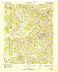
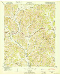
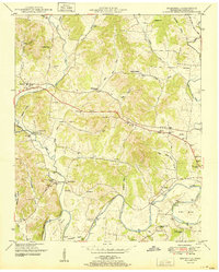 1951 Boonshill1951 Print · USGSMid-century Lincoln County is shown here during a time of established rural church and school life. Researchers can trace family-named landmarks like Childress Cem, find the location of Boonshill Sch, and follow the path of OLD FISHING FORD ROAD along the ELK RIVER.2 unique versions available
 - 1951 Map of King Cove
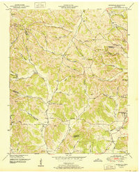
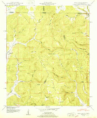 1951 King Cove1951 Print · USGSHighland coves along the Alabama-Tennessee border appear here as they were in the early fifties, a landscape of family-named gaps and hollows. Genealogists can locate several remote burial sites like King Cove Cem and Maxwell Cem or trace the early community at Francisco.2 unique versions available
 - 1951 Map of Taft
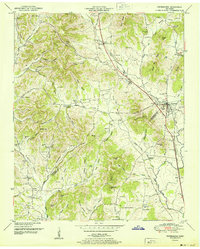
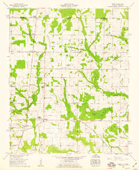
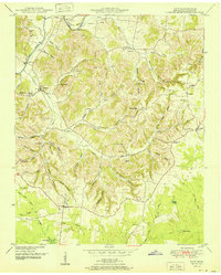 1951 Taft1951 Print · USGSSouthern Lincoln County near the Alabama border is documented here in the early fifties, showing a landscape of upland farms and winding hollows. Genealogists can trace family roots through numerous sites like Smith Chapel, Marys Grove School, and Milam Cem.2 unique versions available
 - 1951 Map of New Market
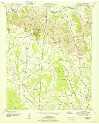
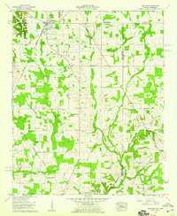
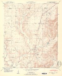 1951 New Market1951 Print · USGSMadison County, Alabama, and the Tennessee borderlands are detailed here in the early fifties, showing a rural landscape defined by the Nashville Chattanooga and St Louis rail line. Researchers can trace family history through dozens of landmarks like Graveyard Hill Cem, Bloucher Ford, and the Old Cherokee Boundary.2 unique versions available
 - 1951 Map of Fisk
 1951 Fisk1951 Print · USGSMadison County and the Alabama-Tennessee borderlands are seen here in the early fifties as a landscape of rural crossroads and family farms. Researchers can trace ancestral roots through dozens of local landmarks like Hazel Green, Sulphur Springs, and the State Line Cem.
 - 1951 Map of Cornersville
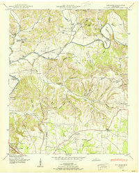
 1951 Cornersville1951 Print · USGSCornersville and the surrounding Tennessee hills are captured in the early 1950s just as the rail-and-river landscape remained central to rural life. Researchers can locate family landmarks like Beechwood Cemetery, the County Farm, and the Louisville and Nashville rail line.2 unique versions available
 - 1951 Map of Fayetteville
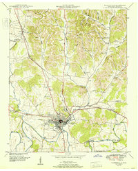 1951 Fayetteville1951 Print · USGSMid-century Fayetteville and the surrounding Lincoln County countryside come alive in this detailed post-war survey. Family historians can trace numerous rural burial grounds and early institutions like Howell Sch, the Mary Chapel, and the Nashville Chattanooga and St Louis rail line.
 - 1951 Map of Dellrose
 1951 Dellrose1951 Print · USGSThe Elk River valley on the Giles and Lincoln county line is shown here in the early fifties, just as the rural river-and-rail economy remained intact. Trace local family roots at Hamilton Mill, the Stone Bluff Bridge, or old church sites like Washington Temple.3 unique versions available
 - 1951 Map of Belleville
 1951 Belleville1951 Print · USGSMid-century Middle Tennessee is captured here as a landscape of tight-knit valley communities and family ridges. Genealogists can trace the location of numerous burial grounds and rural meeting houses, such as Wylie Cem, Bledsoe Cem, and Oak Hill Ch.2 unique versions available
 - 1951 Map of Booneville
 1951 Booneville1951 Print · USGSMoore County and the hollows surrounding Lynchburg are captured in the early fifties before modern development reshaped these Highland Rim communities. Researchers can trace family homesteads near Booneville, the Motlow Cem, and the Charity Sch West.2 unique versions available
 - 1951 Map of Petersburg
 1951 Petersburg1951 Print · USGSThe Tennessee borderlands of Marshall and Lincoln Counties come to life in the early 1950s, centered on the rail hub of Petersburg. Researchers can trace old family lines through a wealth of rural landmarks like Morgan Sch, Wakefield Chapel, and Toll Gate.3 unique versions available
 - 1951 Map of Lincoln
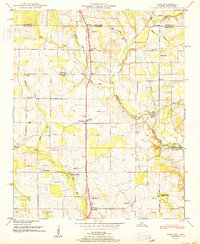
 1951 Lincoln1951 Print · USGSThe Tennessee and Alabama borderlands appear here in the early fifties, showing a rural landscape defined by the loops of the Elk River. Local historians can trace the foundations of communities like Lincoln and Boone Falls, or locate family-named sites such as Rozells Mill and Johnson Sch.
 - 1951 Map of Frankewing
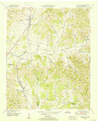
 1951 Frankewing1951 Print · USGSGiles and Lincoln counties are captured here just after the war, showing a landscape defined by ridge-top gaps and valley railroads. Researchers can trace family history through several rural cemeteries and schools, including Garrett Cem, Center Ridge School, and the settlement of McBurg.
 - 1956 Map of Columbia, 1960 Print
 1956 Columbia1960 Print · USGSMiddle Tennessee in the mid-fifties presents a landscape of established river towns and critical rail hubs before the arrival of the modern interstate system. Researchers can trace the routes of the Louisville and Nashville railroad or locate historic landmarks like Stones River National Military Park and the Tennessee National Wildlife Refuge.6 unique versions available
 - 1956 Map of Gadsden, 1966 Print
 1956 Gadsden1966 Print · USGSNorth Alabama in the mid-1950s shows a region transformed by river engineering and federal industry. Genealogists and local historians can trace the development of the Tennessee Valley through the growth of Huntsville, the sprawling Redstone Arsenal, and the expansive Guntersville Lake.3 unique versions available
 - 1958 Map of Gadsden
 1958 Gadsden1958 Print · USGSNorth Alabama comes alive in the late 1950s as the Tennessee Valley Authority’s massive river projects and the rise of the space industry reshaped the landscape. Researchers can trace the mid-century footprints of Huntsville, Redstone Arsenal, and the riverside rail networks of the Southern railroad.
 - 1958 Map of Toney, 1959 Print
 1958 Toney1959 Print · USGSThe Alabama-Tennessee borderlands appear in the late fifties as a network of rural crossroads and family homesteads. Genealogists can trace community roots through an Old Railroad Bed and landmarks like Friendship State Line Church and Golightly Cem.3 unique versions available
 - 1958 Map of Ardmore, 1959 Print
 1958 Ardmore1959 Print · USGSArdmore and the surrounding borderlands of Alabama and Tennessee appear here during the late fifties as a network of rail-side settlements and rural parishes. Genealogists can trace family landmarks like the Delap-Clement Cem, Wooley Springs Sch, and New Zion Church.4 unique versions available
End of results
Showing maps 1-18 of 18
Top cities of Lincoln County
Frequently asked questions
- What are the different types of historical maps available for Lincoln County?
- What is the oldest map of Lincoln County?
- Where can I purchase historical maps of Lincoln County for my home or office?
- Where can I download high-res historical maps of Lincoln County?
- Are there historical topographic maps available for Lincoln County?
- Is there historical aerial imagery available for Lincoln County?
- Where are historical maps of Lincoln County sourced from?