1960s Maps of Macon County, Tennessee
Explore 5 historic maps of Macon County from the 1960s. These maps offer a rare glimpse into what life looked like during the 1960s — showing old roads, neighborhoods, homes, and landmarks that have changed or disappeared over time.
Whether you're researching your family's past, planning a metal detecting trip, or studying how Macon County's landscape evolved across the 1960s, these high-resolution maps are a powerful tool for exploring the history of this region.
- Focus on a specific era: All maps on this page are from the 1960s, giving you a focused view of this time period.
- See what’s changed: Compare century-old streets, trails, and buildings to today's modern landscape using overlays and satellite layers.
- Research with precision: Use these maps for genealogy, historical research, land use analysis, or educational projects.
- View, download, or print: Maps are fully viewable online in high resolution, and can be downloaded or printed for your own records.
Start exploring Macon County's history through authentic maps from the 1960s. This is your window into the past.
Macon County, TN maps
(5)- 1965 Map of Holland, 1967 Print
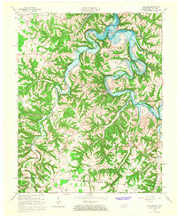 1965 Holland1967 Print · USGSThe Barren River valley in the mid-1960s shows a landscape in transition as the new reservoir fills the winding river bends. Researchers can trace family roots through several rural churches and schools, such as Liberty Church, Highland Church, and the Mt Zion School.
 - 1968 Map of Willette, 1970 Print
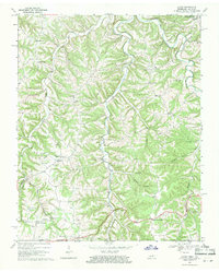
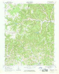 1968 Willette1970 Print · USGSThe hills of Jackson and Macon counties are shown here in the late sixties just before the landscape was changed by the Cordell Hull Reservoir. Genealogists can trace family sites like Thomas Cem, Hayden, and the Wartrace Sch among the winding hollows.
 - 1968 Map of Pleasant Shade, 1970 Print
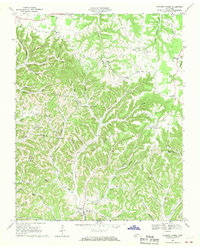 1968 Pleasant Shade1970 Print · USGSUpper Middle Tennessee in the late sixties reveals a landscape of family-run farms and ridge-top communities at the junction of Macon and Smith counties. Genealogists can trace family names through landmarks like Butler Cem, Ebenezer Ch, and the small settlement of Pleasant Shade.2 unique versions available
 - 1968 Map of Red Boiling Springs, 1971 Print
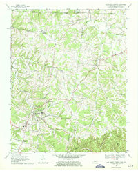 1968 Red Boiling Springs1971 Print · USGSThe Tennessee and Kentucky borderlands near Red Boiling Springs are captured here in the late sixties, showing a landscape defined by deep hollows and creek-side settlements. Genealogists can locate family landmarks such as Sadlers Chapel, Leonard Cem, and the community of Hermitage Springs.
 - 1969 Map of Galen, 1971 Print
 1969 Galen1971 Print · USGSThe Tennessee-Kentucky borderlands in the late sixties featured a dense network of hollows and family-named landmarks. Trace the history of rural communities like Sycamore Valley or Bugtussle and locate old sites like Morgan Cem and Enon Sch.2 unique versions available
End of results
Showing maps 1-5 of 5
Top cities of Macon County
Frequently asked questions
- What are the different types of historical maps available for Macon County?
- What is the oldest map of Macon County?
- Where can I purchase historical maps of Macon County for my home or office?
- Where can I download high-res historical maps of Macon County?
- Are there historical topographic maps available for Macon County?
- Is there historical aerial imagery available for Macon County?
- Where are historical maps of Macon County sourced from?