2020s Maps of McNairy County, Tennessee
Explore 25 historic maps of McNairy County from the 2020s. These maps offer a rare glimpse into what life looked like during the 2020s — showing old roads, neighborhoods, homes, and landmarks that have changed or disappeared over time.
Whether you're researching your family's past, planning a metal detecting trip, or studying how McNairy County's landscape evolved across the 2020s, these high-resolution maps are a powerful tool for exploring the history of this region.
- Focus on a specific era: All maps on this page are from the 2020s, giving you a focused view of this time period.
- See what’s changed: Compare century-old streets, trails, and buildings to today's modern landscape using overlays and satellite layers.
- Research with precision: Use these maps for genealogy, historical research, land use analysis, or educational projects.
- View, download, or print: Maps are fully viewable online in high resolution, and can be downloaded or printed for your own records.
Start exploring McNairy County's history through authentic maps from the 2020s. This is your window into the past.
McNairy County, TN maps
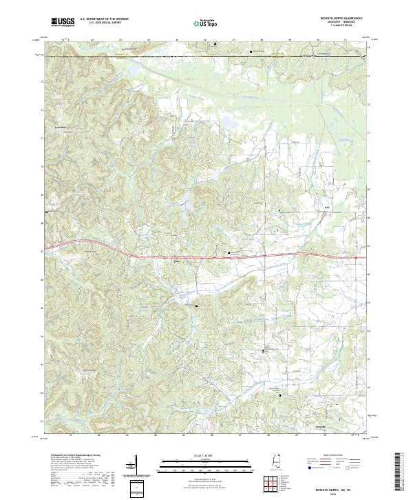
(25)- 2020 Map of Kossuth North, 2020 Print
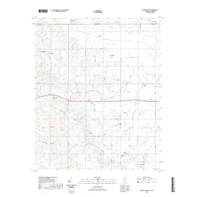 2020 Kossuth North2020 Print · USGSCovers McNairy County, including Kossuth, Gift, and other nearby areas
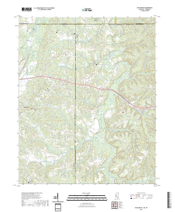
 - 2020 Map of Chalybeate, 2020 Print
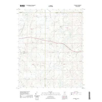 2020 Chalybeate2020 Print · USGSCovers McNairy County, including Chalybeate, Alcorn County, and other nearby areas
 - 2021 Map of Kendrick, 2021 Print
 2021 Kendrick2021 Print · USGSCovers McNairy County, including Corinth, Farmington, and other nearby areas
 - 2021 Map of Corinth, 2021 Print
 2021 Corinth2021 Print · USGSCovers McNairy County, including Corinth, Guys, and other nearby areas
 - 2022 Map of Leapwood, 2022 Print
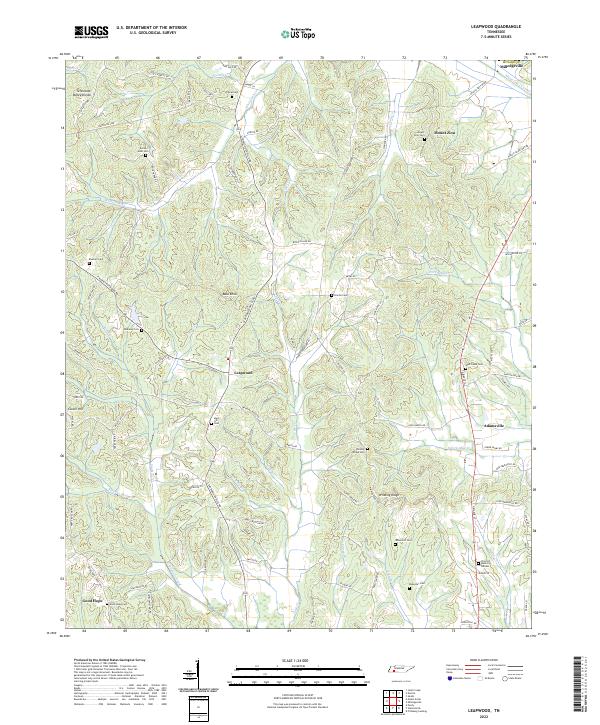 2022 Leapwood2022 Print · USGSMcNairy County's rolling hills and canalized creek bottoms come alive in this detailed look at rural Tennessee. Researchers can trace family history through a dozen burial sites like Mars Hill Cem or locate old community centers at Leapwood and Good Hope.
 - 2022 Map of Jacks Creek, 2022 Print
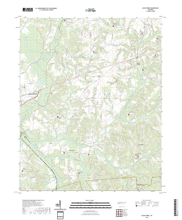 2022 Jacks Creek2022 Print · USGSChester County at the start of the 2020s shows a landscape of enduring rural communities and family-named landmarks. Genealogists and local historians can trace legacy sites like Sweet Lips, Beech Springs Cem, and the Jacks Creek Apostolic Cem.
 - 2022 Map of Rose Creek, 2022 Print
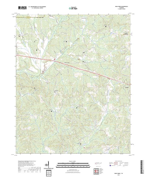 2022 Rose Creek2022 Print · USGSMcNairy County's agricultural corridors and family burial grounds are preserved in this 2022 survey. Researchers can trace deep local roots at Hunters Chapel Cemetery, Rose Creek Village Cemetery, and along the banks of Little Hatchie Creek.
 - 2022 Map of Guys, 2022 Print
 2022 Guys2022 Print · USGSMcNairy County is shown in recent years as a landscape defined by quiet rural townships and numerous family burial grounds. Genealogists can trace local heritage through sites like Saint Rest Cem, Richardson Family Cem, and the community at Guys.
 - 2022 Map of Mount Peter, 2022 Print
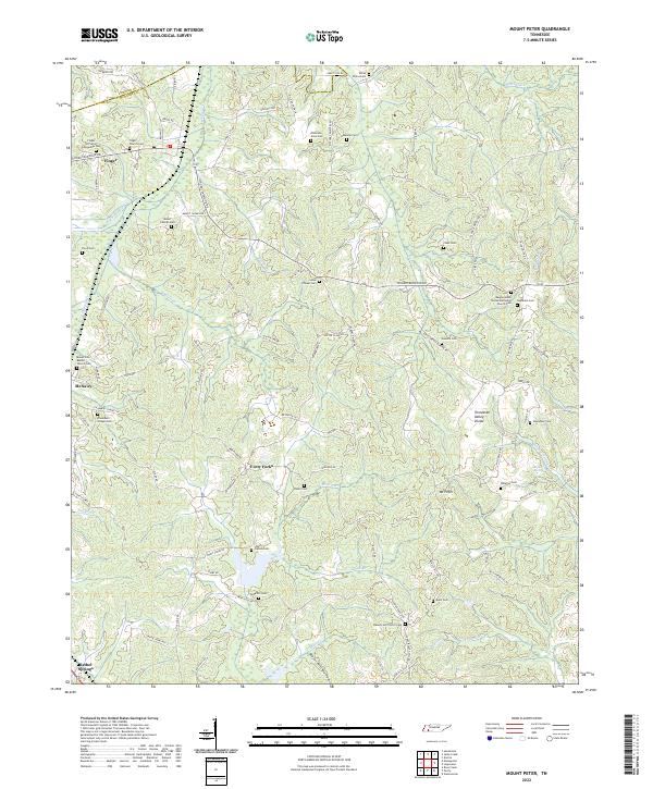 2022 Mount Peter2022 Print · USGSMcNairy and Chester counties are documented here in the early 2020s, showing a landscape defined by the Tennessee Valley Divide. Genealogists can trace numerous family burial grounds including the Anderson Slave Cem, Malone Cem, and White Plains Cem.
 - 2022 Map of Pittsburg Landing, 2022 Print
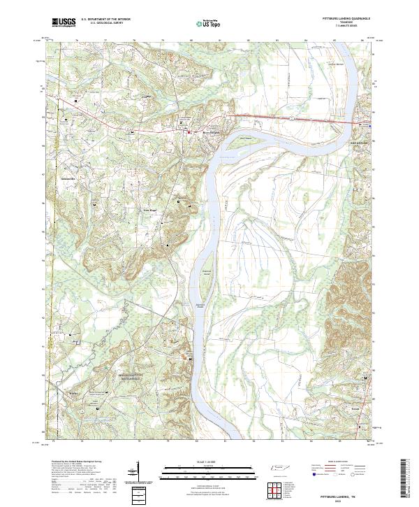 2022 Pittsburg Landing2022 Print · USGSHardin County's riverfront and the hallowed grounds of the Civil War are detailed here in this 2022 survey. Genealogists and historians can trace family names and military positions near Shiloh National Battlefield, Bloody Pond, and the Hardin County Courthouse.
 - 2022 Map of Michie, 2022 Print
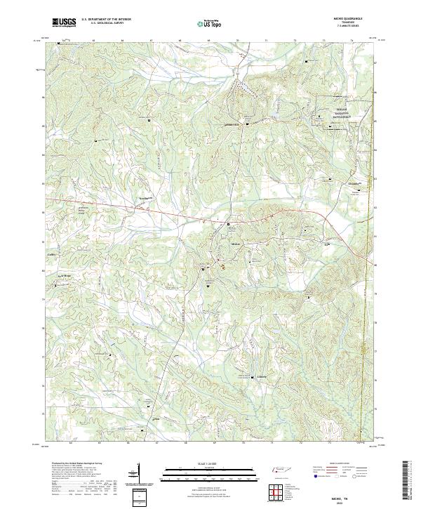 2022 Michie2022 Print · USGSMcNairy County at the Tennessee-Mississippi line is captured here in a moment of rural continuity. Researchers can trace dozens of family burial sites such as Chambers Family Cemetery or visit the southern reaches of Shiloh National Battlefield.
 - 2022 Map of Purdy, 2022 Print
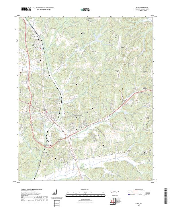 2022 Purdy2022 Print · USGSMcNairy County's rolling hills and community centers come into focus in this contemporary survey of the Tennessee Valley. Researchers can trace family ties through numerous local burial sites including Purdy Wright Cem, Fellowship Baptist Church Cem, and the Warren Cem.
 - 2022 Map of Stantonville, 2022 Print
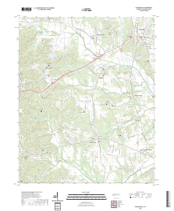 2022 Stantonville2022 Print · USGSStantonville and the McNairy County countryside are shown here in the early 2020s, dominated by the Tennessee Valley Divide. Trace local family roots at Stantonville Cem, Old Lawton, and the West Shiloh Church Cem.
 - 2022 Map of Sardis, 2022 Print
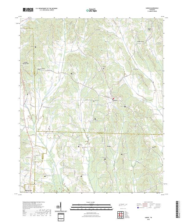 2022 Sardis2022 Print · USGSIn the early twenty-first century, this West Tennessee borderland remains a landscape of quiet crossroads and family burial grounds. Genealogists can locate historic sites like Old Salem Cem, Hinkle, and the Hurricane Church-Cem.
 - 2022 Map of Hornsby, 2022 Print
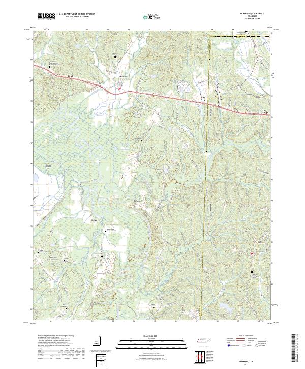 2022 Hornsby2022 Print · USGSHornsby and the Hatchie River bottomlands are captured here in the early twenty-first century, showing a landscape defined by wetlands and small rural communities. Researchers can locate numerous family-named landmarks and burial sites, including McCalip Chapel Cem, Brint Family Cem, and Serles.
 - 2022 Map of Pocahontas, 2022 Print
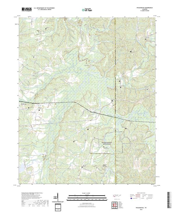 2022 Pocahontas2022 Print · USGSSouthern Hardeman County is captured here in the modern era, showing the quiet landscape around Pocahontas and Essary Springs. Trace local family history at Earnest Family Cem and the Civil War legacy within Shiloh National Battlefield.
 - 2022 Map of Milledgeville, 2022 Print
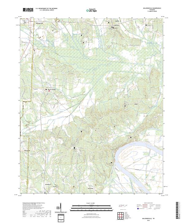 2022 Milledgeville2022 Print · USGSThe Tennessee River and Kentucky Lake shoreline defines this area on the McNairy and Hardin border as it appeared recently. Researchers can trace family roots through numerous landmarks like Old Union Church, Milledgeville Cem, and the Morris Chapel settlement.
 - 2022 Map of Chewalla, 2022 Print
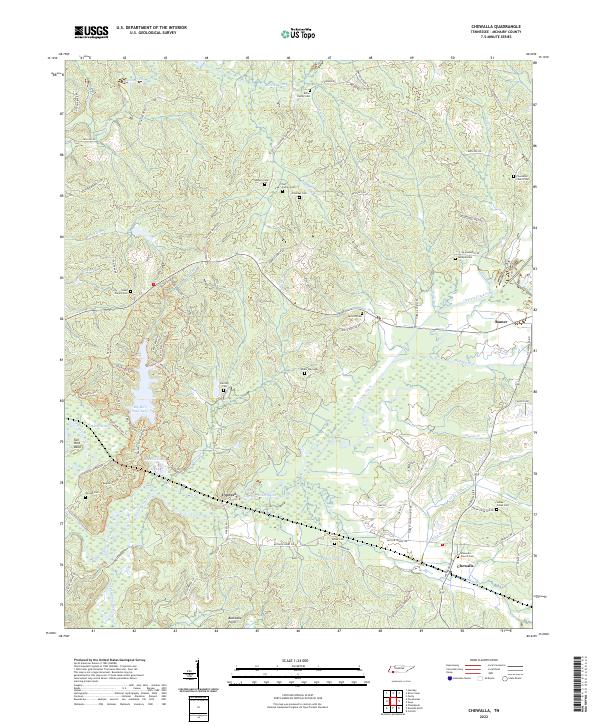 2022 Chewalla2022 Print · USGSMcNairy County settlements and family burial grounds are captured in this modern survey of the Tennessee landscape. Genealogists and researchers can trace local family history at the Head Family Cemetery and Chewalla Church Cemetery or explore the drainage of the Tuscumbia River.
 - 2022 Map of Masseyville, 2022 Print
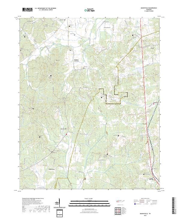 2022 Masseyville2022 Print · USGSThe rural borders of Chester and McNairy counties are mapped here in the early twenty-first century, showing a landscape of small family settlements and winding creek bottoms. Genealogists can locate numerous burial sites including Old Friendship Cem, Hurst Cem, and Cason Cem.
 - 2022 Map of Enville, 2022 Print
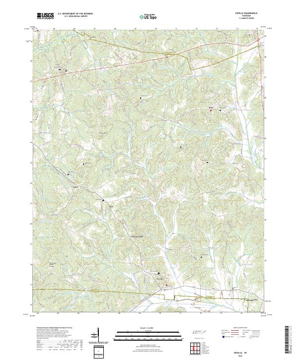 2022 Enville2022 Print · USGSThe rural borderlands where Henderson, Chester, and McNairy counties meet are shown here in modern detail. Genealogists can trace family heritage at Woodlawn Cem, Grove Springs Cem, and the small settlement of Cabo.
 - 2022 Map of Counce, 2022 Print
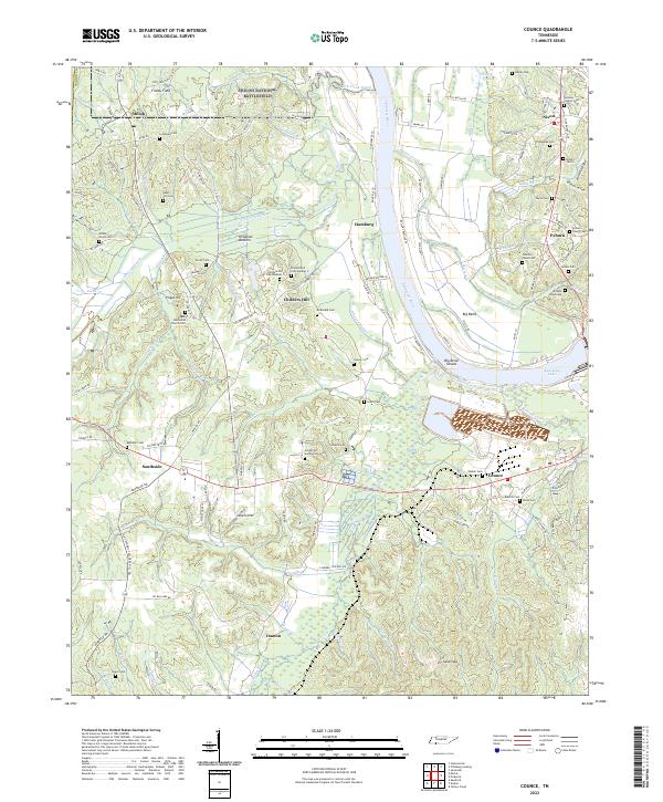 2022 Counce2022 Print · USGSThe Tennessee River corridor and the hallowed ground of Shiloh National Battlefield define this Hardin County landscape. Genealogists can trace family lines across dozens of rural burial sites, including the Wesleys Chapel Cem, Childers Hill Cem Number 1, and William Wood Cem.
 - 2024 Map of Kendrick, 2024 Print
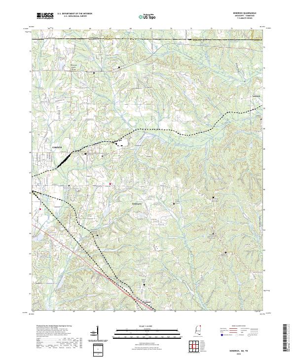 2024 Kendrick2024 Print · USGSAlcorn County, Mississippi, and McNairy County, Tennessee, meet in this modern landscape where the Tennessee Valley Divide defines the watershed. Researchers can trace historic local sites like Wiley Grove Church Cem African American, Kendrick, and the southern reaches of Shiloh National Battlefield.
 - 2024 Map of Kossuth North, 2024 Print
 2024 Kossuth North2024 Print · USGSThe Mississippi-Tennessee borderlands come alive in this recent survey, featuring the quiet crossroads of Theo and Lone Pine. Genealogists can trace family footprints at Shiloh Baptist Church Cem and Liberty African American Cem.
 - 2024 Map of Chalybeate, 2024 Print
 2024 Chalybeate2024 Print · USGSThe Tennessee-Mississippi borderlands come alive in this survey of the area around Chalybeate and Essary Springs. Family historians can trace local roots through numerous sites like Camp Ground Cem, Keith Cem, and Ebenezer Methodist Church.
 - 2024 Map of Corinth, 2024 Print
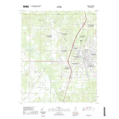
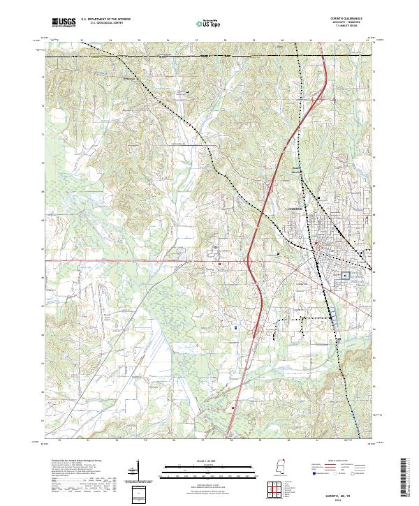 2024 Corinth2024 Print · USGSCorinth and the Mississippi-Tennessee borderlands are seen here in the early twenty-first century, showing the integration of modern infrastructure with extensive protected parklands. Researchers can trace the boundaries of the Shiloh National Battlefield and locate historic burial sites like Corinth National Cemetery and Carmel Cem.
End of results
Showing maps 1-25 of 25
Top cities of McNairy County
- Selmer historical maps
- Adamsville historical maps
- Bethel Springs historical maps
- Michie historical maps
- Eastview historical maps
- Guys historical maps
See more
Frequently asked questions
- What are the different types of historical maps available for McNairy County?
- What is the oldest map of McNairy County?
- Where can I purchase historical maps of McNairy County for my home or office?
- Where can I download high-res historical maps of McNairy County?
- Are there historical topographic maps available for McNairy County?
- Is there historical aerial imagery available for McNairy County?
- Where are historical maps of McNairy County sourced from?