Old Maps of Tellico Plains, Tennessee for Genealogy
Trace your family roots with 26 historic maps of Tellico Plains. These high-res maps reveal old neighborhoods, homesites, landmarks, and streets — helping you uncover where your ancestors lived and how the area evolved over time.
- Explore historic neighborhoods: Identify where your relatives may have lived in the 1800s or 1900s.
- Compare maps over time: Trace the changes in streets, buildings, and landmarks for multi-generational research.
- Perfect for genealogy & ancestry research: Used by family historians and researchers to map out lineage and migration.
These maps are an incredible resource for exploring your personal connection to Tellico Plains's past.
Tellico Plains, TN maps
(26)- 1893 Map of Murphy
 1893 Murphy1893 Print · USGSThe Unaka Mountains and Hiwassee River valley are captured here in the late 19th century, showing a landscape of remote mountain gaps and early industry. Researchers can find old mining sites like Isabella Mine, river crossings such as Prince Fy., and rail stops at Hiwassee Sta..5 unique versions available
 - 1914 Map of Murphy
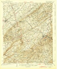
 1914 Murphy1914 Print · USGSThe Tennessee-North Carolina borderlands come to life in this early twentieth-century survey, showcasing a landscape of mountain ridges and river-driven commerce. Researchers can trace the Louisville and Nashville Railroad to old stops like Apalachia Sta or locate the historic Prince Ferry and White Cliff Springs.3 unique versions available
 - 1934 Map of Mount Vernon
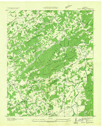 1934 Mount Vernon1934 Print · USGSMonroe County mountain life in the mid-1930s centered on the ridges of the Cherokee National Forest and the banks of the Tellico River. Genealogists can trace early homesteads and community hubs like Belltown P O, Stakely Mill, and the Old Prospect Cem.
 - 1934 Map of Tellico Plains
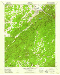
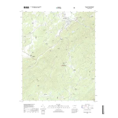
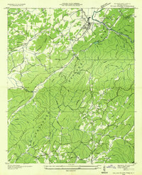 1934 Tellico Plains1934 Print · USGSMonroe County mountain life is captured here in the mid-thirties, showing the rail and river economy of the Tellico River valley. Researchers can trace old mountain schools and family sites like Atkins Sch, Murphys Mill, and Leonards Chapel.
 - 1935 Map of Tellico
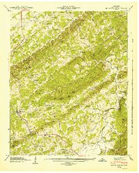
 1935 Tellico1935 Print · USGSMonroe County was a landscape of mountain ridges and remote outposts in the mid-1930s, anchored by the rail hub at Tellico Plains. Genealogists and researchers can trace family landmarks like Carpenter Cem, Oldman Mill, and the Rural Vale School.
 - 1943 Map of Tellico
 1943 Tellico1943 Print · USGSThe valleys and mountain foothills of eastern Tennessee appear here in the 1930s and 40s during the height of the rural schoolhouse era. Genealogists can trace family names through dozens of landmarks like Isbell Cem, Union Grove Ch, and schools such as Manila Sch or Hance Sch.2 unique versions available
 - 1946 Map of Mount Vernon, 1947 Print
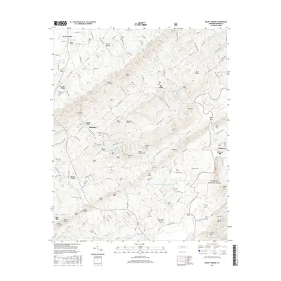
 1946 Mount Vernon1947 Print · USGSMonroe County is shown just after the war, when rural life centered on the local ridges and valley floors. Researchers can trace historic family landmarks such as Belltown Mill, the Tellico Ferry, and cemeteries like Old Prospect Cem.4 unique versions available
 - 1953 Map of Chattanooga
 1953 Chattanooga1953 Print · USGSSoutheast Tennessee in the early fifties shows a landscape reshaped by river management and rail power. Trace the rail lines of the Southern Ry through riverside towns or locate the preserved grounds of the Chickamauga and Chattanooga National Military Park.
 - 1957 Map of Tellico Plains, 1959 Print
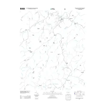
 1957 Tellico Plains1959 Print · USGSMonroe County and the Cherokee National Forest are captured here in the late fifties as the mountain economy transitioned. Genealogists can trace family landmarks and schools including Conasauga Mill, Rural Vale Sch, and the Taylor Cem.3 unique versions available
 - 1957 Map of Chattanooga, 1966 Print
 1957 Chattanooga1966 Print · USGSEast Tennessee in the mid-1960s shows a landscape of massive hydroelectric reservoirs and emerging industrial sites like the Atomic Energy Commission (Oak Ridge Area). Trace the rail networks of the Southern Ry through Chattanooga or locate family-named ridges across the Cumberland Plateau.3 unique versions available
 - 1959 Map of Chattanooga
 1959 Chattanooga1959 Print · USGSSoutheast Tennessee is shown here during a decade of industrial growth and hydroelectric development. Trace the regional rail networks of the Southern Ry and find landmark sites like Lookout Mountain, Fall Creek Falls State Park, and Chattanooga.
 - 1960 Map of Chattanooga
 1960 Chattanooga1960 Print · USGSSoutheast Tennessee and the southern Appalachians are shown here at the height of the river-management era. You can trace the valley rail lines and locate Lookout Mountain and the expansive waters of Chickamauga Reservoir.
 - 1964 Map of Chattanooga
 1964 Chattanooga1964 Print · USGSSoutheast Tennessee and the western Carolinas appear in the mid-sixties as a powerhouse of river-driven industry and mountain wilderness. Genealogists and historians can trace rail-town lineages along the Southern Ry or locate family landmarks near Watts Bar Lake and Tellico Plains.
 - 1981 Map of Cleveland
 1981 Cleveland1981 Print · USGSSoutheast Tennessee and Western North Carolina are documented here in the early eighties, as the Tennessee Valley Authority managed the region's vast river and forest resources. Researchers can trace the rail lines of the Southern and Louisville and Nashville or locate industrial sites in the Copper Basin and settlements like Ducktown.2 unique versions available
 - 2003 Map of Mount Vernon, 2004 Print
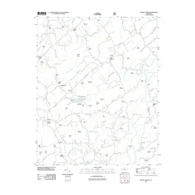
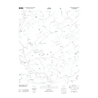
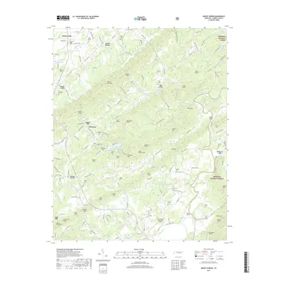
 2003 Mount Vernon2004 Print · USGSMonroe County settlement at the turn of the millennium shows a landscape defined by the Tellico River and the rising ridges of the Cherokee National Forest. Genealogists and local historians can trace family roots through numerous rural landmarks like Stakely Mill, Union Hall, and Eleazar Ch.
 - 2003 Map of Tellico Plains, 2004 Print
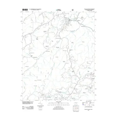
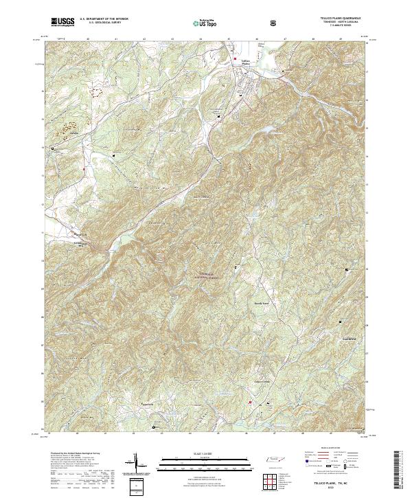
 2003 Tellico Plains2004 Print · USGSMonroe County was transitioning into the new millennium as this survey documented the valleys and ridges surrounding Tellico Plains. Researchers can trace family roots through landmarks like Conasauga Mill, the Holder Cem, and rural congregations at Unicoi Ch.
 - 2011 Map of Mount Vernon, 2011 Print
 2011 Mount Vernon2011 Print · USGSCovers Tellico Plains, including Madisonville, Mount Harmony, and other nearby areas
 - 2011 Map of Tellico Plains, 2011 Print
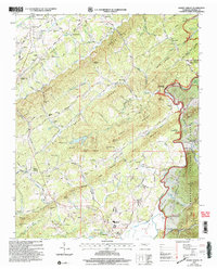
 2011 Tellico Plains2011 Print · USGSCovers Tellico Plains, including Tellico Beach, Sandy Lane, and other nearby areas
 - 2013 Map of Mount Vernon, 2013 Print
 2013 Mount Vernon2013 Print · USGSCovers Tellico Plains, including Madisonville, Mount Harmony, and other nearby areas
 - 2013 Map of Tellico Plains, 2013 Print
 2013 Tellico Plains2013 Print · USGSCovers Tellico Plains, including Tellico Beach, Sandy Lane, and other nearby areas
 - 2016 Map of Mount Vernon, 2016 Print
 2016 Mount Vernon2016 Print · USGSCovers Tellico Plains, including Madisonville, Mount Harmony, and other nearby areas
 - 2016 Map of Tellico Plains, 2016 Print
 2016 Tellico Plains2016 Print · USGSCovers Tellico Plains, including Tellico Beach, Sandy Lane, and other nearby areas
 - 2019 Map of Mount Vernon, 2019 Print
 2019 Mount Vernon2019 Print · USGSCovers Tellico Plains, including Madisonville, Mount Harmony, and other nearby areas
 - 2019 Map of Tellico Plains, 2019 Print
 2019 Tellico Plains2019 Print · USGSCovers Tellico Plains, including Tellico Beach, Sandy Lane, and other nearby areas
 - 2022 Map of Tellico Plains, 2022 Print
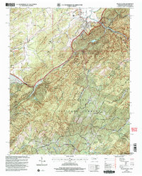
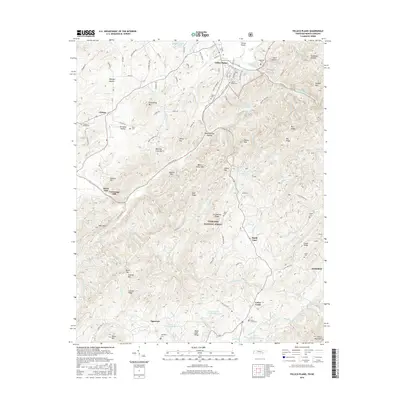
 2022 Tellico Plains2022 Print · USGSThe Tennessee mountains near the North Carolina border come into focus in this recent look at Tellico Plains and the Cherokee National Forest. Genealogists and local historians can trace legacy sites like Conasauga Mill, Rural Vale, and the Tellico Plains Cemetery.
Showing maps 1-25 of 26
Top cities near Tellico Plains
- Sweetwater historical maps
- Madisonville historical maps
- Etowah historical maps
- Englewood historical maps
Frequently asked questions
- What are the different types of historical maps available for Tellico Plains?
- What is the oldest map of Tellico Plains?
- Where can I purchase historical maps of Tellico Plains for my home or office?
- Where can I download high-res historical maps of Tellico Plains?
- Are there historical topographic maps available for Tellico Plains?
- Is there historical aerial imagery available for Tellico Plains?
- Where are historical maps of Tellico Plains sourced from?