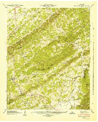
1946 Map of Mount Vernon
USGS Topo · Published 1947About this map
The Old Federal Road and Nashville Road converge near Mount Vernon, illustrating the importance of early overland travel routes through Monroe County. This 1940s landscape is defined by the parallel ridges of Notchy Creek Ridge and the Red Knobs, where small farming communities centered around schools and churches. Evidence of local industry and river-based transport appears at Belltown Mill and the Tellico Ferry on the Tellico River, while the southern reaches transition into the Cherokee National Forest.
Find a feature on this map
89 named features on this map. Tap any name to fly to it.
Don’t see what you’re looking for? This feature index may not catch every label — zoom into the map to look around manually.
Map Details
Editions of this 1946 Mount Vernon Map
4 editions found
Other maps of this area

1893 · Murphy
USGS Topo · 1:125,000

1895 · Loudon
USGS Topo · 1:125,000

1914 · Murphy
USGS Topo · 1:125,000

1933 · Haw Knob
USGS Topo · 1:48,000

1933 · Bald River Falls
USGS Topo · 1:24,000

1933 · Rafter
USGS Topo · 1:24,000

1934 · Mount Vernon
USGS Topo · 1:24,000

1934 · Mecca
USGS Topo · 1:24,000

1934 · Englewood
USGS Topo · 1:24,000

1934 · Tellico Plains
USGS Topo · 1:24,000