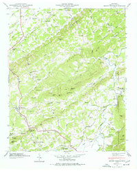
1946 Map of Mount Vernon
USGS Topo · Published 1977About this map
The Old Federal Road traces a historic path through the ridge-and-valley landscape of Monroe County, reflecting the early transit corridors of East Tennessee. This 1946 field examination captures a rural economy still anchored to its waterways and rails, where the Louisville and Nashville line serves remote stops like Tom Station and Rogers Station. The Tellico River dominates the eastern quadrant, its banks marked by the Tellico Ferry and the crossing at Nars Ford.
Find a feature on this map
99 named features on this map. Tap any name to fly to it.
Don’t see what you’re looking for? This feature index may not catch every label — zoom into the map to look around manually.
Map Details
Editions of this 1946 Mount Vernon Map
4 editions found
Other maps of this area

1893 · Murphy
USGS Topo · 1:125,000

1895 · Loudon
USGS Topo · 1:125,000

1914 · Murphy
USGS Topo · 1:125,000

1933 · Haw Knob
USGS Topo · 1:48,000

1933 · Bald River Falls
USGS Topo · 1:24,000

1933 · Rafter
USGS Topo · 1:24,000

1934 · Mount Vernon
USGS Topo · 1:24,000

1934 · Mecca
USGS Topo · 1:24,000

1934 · Englewood
USGS Topo · 1:24,000

1934 · Tellico Plains
USGS Topo · 1:24,000