2020s Maps of Tellico West Industrial Complex, Vonore
Explore 2 historic maps of Tellico West Industrial Complex from the 2020s. These maps offer a rare glimpse into what life looked like during the 2020s — showing old roads, neighborhoods, homes, and landmarks that have changed or disappeared over time.
Whether you're researching your family's past, planning a metal detecting trip, or studying how Tellico West Industrial Complex's landscape evolved across the 2020s, these high-resolution maps are a powerful tool for exploring the history of this region.
- Focus on a specific era: All maps on this page are from the 2020s, giving you a focused view of this time period.
- See what’s changed: Compare century-old streets, trails, and buildings to today's modern landscape using overlays and satellite layers.
- Research with precision: Use these maps for genealogy, historical research, land use analysis, or educational projects.
- View, download, or print: Maps are fully viewable online in high resolution, and can be downloaded or printed for your own records.
Start exploring Tellico West Industrial Complex's history through authentic maps from the 2020s. This is your window into the past.
Tellico West Industrial Complex, Vonore maps
(2)- 2022 Map of Vonore, 2022 Print
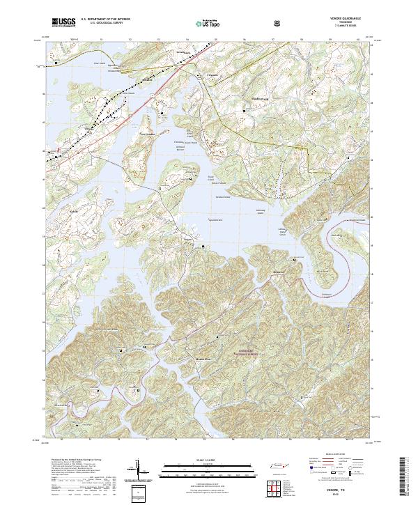 2022 Vonore2022 Print · USGSThe Little Tennessee River valley near the Monroe and Loudon county lines is captured here in the contemporary era. Researchers can locate numerous family burial sites like Niles-McGhee Cem and Hardin Cem, or trace the grounds of Fort Loudon and Shaddon Mill.
 - 2023 Map of Madisonville, 2023 Print
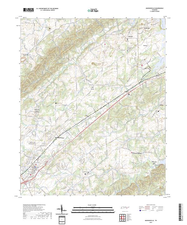 2023 Madisonville2023 Print · USGSThe Monroe County seat and the campus of Hiwassee College appear here in the early twenty-first century. Genealogists can locate family landmarks like Stephens Cem, Kimbrough Cem, and the historic Hopewell Mill on Notchy Creek.
End of results
Showing maps 1-2 of 2
Frequently asked questions
- What are the different types of historical maps available for Tellico West Industrial Complex?
- What is the oldest map of Tellico West Industrial Complex?
- Where can I purchase historical maps of Tellico West Industrial Complex for my home or office?
- Where can I download high-res historical maps of Tellico West Industrial Complex?
- Are there historical topographic maps available for Tellico West Industrial Complex?
- Is there historical aerial imagery available for Tellico West Industrial Complex?
- Where are historical maps of Tellico West Industrial Complex sourced from?