Old Maps of Chestnut Ridge, Lynchburg for Genealogy
Trace your family roots with 11 historic maps of Chestnut Ridge. These high-res maps reveal old neighborhoods, homesites, landmarks, and streets — helping you uncover where your ancestors lived and how the area evolved over time.
- Explore historic neighborhoods: Identify where your relatives may have lived in the 1800s or 1900s.
- Compare maps over time: Trace the changes in streets, buildings, and landmarks for multi-generational research.
- Perfect for genealogy & ancestry research: Used by family historians and researchers to map out lineage and migration.
These maps are an incredible resource for exploring your personal connection to Chestnut Ridge's past.
Chestnut Ridge, Lynchburg maps
(11)- 1936 Map of Belleville
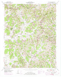
 1936 Belleville1936 Print · USGSLincoln County and the surrounding borderlands are captured here in the mid-1930s, showing a rural landscape organized around deep hollows and creek branches. Researchers can locate numerous local landmarks including Oak Hill Ch, Patton Cem, and the settlement of Belleville.
 - 1944 Map of Shelbyville
 1944 Shelbyville1944 Print · USGSMid-century Middle Tennessee is captured here during the wartime mobilization of the 1940s. Genealogists and researchers can trace family lands near Bugscuffle, Shelbyville Mills, and the expansive Camp Forrest Military Res.
 - 1949 Map of Belleville, 1974 Print
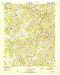
 1949 Belleville1974 Print · USGSLincoln County was a landscape of high ridges and deep hollows in the years following the war, centered around the community of Belleville. Researchers can trace old family burial grounds and country parishes like Hickory Hill Church and Wylie Cemetery.2 unique versions available
 - 1951 Map of Belleville
 1951 Belleville1951 Print · USGSMid-century Middle Tennessee is captured here as a landscape of tight-knit valley communities and family ridges. Genealogists can trace the location of numerous burial grounds and rural meeting houses, such as Wylie Cem, Bledsoe Cem, and Oak Hill Ch.2 unique versions available
 - 1956 Map of Columbia, 1960 Print
 1956 Columbia1960 Print · USGSMiddle Tennessee in the mid-fifties presents a landscape of established river towns and critical rail hubs before the arrival of the modern interstate system. Researchers can trace the routes of the Louisville and Nashville railroad or locate historic landmarks like Stones River National Military Park and the Tennessee National Wildlife Refuge.6 unique versions available
 - 1981 Map of Tullahoma, 1982 Print
 1981 Tullahoma1982 Print · USGSSouthern Tennessee enters the 1980s with a mix of aerospace technology and deep rural roots. Researchers can trace the L & N RR through Shelbyville and Fayetteville or locate family sites like Old Salem Cem and Blanton Chapel near the Cumberland Plateau.
 - 2010 Map of Belleville, 2010 Print
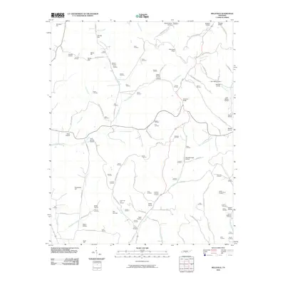 2010 Belleville2010 Print · USGSCovers Chestnut Ridge, including Bledsoe, Belleville, and other nearby areas
 - 2013 Map of Belleville, 2013 Print
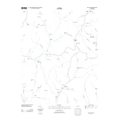 2013 Belleville2013 Print · USGSCovers Chestnut Ridge, including Bledsoe, Belleville, and other nearby areas
 - 2016 Map of Belleville, 2016 Print
 2016 Belleville2016 Print · USGSCovers Chestnut Ridge, including Bledsoe, Belleville, and other nearby areas
 - 2019 Map of Belleville, 2019 Print
 2019 Belleville2019 Print · USGSCovers Chestnut Ridge, including Bledsoe, Belleville, and other nearby areas
 - 2022 Map of Belleville, 2022 Print
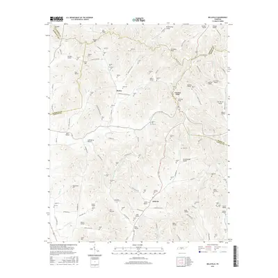
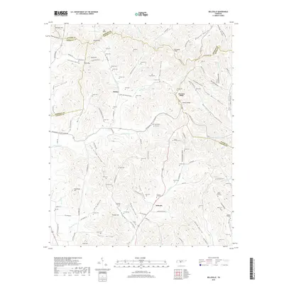
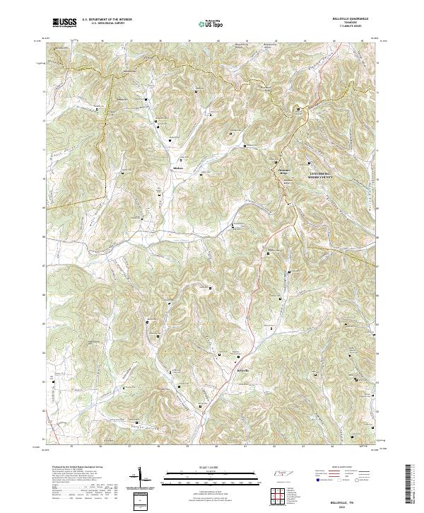 2022 Belleville2022 Print · USGSCovers Chestnut Ridge, including Belleville, Bledsoe, and other nearby areas
End of results
Showing maps 1-11 of 11
Top cities near Chestnut Ridge
- Shelbyville historical maps
- Lewisburg historical maps
- Fayetteville historical maps
- Petersburg historical maps
- Wartrace historical maps
Frequently asked questions
- What are the different types of historical maps available for Chestnut Ridge?
- What is the oldest map of Chestnut Ridge?
- Where can I purchase historical maps of Chestnut Ridge for my home or office?
- Where can I download high-res historical maps of Chestnut Ridge?
- Are there historical topographic maps available for Chestnut Ridge?
- Is there historical aerial imagery available for Chestnut Ridge?
- Where are historical maps of Chestnut Ridge sourced from?